- Surf City, New Jersey
Infobox Settlement
official_name = Surf City, New Jersey
settlement_type = Borough
nickname =
motto =
imagesize =
image_caption =
image_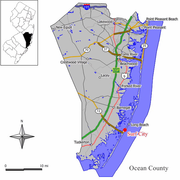
mapsize = 250x200px
map_caption = Map of Surf City in Ocean County. Inset: Location of Ocean County highlighted in the State of New Jersey.
mapsize1 = 250x200px
map_caption1 = Census Bureau map of Surf City, New Jerseysubdivision_type = Country
subdivision_name =United States
subdivision_type1 = State
subdivision_name1 =New Jersey
subdivision_type2 = County
subdivision_name2 = Ocean
government_footnotes =
government_type =Borough (New Jersey)
leader_title =Mayor
leader_name = Leonard T. Connors, Jr.
leader_title1 =
leader_name1 =
established_title = Incorporated
established_date =September 19 ,1894 as "Long Beach City"
established_title1 = Renamed
established_date1 =May 26 ,1899 as "Surf City"unit_pref = Imperial
area_footnotes =
area_magnitude =
area_total_km2 = 2.4
area_land_km2 = 1.9
area_water_km2 = 0.5
area_total_sq_mi = 0.9
area_land_sq_mi = 0.7
area_water_sq_mi = 0.2population_as_of = 2006
population_footnotes =
population_total = 1542
population_density_km2 = 768.5
population_density_sq_mi = 1990.4timezone = Eastern (EST)
utc_offset = -5
timezone_DST = EDT
utc_offset_DST = -4
elevation_footnotes = [Gnis|885413|Borough of Surf City,Geographic Names Information System . AccessedJanuary 4 ,2008 .]
elevation_m = 2
elevation_ft = 7
latd = 39 |latm = 39 |lats = 44 |latNS = N
longd = 74 |longm = 10 |longs = 07 |longEW = Wpostal_code_type =
ZIP code
postal_code = 08008
area_code = 609
blank_name = FIPS code
blank_info = 34-71640GR|2 [ [http://mcdc2.missouri.edu/webrepts/commoncodes/ccc_nj.html A Cure for the Common Codes: New Jersey] , Missouri Census Data Center. AccessedJuly 14 ,2008 .]
blank1_name = GNIS feature ID
blank1_info = 0885413GR|3
website =
footnotes =Surf City is a borough in Ocean County,
New Jersey ,United States . As of theUnited States 2000 Census , the borough population was 1,442. The borough borders theAtlantic Ocean onLong Beach Island .What is now Surf City was originally formed as Long Beach City borough by an Act of the
New Jersey Legislature onSeptember 19 ,1894 , from portions of Stafford Township, based on the results of a referendum held the previous day. The borough was renamed Surf City by a resolution of the Borough Council as ofMay 26 ,1899 ."The Story of New Jersey's Civil Boundaries: 1606-1968", John P. Snyder, Bureau of Geology and Topography; Trenton, New Jersey; 1969. p. 205.]Geography
Surf City is located at coor dms|39|39|41|N|74|9|60|W|city (39.661385, -74.166633)GR|1.
Surf City is 57 miles east-southeast of Philadelphia, PA and 71 miles south of New York, NY.
According to the
United States Census Bureau , the borough has a total area of 0.9square mile s (2.4km² ), of which, 0.7 square miles (1.9 km²) of it is land and 0.2 square miles (0.5 km²) of it (21.74%) is water.History
Home to the first big boarding hotel on the
New Jersey coast , called the Mansion of Health. The area surrounding this hotel was called "Buzby's Place" in the 1830s and 1940s, after one of the owners of the Mansion of Health, Hudson Buzby. The Mansion of Health burned down in 1874, but some old-timers still call the cove at the foot of South First Street on the bay side "Mansion Cove." [Lloyd, pgs. 31-33.]In 1875, the 20 or so permanent members of the area decided to call it Long Beach City, even though the area was still considered part of Stafford Township. But in 1894, Surf City became incorporated, changing its name to Surf City in 1899 after the
United States Postal Service demanded a name change before the town could incorporate, preventing it from being confused with Long Branch in Monmouth County. [Lloyd, pg. 32.]Demographics
USCensusPop
1930=76
1940=129
1950=291
1960=419
1970=1129
1980=1571
1990=1375
2000=1442
estimate= 1542
estyear=2006
estref= [http://factfinder.census.gov/servlet/SAFFPopulation?_event=Search&geo_id=16000US3407750&_geoContext=01000US%7C04000US34%7C16000US3407750&_street=&_county=deal&_cityTown=deal&_state=04000US34&_zip=&_lang=en&_sse=on&ActiveGeoDiv=geoSelect&_useEV=&pctxt=fph&pgsl=160&_submenuId=population_0&ds_name=null&_ci_nbr=null&qr_name=null®=null%3Anull&_keyword=&_industry= Census data for Deal borough] ,United States Census Bureau . AccessedJuly 30 ,2007 .]
footnote=Population 1930 - 1990. [ [http://www.wnjpin.net/OneStopCareerCenter/LaborMarketInformation/lmi01/poptrd6.htm New Jersey Resident Population by Municipality: 1930 - 1990] , Workforce New Jersey Public Information Network. AccessedMarch 1 ,2007 .] As of thecensus GR|2 of 2000, there were 1,442 people, 706 households, and 420 families residing in the borough. Thepopulation density was 1,990.4 people per square mile (773.3/km²). There were 2,621 housing units at an average density of 3,617.9/sq mi (1,405.5/km²). The racial makeup of the borough was 98.06% White, 0.14% African American, 0.21% Native American, 0.35% Asian, 0.42% Pacific Islander, 0.55% from other races, and 0.28% from two or more races. Hispanic or Latino of any race were 1.94% of the population.There were 706 households out of which 13.0% had children under the age of 18 living with them, 48.6% were married couples living together, 7.1% had a female householder with no husband present, and 40.4% were non-families. 34.8% of all households were made up of individuals and 19.4% had someone living alone who was 65 years of age or older. The average household size was 2.04 and the average family size was 2.61.
In the borough the population was spread out with 12.4% under the age of 18, 5.1% from 18 to 24, 21.6% from 25 to 44, 26.8% from 45 to 64, and 34.1% who were 65 years of age or older. The median age was 53 years. For every 100 females there were 90.5 males. For every 100 females age 18 and over, there were 88.8 males.
The median income for a household in the borough was $38,190, and the median income for a family was $50,268. Males had a median income of $40,625 versus $25,208 for females. The
per capita income for the borough was $26,632. About 5.6% of families and 7.5% of the population were below thepoverty line , including 22.1% of those under age 18 and 3.9% of those age 65 or over.Media
Surf City is served primarily by Philadelphia television stations, Atlantic City and Philadelphia based radio stations and two daily newspapers, "
The Press of Atlantic City " and "Asbury Park Press ".Government
Local government
Surf City is governed under the Borough form of New Jersey municipal government. The government consists of a Mayor and a Borough Council comprising six council members, with all positions elected at large. A Mayor is elected directly by the voters to a four-year term of office. The Borough Council consists of six members elected to serve three-year terms on a staggered basis, with two seats coming up for election each year. ["2005 New Jersey Legislative District Data Book",
Rutgers University Edward J. Bloustein School of Planning and Public Policy , April 2005, p. 49.]The Mayor of Surf City Borough is Leonard T. Connors, Jr. (R, term ends
December 31 ,2007 ), who also is the state senator from the 9th Legislative District. Borough Council members are Bettie Creevy (R, 2007), Charles L. Freitag (R, 2007), Francis R. Hodgson, Sr. (R, 2008) and William D. Hodgson (R, 2008), John H. Klose (R, 2009) and James B. Russell (R, 2009). [ [http://www.oceancountyclerk.com/elelectedofficials2007.pdf#page=11 2007 Elected Officials of Ocean County] ,Ocean County, New Jersey . p. 11. AccessedAugust 14 ,2007 .]Federal, state and county representation
Surf City is in the Third Congressional District and is part of New Jersey's 9th Legislative District. [ [http://www.lwvnj.org/pubs/CG06.pdf 2006 New Jersey Citizen's Guide to Government] , New Jersey
League of Women Voters , p. 64. AccessedAugust 30 ,2006 .]Education
For grades K through 6, public school students attend the
Long Beach Island Consolidated School District , which serves students from Barnegat Light, Harvey Cedars, Long Beach Township, Ship Bottom, and Surf City. ["2005 New Jersey Legislative District Data Book",Rutgers University Edward J. Bloustein School of Planning and Public Policy , April 2005, p. 212.] Schools in the district (with 2005-06 enrollment data from theNational Center for Education Statistics [ [http://nces.ed.gov/ccd/schoolsearch/school_list.asp?Search=1&DistrictID=3408910 Data for the Long Beach Island School District] ,National Center for Education Statistics . AccessedMarch 10 ,2008 .] ) are [http://www.lbischools.org/lbi/Jacobsen/_top Ethel Jacobsen School] in Surf City with 132 students in grades Kindergarten - 2 and [http://www.lbischools.org/lbi/LBI/_top Long Beach Island Grade School] in Ship Bottom with 135 students in grades 3 - 6.Public school students in grades 7 through 12 attend the [http://www.srsd.net/middleschool Southern Regional Middle School] (grades 7 and 8) and
Southern Regional High School (grades 9–12). These schools are part of theSouthern Regional School District , which serves the five municipalities in the Long Beach Island Consolidated School District, along with students from Beach Haven, Stafford Township and Ocean Township. [ [http://education.state.nj.us/rc/rc07/narrative/29/4950/29-4950-050.html Southern Regional High School 2007 Report Card Narrative] ,New Jersey Department of Education . AccessedMarch 10 ,2008 . "Situated in Manahawkin, the Southern Regional High School District draws from the constituent municipalities of Long Beach Township, Beach Haven, Surf City, Ship Bottom, Barnegat Light, Harvey Cedars and Stafford Township, as well as the tuition sending municipality of Ocean Township (Waretown)."] . Both schools are in Manahawkin.Landmarks
Surf City Yacht Club (SCYC). Here many sailors and swimmers ranging in age dedicate their summers to the Yacht Club. There are weekly races against other yacht clubs throughout the Island.
Surf City Beach Patrol (SCBP)
Notable residents
Notable current and former residents of Surf City include:
*Gerry P. Little , served on the Ocean CountyBoard of Chosen Freeholders since 2003, and was elected to the Surf City Borough Council in 1995, where he served for eight years. [ [http://www.co.ocean.nj.us/PersonDetailPage.aspx?Name=GerryLittle.xml Freeholder Gerry P. Little] ,Ocean County, New Jersey . AccessedAugust 16 ,2007 .]References
ources
*Lloyd, John Bailey. "Eighteen Miles of History on Long Beach Island." (1994) Down The Shore Publishing and The SandPaper, Inc.
External links
* [http://www.southernocean.com/community/towninfo/surfcity.html Surf City Borough municipal information]
* [http://www.surfcitybeachpatrol.com Surf City Beach Patrol Home Page]
* [http://www.lbischools.org Long Beach Island School District]
*NJReportCard|29|2760|0|Long Beach Island School District
* [http://nces.ed.gov/ccd/schoolsearch/school_list.asp?Search=1&DistrictID=3408910 Data for the Long Beach Island School District] ,National Center for Education Statistics
* [http://www.srsd.net/ Southern Regional School District]
* [http://www.theoceancountylibrary.org/Branches/LBI/lbi.htm Long Beach Island Branch (Surf City) of Ocean County Library]
Wikimedia Foundation. 2010.