- Ship Bottom, New Jersey
Infobox Settlement
official_name = Ship Bottom, New Jersey
settlement_type = Borough
nickname =
motto =
imagesize =
image_caption =
image_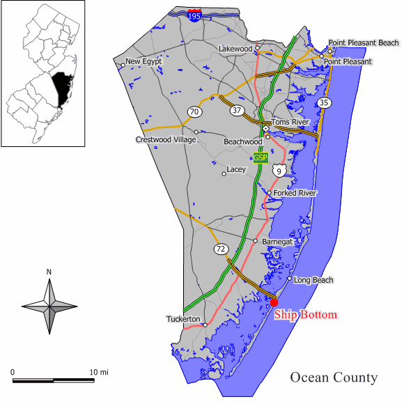
mapsize = 250x200px
map_caption = Map of Ship Bottom in Ocean County. Inset: Location of Ocean County highlighted in the State of New Jersey.
mapsize1 = 250x200px
map_caption1 = Census Bureau map of Ship Bottom, New Jerseysubdivision_type = Country
subdivision_name =United States
subdivision_type1 = State
subdivision_name1 =New Jersey
subdivision_type2 = County
subdivision_name2 = Ocean
government_footnotes =
government_type =Borough (New Jersey)
leader_title =Mayor
leader_name = William Huelsenbeck (2010)
leader_title1 =
leader_name1 =
established_title = Incorporated
established_date =March 3 ,1925 as "Ship Bottom-Beach Arlington"
established_title1 = Renamed
established_date1 = 1947 as "Ship Bottom"unit_pref = Imperial
area_footnotes =
area_magnitude =
area_total_km2 = 2.6
area_land_km2 = 1.8
area_water_km2 = 0.8
area_total_sq_mi = 1.0
area_land_sq_mi = 0.7
area_water_sq_mi = 0.3population_as_of = 2006
population_footnotes =
population_total = 1427
population_density_km2 = 768.8
population_density_sq_mi = 1991.1timezone = Eastern (EST)
utc_offset = -5
timezone_DST = EDT
utc_offset_DST = -4
elevation_footnotes = [Gnis|885394|Borough of Ship Bottom,Geographic Names Information System . AccessedJanuary 4 ,2008 .]
elevation_m = 2
elevation_ft = 7
latd = 39 |latm = 38 |lats = 42 |latNS = N
longd = 74 |longm = 10 |longs = 57 |longEW = Wpostal_code_type =
ZIP code
postal_code = 08008
area_code = 609
blank_name = FIPS code
blank_info = 34-67110GR|2 [ [http://mcdc2.missouri.edu/webrepts/commoncodes/ccc_nj.html A Cure for the Common Codes: New Jersey] , Missouri Census Data Center. AccessedJuly 14 ,2008 .]
blank1_name = GNIS feature ID
blank1_info = 0885394GR|3
website = http://www.shipbottom.org
footnotes =Ship Bottom is a Borough in Ocean County,
New Jersey ,United States . As of theUnited States 2000 Census , the borough population was 1,384. The borough is located onLong Beach Island and borders theAtlantic Ocean .Ship Bottom was incorporated as the borough of Ship Bottom-Beach Arlington by an Act of the
New Jersey Legislature onMarch 3 ,1925 , from portions of Long Beach Township, based on the results of a referendum held onMay 23 ,1925 . The borough name was shortened to Ship Bottom in 1947."The Story of New Jersey's Civil Boundaries: 1606-1968", John P. Snyder, Bureau of Geology and Topography; Trenton, New Jersey; 1969. p. 205.]Ship Bottom is known as the "gateway to Long Beach Island", as Route 72 provides the sole road access from Manahawkin in Stafford Township, ending in Ship Bottom as it crosses
Manahawkin Bay via theManahawkin Bay Bridge (formally known as the Dorland J. Henderson Memorial Bridge).Geography
Ship Bottom is located at coor dms|39|38|49|N|74|10|53|W|city (39.647060, -74.181322)GR|1.
According to the
United States Census Bureau , the borough has a total area of 1.0square mile s (2.6km² ), of which, 0.7 square miles (1.8 km²) of it is land and 0.3 square miles (0.8 km²) of it (30.30%) is water.Demographics
USCensusPop
1930=277
1940=396
1950=533
1960=717
1970=1079
1980=1427
1990=1352
2000=1384
estimate= 1427
estyear=2006
estref= [http://factfinder.census.gov/servlet/SAFFPopulation?_event=Search&geo_id=16000US3405440&_geoContext=01000US%7C04000US34%7C16000US3405440&_street=&_county=ship+bottom&_cityTown=ship+bottom&_state=04000US34&_zip=&_lang=en&_sse=on&ActiveGeoDiv=geoSelect&_useEV=&pctxt=fph&pgsl=160&_submenuId=population_0&ds_name=null&_ci_nbr=null&qr_name=null®=null%3Anull&_keyword=&_industry= Census data for Ship Bottom borough] ,United States Census Bureau . AccessedAugust 10 ,2007 .]
footnote=Population 1930 - 1990. [ [http://www.wnjpin.net/OneStopCareerCenter/LaborMarketInformation/lmi01/poptrd6.htm New Jersey Resident Population by Municipality: 1930 - 1990] , Workforce New Jersey Public Information Network. AccessedMarch 1 ,2007 .] As of thecensus GR|2 of 2000, there were 1,384 people, 664 households, and 395 families residing in the borough. Thepopulation density was 1,991.1 people per square mile (763.4/km²). There were 2,218 housing units at an average density of 3,191.0/sq mi (1,223.4/km²). The racial makeup of the borough was 96.32% White, 0.29% African American, 0.72% Native American, 0.87% Asian, 1.08% from other races, and 0.72% from two or more races. Hispanic or Latino of any race were 5.78% of the population.There were 664 households out of which 14.3% had children under the age of 18 living with them, 47.3% were married couples living together, 8.0% had a female householder with no husband present, and 40.4% were non-families. 35.8% of all households were made up of individuals and 17.0% had someone living alone who was 65 years of age or older. The average household size was 2.08 and the average family size was 2.65.
In the borough the population was spread out with 14.8% under the age of 18, 5.9% from 18 to 24, 22.7% from 25 to 44, 29.7% from 45 to 64, and 26.9% who were 65 years of age or older. The median age was 50 years. For every 100 females there were 92.8 males. For every 100 females age 18 and over, there were 94.2 males.
The median income for a household in the borough was $42,098, and the median income for a family was $60,417. Males had a median income of $36,382 versus $28,958 for females. The
per capita income for the borough was $27,870. About 4.1% of families and 8.2% of the population were below thepoverty line , including 15.0% of those under age 18 and 2.8% of those age 65 or over.Government
Local government
Ship Bottom is incorporated under the Borough form of New Jersey municipal government. The Governing Body consists of the Mayor and a six-member Council. The Mayor is elected for a term of four years. Borough Council members serve three-year terms of office on a staggered basis, with two seats coming up for election each year. Each Council member chairs a committee that oversees a department: Revenue and Finance; Public Safety; Water/Sewer; Parks and Recreation; Public Property and Community Affairs; and Public Works. [ [http://www.shipbottom.org/main.htm The Borough of Ship Bottom] , accessed
July 12 ,2006 ]The
Mayor of Ship Bottom Borough is William Huelsenbeck (R, term endsDecember 31 ,2010 ). Members of the Ship Bottom Borough Council are Council President Edward English (R, 2008), Dr. Robert Gleason (R, 2009), Frank Malatino (R, 2008), William Rickards (R, 2009), Richard J. Sinopoli (R, 2010) and Tom Tallon (R, 2010). [ [http://www.shipbottom.org/council.htm Governing Body and Committee Chairs] , Ship Bottom Borough. AccessedJune 16 ,2008 .] [ [http://www.oceancountyclerk.com/elelectedofficials2008.pdf#page=10 2008 Elected Officials of Ocean County] ,Ocean County, New Jersey . p. 10-11. AccessedJune 16 ,2008 .]Federal, state and county representation
Ship Bottom is in the Third Congressional District and is part of New Jersey's 9th Legislative District. [ [http://www.lwvnj.org/pubs/CG06.pdf 2006 New Jersey Citizen's Guide to Government] , New Jersey
League of Women Voters , p. 64. AccessedAugust 30 ,2006 .]Education
For grades K through 6, public school students attend the
Long Beach Island Consolidated School District , which serves students from Barnegat Light, Harvey Cedars, Long Beach Township, Ship Bottom and Surf City. ["2005 New Jersey Legislative District Data Book",Rutgers University Edward J. Bloustein School of Planning and Public Policy , April 2005, p. 212.] Schools in the district (with 2005-06 enrollment data from theNational Center for Education Statistics [ [http://nces.ed.gov/ccd/schoolsearch/school_list.asp?Search=1&DistrictID=3408910 Data for the Long Beach Island School District] ,National Center for Education Statistics . AccessedMarch 10 ,2008 .] ) are [http://www.lbischools.org/lbi/Jacobsen/_top Ethel Jacobsen School] in Surf City with 132 students in grades Kindergarten - 2 and [http://www.lbischools.org/lbi/LBI/_top Long Beach Island Grade School] in Ship Bottom with 135 students in grades 3 - 6.Public school students in grades 7 through 12 attend the [http://www.srsd.net/middleschool Southern Regional Middle School] (grades 7 and 8) and
Southern Regional High School (grades 9 - 12). These schools are part of theSouthern Regional School District , which serves the five municipalities in the Long Beach Island Consolidated School District, along with students from Beach Haven, Stafford Township and Ocean Township. [ [http://education.state.nj.us/rc/rc07/narrative/29/4950/29-4950-050.html Southern Regional High School 2007 Report Card Narrative] ,New Jersey Department of Education . AccessedMarch 10 ,2008 . "Situated in Manahawkin, the Southern Regional High School District draws from the constituent municipalities of Long Beach Township, Beach Haven, Surf City, Ship Bottom, Barnegat Light, Harvey Cedars and Stafford Township, as well as the tuition sending municipality of Ocean Township (Waretown)."] . Both schools are in Manahawkin.Notable residents
Notable current and former residents of Ship Bottom include:
*Matt Kmosko (1990), former U.S. soccer defender who played three and a half seasons inMajor League Soccer . [ [http://www.wsoccer.com/leagues/mls/crew/kmosko.htm Matt Kmosko] ,Columbus Crew . AccessedAugust 14 ,2007 .]References
External links
* [http://www.shipbottom.org/ Ship Bottom Borough website]
* [http://www.lbischools.org Long Beach Island School District]
*NJReportCard|29|2760|0|Long Beach Island School District
* [http://nces.ed.gov/ccd/schoolsearch/school_list.asp?Search=1&DistrictID=3408910 Data for the Long Beach Island School District] ,National Center for Education Statistics
* [http://www.srsd.net/ Southern Regional School District]
Wikimedia Foundation. 2010.