- Manzanola, Colorado
-
Town of Manzanola, Colorado — Town — Manzanola welcome sign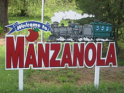
Nickname(s): "Manza", pronunciation muhn'sah Location in Otero County and the state of Colorado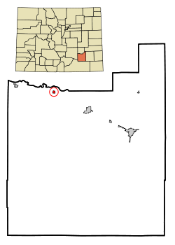
Coordinates: 38°6′33″N 103°52′4″W / 38.10917°N 103.86778°WCoordinates: 38°6′33″N 103°52′4″W / 38.10917°N 103.86778°W Country  United States
State  Colorado
County[1] Otero Incorporated (town) July 9, 1900[2] Government – Type Statutory Town[1] Area – Total 0.3 sq mi (0.7 km2) – Land 0.3 sq mi (0.7 km2) – Water 0 sq mi (0 km2) Elevation[3] 4,255 ft (1,297 m) Population (2000) – Total 525 – Density 1,750/sq mi (750/km2) Time zone Mountain (MST) (UTC-7) – Summer (DST) MDT (UTC-6) ZIP code[4] 81058 Area code(s) 719 FIPS code 08-48500 GNIS feature ID 0204826 Manzanola is a Statutory Town in Otero County, Colorado, United States. The population was 525 at the 2000 census.
Contents
Geography
Manzanola is located at 38°6′33″N 103°52′4″W / 38.10917°N 103.86778°W (38.109096, -103.867739)[5].
According to the United States Census Bureau, the town has a total area of 0.3 square miles (0.78 km2), all of it land.
Demographics
As of the census[6] of 2000, there were 525 people, 189 households, and 120 families residing in the town. The population density was 2,018.2 people per square mile (779.6/km²). There were 209 housing units at an average density of 803.4 per square mile (310.4/km²). The racial makeup of the town was 74.48% White, 0.57% African American, 1.14% Native American, 0.57% Asian, 20.76% from other races, and 2.48% from two or more races. Hispanic or Latino of any race were 45.14% of the population.
There were 189 households out of which 30.2% had children under the age of 18 living with them, 45.0% were married couples living together, 12.7% had a female householder with no husband present, and 36.5% were non-families. 31.2% of all households were made up of individuals and 16.9% had someone living alone who was 65 years of age or older. The average household size was 2.74 and the average family size was 3.57.
In the town the population was spread out with 30.7% under the age of 18, 11.6% from 18 to 24, 24.0% from 25 to 44, 18.9% from 45 to 64, and 14.9% who were 65 years of age or older. The median age was 33 years. For every 100 females there were 89.5 males. For every 100 females age 18 and over, there were 88.6 males.
The median income for a household in the town was $19,196, and the median income for a family was $26,250. Males had a median income of $24,688 versus $15,250 for females. The per capita income for the town was $9,598. About 23.2% of families and 30.3% of the population were below the poverty line, including 45.4% of those under age 18 and 15.8% of those age 65 or over.
See also
References
- ^ a b "Active Colorado Municipalities". State of Colorado, Department of Local Affairs. http://www.dola.state.co.us/dlg/local_governments/municipalities.html. Retrieved 2007-09-01.
- ^ "Colorado Municipal Incorporations". State of Colorado, Department of Personnel & Administration, Colorado State Archives. 2004-12-01. http://www.colorado.gov/dpa/doit/archives/muninc.html. Retrieved 2007-09-02.
- ^ "US Board on Geographic Names". United States Geological Survey. 2007-10-25. http://geonames.usgs.gov. Retrieved 2008-01-31.
- ^ "ZIP Code Lookup" (JavaScript/HTML). United States Postal Service. http://zip4.usps.com/zip4/citytown.jsp. Retrieved November 18, 2007.
- ^ "US Gazetteer files: 2010, 2000, and 1990". United States Census Bureau. 2011-02-12. http://www.census.gov/geo/www/gazetteer/gazette.html. Retrieved 2011-04-23.
- ^ "American FactFinder". United States Census Bureau. http://factfinder.census.gov. Retrieved 2008-01-31.
External links
Municipalities and communities of Otero County, Colorado Cities 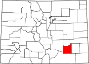
Towns Unincorporated
communityCategories:- Populated places in Otero County, Colorado
- Towns in Colorado


Wikimedia Foundation. 2010.