- Marlman, Colorado
-
Marlman, Colorado — Town — Coordinates: 39°13′12″N 104°32′12″W / 39.22°N 104.53667°WCoordinates: 39°13′12″N 104°32′12″W / 39.22°N 104.53667°W Country  United States
State  Colorado
Counties Bent[1] Elevation[1] 6,719 ft (2,048 m) Time zone MST (UTC-7) – Summer (DST) MDT (UTC-6) ZIP code[2] 81050 (La Junta) Marlman is an unincorporated town in Bent and Otero counties in the state of Colorado. The U.S. Post Office at La Junta (ZIP Code 81050) now serves Marlman postal addresses.[2]
Marlman lies along SH 194 15 miles northeast of La Junta and 20 miles west of Las Animas, the county seat and the largest city of the county.
See also
References
- ^ a b "US Board on Geographic Names". United States Geological Survey. 2007-10-25. http://geonames.usgs.gov. Retrieved 2008-01-31.
- ^ a b "ZIP Code Lookup" (JavaScript/HTML). United States Postal Service. December 27, 2006. http://zip4.usps.com/zip4/citytown.jsp. Retrieved December 27, 2006.
Municipalities and communities of Bent County, Colorado City 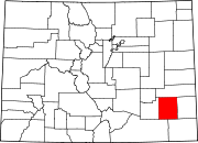
CDP Unincorporated
communitiesMunicipalities and communities of Otero County, Colorado Cities 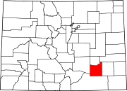
Towns Unincorporated
communityMarlman | Timpas
Categories:- Populated places in Bent County, Colorado
- Unincorporated communities in Colorado
- Populated places in Otero County, Colorado


Wikimedia Foundation. 2010.