- Rocky Ford, Colorado
Infobox Settlement
official_name = City of Rocky Ford, Colorado
other_name =
native_name =
nickname =
settlement_type =City
motto =
imagesize =
image_caption =
flag_size =
image_
seal_size =
image_shield =
shield_size =
image_blank_emblem =
blank_emblem_type =
blank_emblem_size =
imagesize =
image_caption =
flag_size =
image_
seal_size =
image_shield =
shield_size =
image_blank_emblem =
blank_emblem_type =
blank_emblem_size =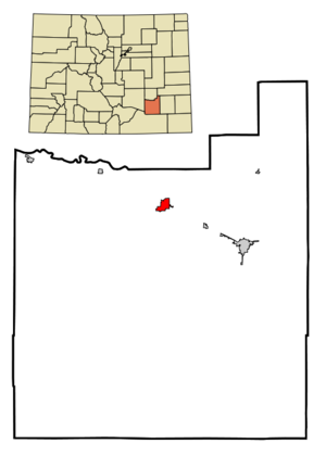
mapsize = 250x200px
map_caption = Location in Otero County and the state ofColorado
mapsize1 =
map_caption1 =
image_dot_
dot_mapsize =
dot_map_caption =
dot_x =
dot_y =
pushpin_
pushpin_label_position =
pushpin_map_caption =
pushpin_mapsize =
subdivision_type = Country
subdivision_name = USA
subdivision_type1 = State
subdivision_name1 = flag|Colorado
subdivision_type2 = Countycite web | url = http://www.dola.state.co.us/dlg/local_governments/municipalities.html | title = Active Colorado Municipalities | format =HTML | publisher = State of Colorado, Department of Local Affairs | accessdate = 2007-09-01]
subdivision_name2 = Otero CountyGR|3
subdivision_type3 =
subdivision_name3 =
subdivision_type4 =
subdivision_name4 =
government_footnotes =
government_type = Statutory City
leader_title =
leader_name =
leader_title1 =
leader_name1 =
leader_title2 =
leader_name2 =
leader_title3 =
leader_name3 =
leader_title4 =
leader_name4 =
established_title =
established_date =
established_title2 = Incorporated
established_date2 =August 19 ,1887 cite web | url = http://www.colorado.gov/dpa/doit/archives/muninc.html | title = Colorado Municipal Incorporations | format =HTML | publisher = State of Colorado, Department of Personnel & Administration, Colorado State Archives | date =2004-12-01 | accessdate = 2007-09-02]
established_title3 =
established_date3 =
area_magnitude =
unit_pref = Imperial
area_footnotes =
area_total_km2 = 4.4
area_land_km2 = 4.4
area_water_km2 = 0
area_total_sq_mi = 1.7
area_land_sq_mi = 1.7
area_water_sq_mi = 0
area_water_percent =
area_urban_km2 =
area_urban_sq_mi =
area_metro_km2 =
area_metro_sq_mi =
area_blank1_title =
area_blank1_km2 =
area_blank1_sq_mi =
population_as_of = 2000
population_footnotes =
population_note =
population_total = 4286
population_density_km2 = 974.1
population_density_sq_mi = 2521.2
population_metro =
population_density_metro_km2 =
population_density_metro_sq_mi =
population_urban =
population_density_urban_km2 =
population_density_urban_sq_mi =
population_blank1_title =
population_blank1 =
population_density_blank1_km2 =
population_density_blank1_sq_mi =
timezone = Mountain (MST)
utc_offset = -7
timezone_DST = MDT
utc_offset_DST = -6
latd = 38 |latm = 3 |lats = 4 |latNS = N
longd = 103 |longm = 43 |longs = 17 |longEW = W
elevation_footnotes = GR|3
elevation_m = 1274
elevation_ft = 4180
postal_code_type =ZIP code cite web | url = http://zip4.usps.com/zip4/citytown.jsp | title = ZIP Code Lookup| format =JavaScript /HTML | publisher =United States Postal Service | accessdate = December 26 | accessyear = 2007]
postal_code = 81067
area_code = 719
blank_name = FIPS code
blank_info = 08-65190
blank1_name = GNIS feature ID
blank1_info = [http://geonames.usgs.gov/pls/gnispublic/f?p=gnispq:3:::NO::P3_FID:0195481 0195481]
website =
footnotes =The City of Rocky Ford is a Statutory City located in Otero County,
Colorado ,United States . The population was 4,286 at theUnited States Census 2000 .Geography
Rocky Ford is located at coor dms|38|3|4|N|103|43|17|W|city (38.051000, -103.721387)GR|1.
According to the
United States Census Bureau , the city has a total area of 1.7square mile s (4.4km² ), of which, 1.7 square miles (4.4 km²) of it is land and 0.58% is water.Demographics
As of the
census GR|2 of 2000, there were 4,286 people, 1,655 households, and 1,136 families residing in the city. Thepopulation density was 2,521.8 people per square mile (973.4/km²). There were 1,852 housing units at an average density of 1,089.7/sq mi (420.6/km²). The racial makeup of the city was 72.42% White, 0.40% African American, 1.47% Native American, 0.75% Asian, 0.12% Pacific Islander, 21.86% from other races, and 2.99% from two or more races. Hispanic or Latino of any race were 57.14% of the population.There were 1,655 households out of which 33.0% had children under the age of 18 living with them, 48.1% were married couples living together, 15.5% had a female householder with no husband present, and 31.3% were non-families. 28.0% of all households were made up of individuals and 12.7% had someone living alone who was 65 years of age or older. The average household size was 2.53 and the average family size was 3.07.
In the city the population was spread out with 28.2% under the age of 18, 8.7% from 18 to 24, 23.9% from 25 to 44, 21.6% from 45 to 64, and 17.6% who were 65 years of age or older. The median age was 37 years. For every 100 females there were 95.9 males. For every 100 females age 18 and over, there were 91.2 males.
The median income for a household in the city was $23,359, and the median income for a family was $29,470. Males had a median income of $26,271 versus $17,485 for females. The
per capita income for the city was $12,742. About 14.6% of families and 20.3% of the population were below thepoverty line , including 28.2% of those under age 18 and 11.6% of those age 65 or over.Agriculture
Rocky Ford farmers produces cantelopes and watermelons for the Rocky Mountain region and package seeds for national distribution. [http://rockyfordchamber.net/ Rocky Ford Chamber of Commerce] ] [ [http://www.colorado.com/article226 Colorado Farm Talk] ]
ee also
*
Rocky Ford High School
*Colorado municipalities
*Otero County, Colorado
*State of Colorado References
External links
* [http://www.rocky-ford.com City of Rocky Ford - Official Site]
* [http://www.cmca.gen.co.us/Municipality.cfm?MunicipalityID=157 City of Rocky Ford contacts]
* [http://www.dot.state.co.us/App_DTD_DataAccess/Downloads/CityMaps/Rocky%20Ford.pdf CDOT map of the City of Rocky Ford]
*Mapit-US-cityscale|38.051|-103.721387
Wikimedia Foundation. 2010.