- Orchard City, Colorado
-
Town of Orchard City, Colorado — Town — Location in Delta County and the state of Colorado
Coordinates: 38°48′59″N 107°58′37″W / 38.81639°N 107.97694°WCoordinates: 38°48′59″N 107°58′37″W / 38.81639°N 107.97694°W Country  United States
State  Colorado
County[1] Delta Incorporated (town) May 25, 1912[2] Government – Type Statutory Town[1] Area – Total 11.4 sq mi (29.5 km2) – Land 11.4 sq mi (29.5 km2) – Water 0 sq mi (0 km2) Elevation[3] 5,446 ft (1,660 m) Population (2000) – Total 2,880 – Density 252.6/sq mi (97.6/km2) Time zone Mountain (MST) (UTC-7) – Summer (DST) MDT (UTC-6) ZIP code[4] 81410 Area code(s) 970 FIPS code 08-55980 GNIS feature ID 0203073 Website Town of Orchard City Orchard City is a Statutory Town in Delta County, Colorado, United States. The population was 2,880 at the 2000 census. The Austin Post Office (ZIP Code 81410) serves Orchard City.
Orchard City should not be confused with the unincorporated community of Orchard in Morgan County, Colorado.
Contents
Geography
Orchard City is located at 38°48′59″N 107°58′37″W / 38.81639°N 107.97694°W (38.816360, -107.976951)[5].
According to the United States Census Bureau, the town has a total area of 11.4 square miles (30 km2), all of it land.
History
In the early 20th century, because residents in this area were getting sick from drinking ditch water, three small communities (Austin, Cory, and Eckert) agreed to consolidate in order to be able to raise enough money to build a water pipeline. Thus Orchard City was incorporated in 1912, but even to this day it's more common for people to refer to one of the three specific communities within the boundaries of Orchard City. More info on the town website (listed under "External links", below).
Demographics
As of the census[6] of 2000, there were 2,880 people, 1,154 households, and 880 families residing in the town. The population density was 252.6 people per square mile (97.5/km²). There were 1,261 housing units at an average density of 110.6 per square mile (42.7/km²). The racial makeup of the town was 94.38% White, 0.07% African American, 0.97% Native American, 0.45% Asian, 0.07% Pacific Islander, 2.05% from other races, and 2.01% from two or more races. Hispanic or Latino of any race were 7.92% of the population.
There were 1,154 households out of which 25.7% had children under the age of 18 living with them, 67.3% were married couples living together, 6.2% had a female householder with no husband present, and 23.7% were non-families. 20.9% of all households were made up of individuals and 11.6% had someone living alone who was 65 years of age or older. The average household size was 2.41 and the average family size was 2.78.
In the town the population was spread out with 21.3% under the age of 18, 4.9% from 18 to 24, 19.7% from 25 to 44, 26.8% from 45 to 64, and 27.4% who were 65 years of age or older. The median age was 48 years. For every 100 females there were 96.7 males. For every 100 females age 18 and over, there were 93.5 males.
The median income for a household in the town was $35,915, and the median income for a family was $40,257. Males had a median income of $30,938 versus $20,179 for females. The per capita income for the town was $17,636. About 5.5% of families and 9.3% of the population were below the poverty line, including 10.5% of those under age 18 and 12.5% of those age 65 or over.
References
- ^ a b "Active Colorado Municipalities". State of Colorado, Department of Local Affairs. http://www.dola.state.co.us/dlg/local_governments/municipalities.html. Retrieved 2007-09-01.
- ^ "Colorado Municipal Incorporations". State of Colorado, Department of Personnel & Administration, Colorado State Archives. 2004-12-01. http://www.colorado.gov/dpa/doit/archives/muninc.html. Retrieved 2007-09-02.
- ^ "US Board on Geographic Names". United States Geological Survey. 2007-10-25. http://geonames.usgs.gov. Retrieved 2008-01-31.
- ^ "ZIP Code Lookup" (JavaScript/HTML). United States Postal Service. http://zip4.usps.com/zip4/citytown.jsp. Retrieved November 28, 2007.
- ^ "US Gazetteer files: 2010, 2000, and 1990". United States Census Bureau. 2011-02-12. http://www.census.gov/geo/www/gazetteer/gazette.html. Retrieved 2011-04-23.
- ^ "American FactFinder". United States Census Bureau. http://factfinder.census.gov. Retrieved 2008-01-31.
External links
Municipalities and communities of Delta County, Colorado City 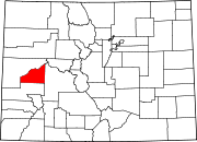
Towns Unincorporated
communitiesCategories:- Populated places in Delta County, Colorado
- Towns in Colorado


Wikimedia Foundation. 2010.