- Orchard Mesa, Colorado
-
Orchard Mesa, Colorado — CDP — Location in Mesa County and the state of Colorado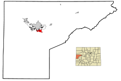
Coordinates: 39°2′19″N 108°31′33″W / 39.03861°N 108.52583°WCoordinates: 39°2′19″N 108°31′33″W / 39.03861°N 108.52583°W Country  United States
State  Colorado
County Mesa[1] Area – Total 5.6 sq mi (14.4 km2) – Land 5.4 sq mi (13.9 km2) – Water 0.2 sq mi (0.5 km2) Elevation[1] 4,649 ft (1,417 m) Population (2010) – Total 6,836 – Density 1,229.5/sq mi (474.7/km2) Time zone Mountain (MST) (UTC-7) – Summer (DST) MDT (UTC-6) ZIP code 81503 Area code(s) 970 FIPS code 08-56035 GNIS feature ID 0174585 Orchard Mesa is a census-designated place (CDP) in Mesa County, Colorado, United States. The population was 6,836 at the 2010 census.[2] Orchard Mesa is an unincorporated area adjacent to the city of Grand Junction.
Geography
Orchard Mesa is located at 39°02′19″N 108°31′33″W / 39.038727°N 108.525939°W.[3]
According to the United States Census Bureau, the CDP has a total area of 5.6 square miles (15 km2), of which 5.4 square miles (14 km2) is land and 0.2 square miles (0.52 km2), or 3.42%, is water.
Demographics
As of the census[4] of 2000, there were 6,456 people, 2,421 households, and 1,849 families residing in the CDP. The population density was 1,202.5 people per square mile (464.2/km²). There were 2,518 housing units at an average density of 469.0 per square mile (181.0/km²). The racial makeup of the CDP was 93.54% White, 0.36% African American, 0.85% Native American, 0.34% Asian, 0.12% Pacific Islander, 3.31% from other races, and 1.47% from two or more races. Hispanic or Latino of any race were 8.72% of the population.
There were 2,421 households out of which 36.0% had children under the age of 18 living with them, 63.6% were married couples living together, 8.7% had a female householder with no husband present, and 23.6% were non-families. 19.0% of all households were made up of individuals and 7.3% had someone living alone who was 65 years of age or older. The average household size was 2.66 and the average family size was 3.03.
In the CDP the population was spread out with 27.3% under the age of 18, 7.2% from 18 to 24, 29.4% from 25 to 44, 24.1% from 45 to 64, and 12.0% who were 65 years of age or older. The median age was 37 years. For every 100 females there were 94.9 males. For every 100 females age 18 and over, there were 95.8 males.
The median income for a household in the CDP was $40,885, and the median income for a family was $45,802. Males had a median income of $30,589 versus $23,775 for females. The per capita income for the CDP was $17,293. About 4.6% of families and 5.8% of the population were below the poverty line, including 8.0% of those under age 18 and 2.8% of those age 65 or over.
References
- ^ a b "US Board on Geographic Names". United States Geological Survey. 2007-10-25. http://geonames.usgs.gov. Retrieved 2008-01-31.
- ^ "Profile of General Population and Housing Characteristics: 2010 Demographic Profile Data (DP-1): Orchard Mesa CDP, Colorado". U.S. Census Bureau, American Factfinder. http://factfinder2.census.gov. Retrieved November 22, 2011.
- ^ "US Gazetteer files: 2010, 2000, and 1990". United States Census Bureau. 2011-02-12. http://www.census.gov/geo/www/gazetteer/gazette.html. Retrieved 2011-04-23.
- ^ "American FactFinder". United States Census Bureau. http://factfinder.census.gov. Retrieved 2008-01-31.
Municipalities and communities of Mesa County, Colorado Cities 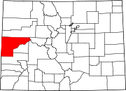
Towns CDPs Unincorporated
communitiesGateway | Glade Park | Loma | Mack | Mesa | Molina | Whitewater
Ghost town Categories:- Census-designated places in Colorado
- Populated places in Mesa County, Colorado


Wikimedia Foundation. 2010.