- Palisade, Colorado
Infobox Settlement
official_name = Town of Palisade, Colorado
other_name =
native_name =
nickname = Peach Capital of Colorado
settlement_type =Town
motto =
imagesize =
image_caption =
flag_size =
image_
seal_size =
image_shield =
shield_size =
image_blank_emblem =
blank_emblem_type =
blank_emblem_size =
imagesize =
image_caption =
flag_size =
image_
seal_size =
image_shield =
shield_size =
image_blank_emblem =
blank_emblem_type =
blank_emblem_size =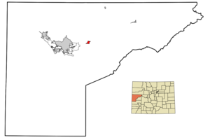
mapsize = 250px
map_caption = Location in Mesa County and the state ofColorado
mapsize1 =
map_caption1 =
image_dot_
dot_mapsize =
dot_map_caption =
dot_x =
dot_y =
pushpin_
pushpin_label_position =
pushpin_map_caption =
pushpin_mapsize =
subdivision_type = Country
subdivision_name = USA
subdivision_type1 = State
subdivision_name1 = flag|Colorado|name=State of Colorado
subdivision_type2 = Countycite web | url = http://www.dola.state.co.us/dlg/local_governments/municipalities.html | title = Active Colorado Municipalities | format =HTML | publisher = State of Colorado, Department of Local Affairs | accessdate = 2007-09-01]
subdivision_name2 = Mesa County
subdivision_type3 =
subdivision_name3 =
subdivision_type4 =
subdivision_name4 =
government_footnotes =
government_type = Statutory Town
leader_title =Mayor
leader_name = Dave Walker
leader_title1 =
leader_name1 =
leader_title2 =
leader_name2 =
leader_title3 =
leader_name3 =
leader_title4 =
leader_name4 =
established_title =
established_date =
established_title2 = Incorporated (town)
established_date2 =April 4 ,1904 cite web | url = http://www.colorado.gov/dpa/doit/archives/muninc.html | title = Colorado Municipal Incorporations | format =HTML | publisher = State of Colorado, Department of Personnel & Administration, Colorado State Archives | date =2004-12-01 | accessdate = 2007-09-02]
established_title3 =
established_date3 =
area_magnitude =
unit_pref = Imperial
area_footnotes =
area_total_km2 = 2.8
area_land_km2 = 2.8
area_water_km2 = 0
area_total_sq_mi = 1.1
area_land_sq_mi = 1.1
area_water_sq_mi = 0
area_water_percent =
area_urban_km2 =
area_urban_sq_mi =
area_metro_km2 =
area_metro_sq_mi =
area_blank1_title =
area_blank1_km2 =
area_blank1_sq_mi =
population_as_of = 2000
population_footnotes =
population_note =
population_total = 2579
population_density_km2 = 921.1
population_density_sq_mi = 2344.5
population_metro =
population_density_metro_km2 =
population_density_metro_sq_mi =
population_urban =
population_density_urban_km2 =
population_density_urban_sq_mi =
population_blank1_title =
population_blank1 =
population_density_blank1_km2 =
population_density_blank1_sq_mi =
timezone = Mountain (MST)
utc_offset = -7
timezone_DST = MDT
utc_offset_DST = -6
latd = 39 |latm = 6 |lats = 34 |latNS = N
longd = 108 |longm = 21 |longs = 15 |longEW = W
elevation_footnotes = GR|3
elevation_m = 1441
elevation_ft = 4728
postal_code_type =ZIP code cite web | url = http://zip4.usps.com/zip4/citytown.jsp | title = ZIP Code Lookup| format =JavaScript /HTML | publisher =United States Postal Service | accessdate = December 2 | accessyear = 2007]
postal_code = 81526
area_code = 970
blank_name = FIPS code
blank_info = 08-56970
blank1_name = GNIS feature ID
blank1_info = [http://geonames.usgs.gov/pls/gnispublic/f?p=gnispq:3:::NO::P3_FID:0174630 0174630]
website = [http://www.townofpalisade.org/ Town of Palisade] [http://www.palisadetourism.com/ Visitor Info]
footnotes =Palisade is a Statutory Town in Mesa County,
Colorado ,United States . It is part of theGrand Junction Metropolitan Statistical Area . The population was 2,579 at the 2000 census.Palisade is known for its
peach orchard s andwine vineyard s, and isColorado 's peach capitol.Geography
Palisade is located at coor dms|39|6|34|N|108|21|15|W|city (39.109335, -108.354277)GR|1.
According to the
United States Census Bureau , the town has a total area of 1.1square mile s (2.8km² ), of which, 1.1 square miles (2.8 km²) of it is land and 0.92% is water.Demographics
As of the
census GR|2 of 2000, there were 2,579 people, 1,051 households, and 689 families residing in the town. Thepopulation density was 2,399.5 people per square mile (930.6/km²). There were 1,117 housing units at an average density of 1,039.3/sq mi (403.1/km²). The racial makeup of the town was 93.91% White, 0.19% African American, 1.05% Native American, 0.50% Asian, 0.27% Pacific Islander, 1.36% from other races, and 2.71% from two or more races. Hispanic or Latino of any race were 6.24% of the population.There were 1,051 households out of which 30.5% had children under the age of 18 living with them, 49.8% were married couples living together, 12.0% had a female householder with no husband present, and 34.4% were non-families. 29.5% of all households were made up of individuals and 12.9% had someone living alone who was 65 years of age or older. The average household size was 2.35 and the average family size was 2.91.
In the town the population was spread out with 24.3% under the age of 18, 7.6% from 18 to 24, 26.5% from 25 to 44, 21.5% from 45 to 64, and 20.2% who were 65 years of age or older. The median age was 40 years. For every 100 females there were 87.8 males. For every 100 females age 18 and over, there were 85.3 males.
The median income for a household in the town was $27,739, and the median income for a family was $31,797. Males had a median income of $28,231 versus $21,875 for females. The
per capita income for the town was $15,539. About 11.0% of families and 14.0% of the population were below thepoverty line , including 21.2% of those under age 18 and 10.7% of those age 65 or over.Education
Palisade has one high school,
Palisade High School .ee also
*
State of Colorado
**Colorado cities and towns
***Colorado municipalities
**Colorado counties
***Mesa County, Colorado References
External links
* [http://www.townofpalisade.org/ Town of Palisade website]
** [http://www.dot.state.co.us/App_DTD_DataAccess/Downloads/CityMaps/Palisade.pdf CDOT map of the Town of Palisade]
*** [http://www.palisadetourism.com/ Visitor Information Website]
*Mapit-US-cityscale|39.109335|-108.354277
Wikimedia Foundation. 2010.