- Manning, Alberta
-
Manning — Town — Town of Manning Nickname(s): Land of the Mighty Moose Location of Manning in Alberta Coordinates: 56°54′51″N 117°37′38″W / 56.91417°N 117.62722°WCoordinates: 56°54′51″N 117°37′38″W / 56.91417°N 117.62722°W Country  Canada
Province  Alberta
Region Northern Alberta Census division 17 Municipal District County of Northern Lights Incorporated 1952 (village) 1957 (town) Government[1] - Mayor Sunni-Jeanne Walker - Governing body Manning Town Council - MLA Area - Total 1.3 sq mi (3.42 km2) Elevation 1,549 ft (472 m) Population (2006)[2] - Total 1,493 - Density 1,129.5/sq mi (436.1/km2) Time zone MST (UTC-7) Postal code span Area code(s) -1+780 Highways Highway 35
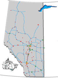
Highway 691Waterway Notikewin River Website Town of Manning Manning is a town in northern Alberta, Canada. It is known as the "Land of the Mighty Moose". It is located on Highway 35 73 km (45 mi) north of Peace River on the Notikewin River.
Manning is a service centre for the local agriculture, forestry and gas industries. It also serves the nearby rural area within the County of Northern Lights including Deadwood, Hotchkiss, North Star and Notikewin.
Contents
History
The original name "Aurora", was rejected by the postal authorities because of possibility of confusion with Aurora, Ontario.[3][citation needed] At a public meeting in 1947, the community was renamed in honour of Ernest Manning who was the premier of Alberta from 1943 to 1968.
Amenities
Manning has a swimming pool, curling rink, ice hockey arena, ski hill and golf course. There is a post office, hospital, seven churches, and three bars. Manning also has a museum. It's a home to many pieces of antique farming equipment, vehicles and other extraordinary items, like the albino moose.
For about thirty years, the Manning Farmers’ Market[4]has been a fixture in the hub of Manning.
Education
Manning contains two public schools, Manning Elementary [5] (K-6) and Paul Rowe High School (7-12); and one separate school, Rosary Separate School (K-9).
Manning is also home to a Northern Lakes College campus.
Demographics
According to the 2006 census, Manning has a:
- population of 1,493 living in 595 dwellings, a 15.5% increase from 2001
- land area of 3.42 km2 (1.32 sq mi)
- and a population density of 436.1 /km2 (1,129 /sq mi).[2]
Historical list of mayors
- Del Harbourne
- Ken McVicar
- Bill King
- Dan Paulovich
- Sunni Walker (present)
See also
- List of communities in Alberta
- List of towns in Alberta
References
- ^ Alberta Municipal Affairs: Municipal Officials Search
- ^ a b Statistics Canada (Census 2006). "Manning - Community Profile". http://www12.statcan.ca/english/census06/data/profiles/community/Details/Page.cfm?Lang=E&Geo1=CSD&Code1=4817078&Geo2=PR&Code2=48&Data=Count&SearchText=Manning&SearchType=Begins&SearchPR=01&B1=All&GeoLevel=&GeoCode=4817078. Retrieved 2007-06-12.
- ^ Holmgren, Eric J. & Patricia M. Holmgren. Over 2000 Place Names of Alberta. expanded 3rd ed. Saskatoon, Saskatchewan. Western Producer Prairie Books. 1976. p. 173
- ^ Manning Farmers’ Market
- ^ Manning Elementary School
External links
- Town of Manning
- Discover the Peace Country. Manning Statistics

Chinchaga Wildland HighLevel Fort Vermilion 
Fort St. John 
 Manning

Hines Creek Berwyn Peace River Categories:- Towns in Alberta
- Municipal seats in Alberta
Wikimedia Foundation. 2010.

