- Bowden, Alberta
Infobox Settlement
official_name = Town of Bowden
other_name =
native_name =
nickname =
settlement_type = Town
motto =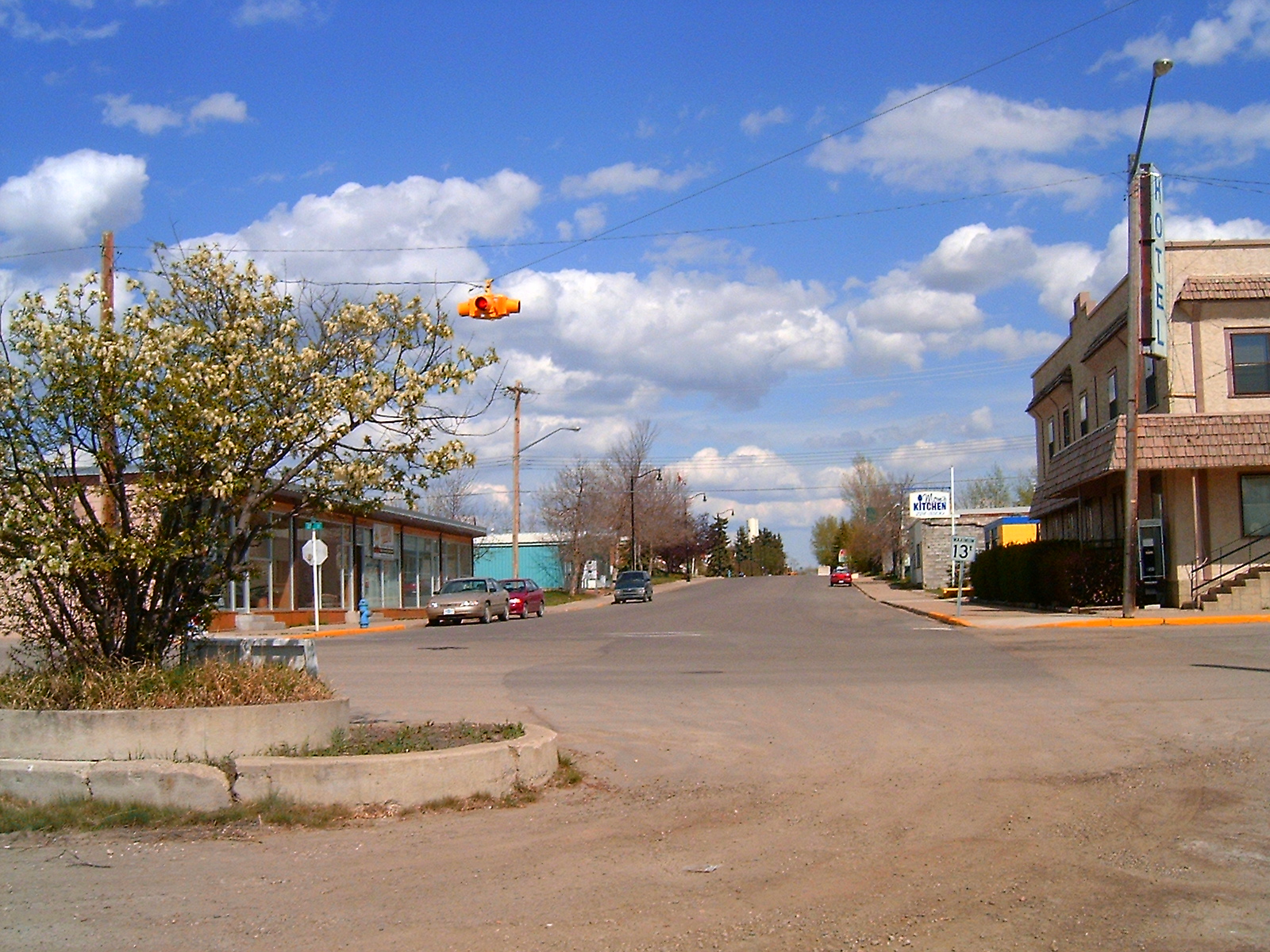
imagesize =
image_caption = Bowden main street
flag_size =
image_
seal_size =
image_shield =
shield_size =
image_blank_emblem = Bowden-logo.png
mapsize =
map_caption =
mapsize1 =
map_caption1 =
image_dot_
dot_mapsize = 180px
dot_map_caption = Location of Bowden inAlberta
dot_x =81 |dot_y =173
pushpin_
pushpin_label_position =
pushpin_map_caption =
pushpin_mapsize =
subdivision_type = Country
subdivision_name = CAN
subdivision_type1 = Province
subdivision_name1 = AB
subdivision_type2 = Region
subdivision_name2 =Central Alberta
subdivision_type3 = Census division
subdivision_name3 = 8
subdivision_type4 = County
subdivision_name4 = Red Deer County
government_footnotes =
government_type =
leader_title = Mayor
leader_name = Cody Berggren
leader_title1 = Governing body
leader_name1 = Bowden Town Council
leader_title2 = Manager
leader_name2 = Dan Proctor
leader_title3 = MP
leader_name3 = Bob Mills
leader_title4 = MLA
leader_name4 =Victor Doerksen
established_title = Founded
established_date = 1887
established_title2 = Incorporated
established_date2 = 1981
established_title3 =
established_date3 =
area_magnitude =
unit_pref =
area_footnotes =
area_total_km2 = 1.90
area_land_km2 =
area_water_km2 =
area_total_sq_mi =
area_land_sq_mi =
area_water_sq_mi =
area_water_percent =
area_urban_km2 =
area_urban_sq_mi =
area_metro_km2 =
area_metro_sq_mi =
population_as_of = 2006
population_footnotes =
population_note =
population_total = 1,205
population_density_km2 = 635.7
population_density_sq_mi =
population_metro =
population_density_metro_km2 =
population_density_metro_sq_mi =
population_urban =
population_density_urban_km2 =
population_density_urban_sq_mi =
population_blank1_title =
population_blank1 =
population_density_blank1_km2 =
population_density_blank1_sq_mi=
timezone = MST
utc_offset = -7
timezone_DST =
utc_offset_DST =
latd=51 |latm=55 |lats=50 |latNS=N
longd=114 |longm=01 |longs=32 |longEW=W
elevation_footnotes =
elevation_m = 998
elevation_ft =
postal_code_type = Postal code span
postal_code = T4E
area_code = +1-403
blank_name =
blank_info =
blank1_name =
blank1_info =
website = [http://www.town.bowden.ab.ca Town of Bowden]
footnotes =Bowden is a
town incentral Alberta ,Canada . It is located in Red Deer County, km to mi|45|spell=Commonwealth|precision=0|wiki=yes south of Red Deer, on the Queen Elizabeth II Highway.Geography
Nearby communities are Innisfail (north), James River Bridge (west), Huxley (east) and Olds (south).
Bowden also has a 9 hole golf course with a fully licensed clubhouse.
Demographics
Its population was 1,174 in 2005. [
Alberta Municipal Affairs - [http://www.municipalaffairs.gov.ab.ca/ms/pdf/2005pop.pdf 2005 Municipal Census] ] In 2006, Bowden had a population of 1,205 living in 531 dwellings, a 2.6% increase from 2001. The town has a land area of km2 to mi2|1.90|abbr=yes|wiki=yes and apopulation density of Pop density km2 to mi2|635.7| spell=UK | abbr=yes.Cite web| url= http://www12.statcan.ca/english/census06/data/profiles/community/Details/Page.cfm?Lang=E&Geo1=CSD&Code1=4808006&Geo2=PR&Code2=48&Data=Count&SearchText=Bowden&SearchType=Begins&SearchPR=01&B1=All&GeoLevel=&GeoCode=4808006 | title= Bowden - Community Profile | author= Statistics Canada| authorlink= Statistics Canada| year= Census 2006 | accessdate= 2007-06-10]ee also
*
List of communities in Alberta
*Towns of Alberta References
External links
* [http://www.town.bowden.ab.ca Town of Bowden]
Geographic Location (8-way)
Centre = Bowden
North =

Wikimedia Foundation. 2010.