- Alberta Highway 22
-
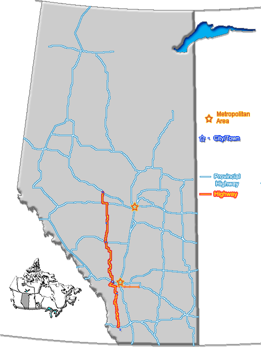
Highway 22

Cowboy Trail Route information Length: 584 km (363 mi) Major junctions From:  Hwy 3 (Crowsnest Highway) near Lundbreck
To:  Hwy 18 near Mayerthorpe
Location Rural municipalities: Pincher Creek No. 9 M.D., Ranchland No. 26 M.D., Foothills No. 31 M.D., Rocky View County, Mountain View County, Clearwater County, Wetaskiwin No. 10 County, Brazeau County, Parkland County, Yellowhead County, Lac Ste. Anne County Towns: Black Diamond, Turner Valley, Cochrane, Sundre, Rocky Mountain House, Drayton Valley, Mayerthorpe Villages: Longview, Cremona, Caroline Highway system Provincial highways in Alberta
←  Hwy 21
Hwy 22X  →
→Highway 22 is a highway in Alberta, Canada. The highway has been billed as the Cowboy Trail by Travel Alberta since it passes through a lot of ranch country. The highway generally follows the eastern slopes of the Rocky Mountains.
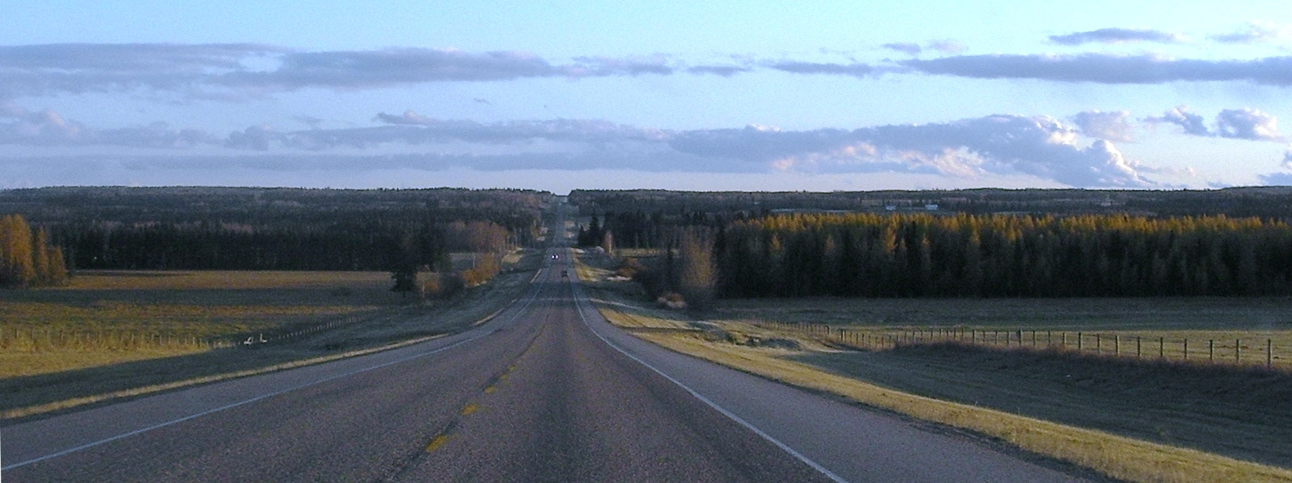
 Southbound, north of Sundre
Highway 22 starts at the Crowsnest Highway (Highway 3) between Pincher Creek and the Crowsnest Pass. It then goes north through Longview, Black Diamond, Turner Valley, and Millarville. The highway then jogs west at Highway 22X. About 30 km (19 mi) later, it turns north again and passes through the Hamlet of Bragg Creek where Highway 22X ends. Highway 22 continues north past the Trans-Canada Highway (Highway 1) west of Calgary, north through the Town of Cochrane, the Hamlet of Cochrane Lake, and the Village of Cremona to Highway 27.
The highway continues in a generally northward direction (with a number of westward jogs), passing through Sundre, Caroline, Rocky Mountain House and Drayton Valley until it intersects Highway 16 (Yellowhead Highway) at Entwistle approximately 85 km (53 mi) west of Edmonton). After a 8 km (5.0 mi) jog to the west, it continues north to cross Highway 43 at Town of Mayerthorpe, where it terminates 7 km north of the town at Highway 18.
Major intersections
From south to north:
km Description 0 Hwy 3 – Lethbridge, Cowley, Crowsnest Pass
Highway 22 begins24 Crosses Oldman River 44  Hwy 520 east – Claresholm, Barons
71  Hwy 533 east – Nanton, Vulcan
Highway 22 enters Chain Lakes Provincial Park82  Hwy 532 west – Don Getty Wildland Provincial Park
96  Hwy 540 east – Pekisko
109 Longview
Crosses the Highwood River111  Hwy 541 west – Elbow-Sheep Wildland Provincial Park
118 Hartell
 Hwy 543 east – High River
128 Black Diamond
 Hwy 7 east – Okotoks, Aldersyde
Highway 22 turns west132 Turner Valley
 Hwy 546 west
Highway 22 continues north143  Hwy 549 west – Millarville
Begin Highway 549 concurrence146 Hwy 549 east – Okotoks
End Highway 549 concurrence159  Hwy 22X east – Calgary
Highway 22 turns west near Priddis185  Hwy 66 west – Little Elbow recreation area
 Hwy 762 south – Millarville
Highway 22 continues north189 Bragg Creek
 Hwy 758 south – Bragg Creek Provincial Park
194 Passes the resort community of Redwood Meadows 199  Hwy 8 east – Calgary (Glenmore Trail)
207  Hwy 1 (Exit 161/161A) – Calgary, Banff
217 Crosses the Bow River and enters Cochrane 219  Hwy 1A – Calgary, Canmore
exits Cochrane228  Hwy 567 east – Airdrie, Irricana
244 Bottrel (2 km west)
 Hwy 574 east – Madden, Crossfield
255  Hwy 579 west – Water Valley
259 Cremona
 Hwy 580 east – Carstairs
274 Shantz
 Hwy 582 east – Didsbury
289  Hwy 27 east – Olds, Torrington, Three Hills
Highway 22 turns west294 Enters Sundre
Crosses the Little Red Deer River297 Crosses Red Deer River 298  Hwy 760 south – Bergen
299  Hwy 584 west
Highway 22 continues north and exits Sundre315  Hwy 587 east – Bowden
332  Hwy 54 east – Innisfail
Highway 22 jogs west337 Passes through Caroline 345  Hwy 591 west
Highway 22 continues north371  Hwy 11 east – Sylvan Lake, Red Deer, Stettler
Highway 22 turns west
Begin Highway 11 concurrence379 Rocky Mountain House
 Hwy 11A west /
  Hwy 752 south
 Hwy 598 east – Leslieville
383 Hwy 11 west – Nordegg, Saskatchewan River Crossing
End Highway 11 concurrence
Highway 22 continues north and exits Rocky Mountain House389  Hwy 12 east – Bentley, Lacombe, Stettler
416  Hwy 53 east – Rimbey, Ponoka
443  Hwy 13 – Alder Flats, Winfield, Wetaskiwin
463  Hwy 616 – Buck Creek, Breton
474  Hwy 39 east – Thorsby, Calmar, Leduc
Highway 22 jogs west480 Crosses the North Saskatchewan River 485  Hwy 620 west – Lodgepole, Brazeau Reservoir
Highway 22 turns north and passes through Drayton Valley495 Rocky Rapids
 Hwy 621 west – Cynthia
505  Hwy 624 east – Tomahawk
530  Hwy 16 east – Spruce Grove, Edmonton
 Hwy 16A west – Entwistle, Evansburg
Highway 22 truns west
Begin Highway 16 concurrence, crosses the Pembina River538 Hwy 16 west – Edson, Hinton, Jasper
Highway 22 continues north
End Highway 16 concurrence539 Hwy 16A – Entwistle, Evansburg571  Hwy 647 west – Anselmo
577  Hwy 43 – Valleyview, Grande Prairie, Edmonton
Highway 22 passes through Mayerthorpe584 Hwy 18 – Green Court, Barrhead, Westlock
Highway 22 ends1.000 mi = 1.609 km; 1.000 km = 0.621 mi
Concurrency terminus • Closed/Former • Incomplete access • UnopenedExternal links
- 2010 Provincial Highways 1 - 216 Series Progress Chart (map, 8 MB) by Alberta Transportation.
- The Cowboy Trail's official webpage
Highways in Alberta 
Expressways
and FreewaysNamed
HighwaysAnthony Henday · Bicentennial · Bighorn · Bow Valley Parkway · Bow Valley Trail · Buffalo · Cowboy · Crowsnest · David Thompson · Devonian Way · Dinosaur · Forestry Trunk · Grizzly · Hoo Doo Trail · Icefields Parkway · Mackenzie · Northern Woods and Water Route · Parkland · Poundmaker · Queen Elizabeth II · Red Coat Trail · Sherwood Park Freeway · Stoney · Trans-Canada · Veterans Memorial · Yellowhead1-216 Series 1 · 1A · 1X · 2 · 2A · 3 · 3A · 4 · 5 · 6 · 7 · 8 · 9 · 10 · 10X · 11 · 11A · 12 · 13 · 13A · 14 · 15 · 16 · 16A · 17 · 18 · 19 · 20 · 20A · 21 · 22 · 22X · 23 · 24 · 25 · 26 · 27 · 28 · 28A · 29 · 31 · 32 · 33 · 35 · 36 · 37 · 38 · 39 · 40 · 41 · 41A · 42 · 43 · 44 · 45 · 47 · 49 · 50 · 52 · 53 · 54 · 55 · 56 · 58 · 59 · 60 · 61 · 62 · 63 · 64 · 64A · 66 · 68 · 69 · 72 · 88 · 93 · 93A · 100 · 201 · 216Categories:- Alberta Primary Highways, 1-216 series


Wikimedia Foundation. 2010.