- Alberta Highway 22X
-
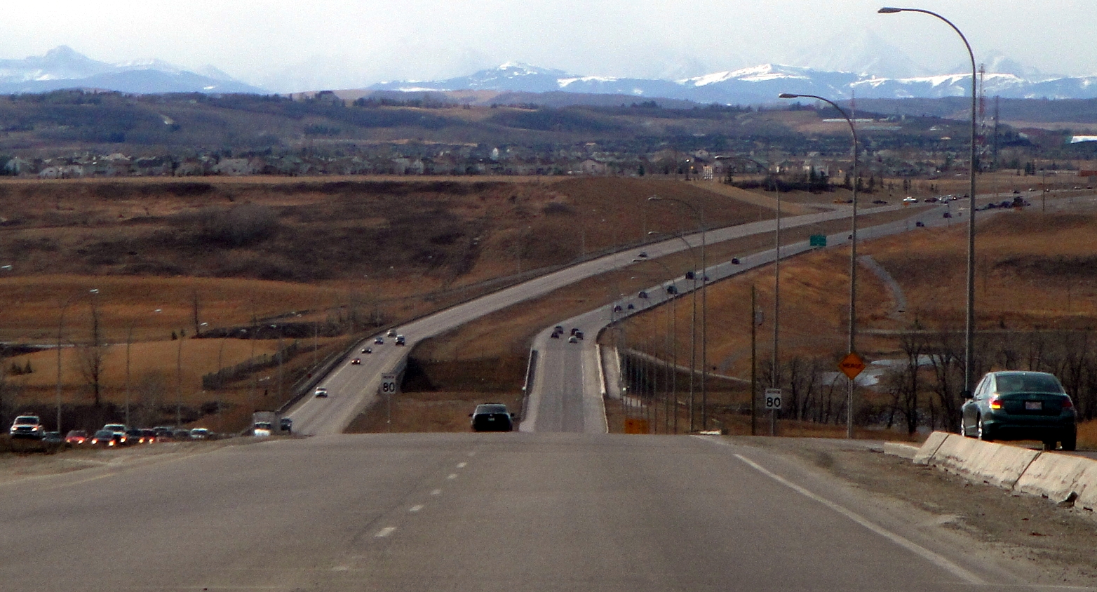
Highway 22X

Route information Length: 74 km (46 mi) Major junctions From: 
 Hwy 24 / Hwy 901 near Carseland
To:  Hwy 22 (Cowboy Trail) near Priddis
Location Rural municipalities: Wheatland County, Rocky View County, Foothills No. 31 M.D. Major cities: Calgary Highway system Provincial highways in Alberta
←  Hwy 22
Hwy 23  →
→Highway 22X is a highway in Alberta, Canada. Highway 22X is an east-west branch of the north-south running, Highway 22. The 22X goes from the junction of Highway 24 and Highway 901, westerly to the junction of Highway 22 just east of Priddis over a distance of about 54 km (34 mi). The highway passes through southern Calgary, where it becomes Marquis of Lorne Trail (
 /mɑrˈkiː/; sometimes referred to by the French variant "Marquis de Lorne Trail"), and over Highway 2 (Deerfoot Trail within Calgary). When the highway crosses Macleod Trail (Highway 2A), it changes its name to Spruce Meadows Trail, after the show jumping facility of the same name that it passes. About 10 km (6.2 mi) after it exits the west end of the city, the 22X ends at Highway 22 just east of the Hamlet of Priddis.
Contemporary issues
The Marquis of Lorne Trail portion of Highway 22X has, in recent history, earned a reputation of being extremely dangerous. Southward growth of Calgary had turned the small rural highway (it remains a 2-lane rural arterial road in many places) into an urban street that was not suited for high traffic volumes[citation needed]. Major upgrades have made the stretch of highway safer, the most important of which extended Deerfoot Trail southward to create a continuous Highway 2, reducing the need for trucks and southbound vehicles to cut over to Macleod Trail via 22X. In the late 1990s the son of a motorist killed along 22X spearheaded efforts to have streetlights installed along the most dangerous stretch of road. Despite the completion of the Deerfoot Trail extension, 22X remains a major access road for a half-dozen communities: Bridlewood, Somerset, Silverado, Sundance, Chaparall, McKenzie Lake, Cranston, Auburn Bay, and Mahogany.
As of late 2007, the latest upgrade project of twinning 22X, the deck for the second bridge that crosses Fish Creek Provincial Park and the Bow River, has been completed; the road is now twinned from just east of Macleod Trail to just before 52nd Street SE, east of the Deerfoot Trail. Highway 22X is also twinned west of Macleod Trail to a point beyond Calgary's city limits, though the road remains two lanes as it crosses over Macleod Trail.
Until the late 1990s, all of Highway 22X within the City of Calgary went by the name "Marquis of Lorne Trail", until the owners of Spruce Meadows successfully lobbied the city to rename the western portion after the internationally known show-jumping facility. It is now known as "Spruce Meadows Trail" or simply, "22X". In 2009, the province announced plans to complete the southeastern portion of the Calgary ring road by extending the still-under-construction East Freeway (or Stoney Trail) south from Highway 1A. Provincial announcements and media have indicated that the ring road project also includes the portion of Highway 22X from the East Freeway to Macleod Trail. Whether this means the road will be upgraded, or possibly receive a new designation, remains to be seen.
See also
External links
- 2010 Provincial Highways 1 - 216 Series Progress Chart (map, 8 MB) by Alberta Transportation.
Roads in Calgary, Alberta North-south routes Nose Hill Drive • Sarcee Trail • Shaganappi Trail • Crowchild Trail · Centre Street · Macleod Trail · Edmonton Trail • Blackfoot Trail • Deerfoot Trail • Barlow Trail • Metis Trail • 52 Street EEast-west routes Country Hills Boulevard • Beddington Trail • Airport Trail • McKnight Boulevard • John Laurie Boulevard • Memorial Drive • Bow Trail • 17 Avenue SW • 17 Avenue SE • Heritage Drive • Southland Drive • Anderson Road • Canyon Meadows DriveHighways and expressways 1 (16 Avenue N) · 1A (Crowchild Trail) · 2 (Deerfoot Trail) · 2A (Macleod Trail) · 8 (Glenmore Trail) · 22X (Marquis of Lorne Trail) · 201 (Stoney Trail) • 560 (Glenmore Trail) • 563 (Old Banff Coach Road) • 772 (Symons Valley Road) • 773 (37 Street SW)Highways in Alberta 
Expressways
and FreewaysNamed
HighwaysAnthony Henday · Bicentennial · Bighorn · Bow Valley Parkway · Bow Valley Trail · Buffalo · Cowboy · Crowsnest · David Thompson · Devonian Way · Dinosaur · Forestry Trunk · Grizzly · Hoo Doo Trail · Icefields Parkway · Mackenzie · Northern Woods and Water Route · Parkland · Poundmaker · Queen Elizabeth II · Red Coat Trail · Sherwood Park Freeway · Stoney · Trans-Canada · Veterans Memorial · Yellowhead1-216 Series 1 · 1A · 1X · 2 · 2A · 3 · 3A · 4 · 5 · 6 · 7 · 8 · 9 · 10 · 10X · 11 · 11A · 12 · 13 · 13A · 14 · 15 · 16 · 16A · 17 · 18 · 19 · 20 · 20A · 21 · 22 · 22X · 23 · 24 · 25 · 26 · 27 · 28 · 28A · 29 · 31 · 32 · 33 · 35 · 36 · 37 · 38 · 39 · 40 · 41 · 41A · 42 · 43 · 44 · 45 · 47 · 49 · 50 · 52 · 53 · 54 · 55 · 56 · 58 · 59 · 60 · 61 · 62 · 63 · 64 · 64A · 66 · 68 · 69 · 72 · 88 · 93 · 93A · 100 · 201 · 216Categories:- Alberta Primary Highways, 1-216 series

Wikimedia Foundation. 2010.