- Cranston, Calgary
-
For other uses, see Cranston (disambiguation).
Cranston — Neighbourhood — Location of Cranston in Calgary Coordinates: 50°53′32″N 113°59′01″W / 50.89222°N 113.98361°W Country  Canada
Province  Alberta
City  Calgary
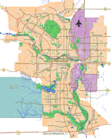
Quadrant SE Ward 12 Government[1] - Administrative body Calgary City Council - Alderman Shane Keating - MLA Art Johnston (Calgary-Hays) Elevation 1,045 m (3,428 ft) Population (2010)[2] - Total 9,645 Website Cranston Community Association Cranston is a master planned residential community in the south-east quadrant of Calgary, Alberta. Cranston contains a wide range of single family and multi family residential, commercial, one public elementary school and one separate board K-9 school, and Century Hall (a private Cranston residents recreation facility). It is bounded by Marquis of Lorne Trail to the north and Fish Creek Park and the Bow River to the west and south. Its eastern boundary is Deerfoot Trail and the new communities of Auburn Bay and the mixed use town centre development of Seton and the new Calgary South Health Campus hospital. It is represented in the Calgary City Council by Ward 12 Alderman Shane Keating.[1]
Contents
Demographics
In 2010 the neighbourhood had a population of 9.645.[3][4]
In 2009, the neighbourhood had a population of 9,140, a 28% increase from 2007, when the census registered 6,615 residents.[2]
Education
In September 2010, the Calgary Board of Education opened Cranston Elementary School which serves K-4 students residing in Cranston. Additionally, the Calgary Catholic School District opened the Christ the King School in September 2010.
Community Amenities
Cranston Market is a feature of the community that provides the residents of the community many different stores and services. Some of the tenants of the Market include Sobeys, Petro Canada, the Berwick Public House, Subway, Good Earth Cafe as well as many professional services such as a dentist, an optometrist and a veterinary clinic.
Directly across the street from the Market is the brand new Century Hall. This is a facility that is private and only accessible by residents of Cranston and their guests. There are multiple meeting and banquet rooms, a full size gymnasium as well as a 7-acre (28,000 m2) gated park which includes tennis courts, hockey rink, basketball courts, a playground and a waterpark. .[5]
See also
References
- ^ a b City of Calgary (2004). "Ward 12 Profile". http://www.calgary.ca/docgallery/bu/cns/community_social_statistics/ward_12_profile.pdf. Retrieved 2007-05-17.
- ^ a b City of Calgary (2008). "2008 Civic Census Summary". http://www.calgary.ca/DocGallery/BU/cityclerks/city.pdf. Retrieved 2009-04-29.
- ^ City of Calgary (2006). "Community Population Comparison". http://www.calgary.ca/DocGallery/BU/cityclerks/popcomparisonbycomm.pdf. Retrieved 2009-10-01.
- ^ City of Calgary (2006). "Cranston Community Statistics". http://www.calgary.ca/docgallery/bu/cns/community_social_statistics/cranston.pdf. Retrieved 2007-05-17.
- ^ Cranston Residents Association (2010). "Century Hall Brochure". http://www.cranston-community.com/Community/~/media/www.cranston.com/pdf/downloads/Century%20Hall%20Brochure.ashx. Retrieved 2010-05-02.
External links
- Federation of Calgary Communities. "Cranston Community". http://www.calgaryarea.com/se/cranston/cranston.htm. Retrieved 2007-05-17.
Coordinates: 50°53′32″N 113°59′01″W / 50.89222°N 113.98361°W
Categories:- Neighbourhoods in Calgary
- Calgary stubs
Wikimedia Foundation. 2010.


