- Haysboro, Calgary
Infobox Settlement
official_name = Haysboro
other_name =
settlement_type = Neighbourhood
imagesize =
image_caption =
city_logo =
citylogo_size =
mapsize =
map_caption =
image_dot_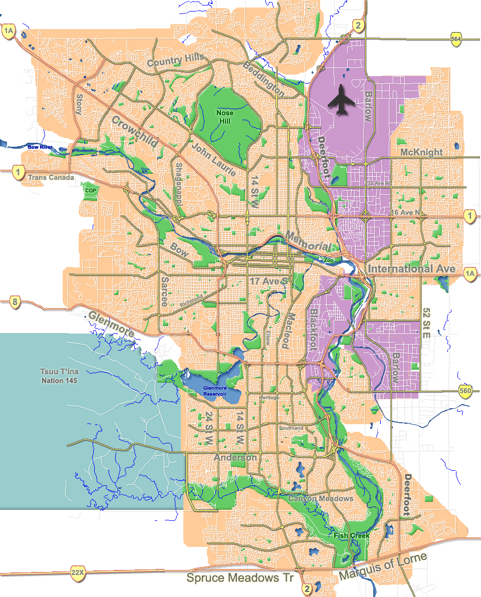
dot_mapsize = 225px
dot_map_caption = Location of Haysboro inCalgary
dot_x = 118|dot_y = 186
subdivision_type = Country
subdivision_name = CAN
subdivision_type1 = Province
subdivision_name1 = AB
subdivision_type2 = City
subdivision_name2 = flag|Calgary
subdivision_type3 = Quadrant
subdivision_name3 = SW
subdivision_type4 = Ward
subdivision_name4 = 12
government_footnotes =
government_type =
leader_title = Administrative body
leader_name =Calgary City Council
leader_title1 = Alderman
leader_name1 = Ric McIver
leader_title2 =
leader_name2 =
established_title = Established
established_date = 1958
established_title2 = Annexed
established_date2 = 1956
area_magnitude =
area_footnotes =
area_total_km2 = 2.9
population_as_of = 2006
population_footnotes =
population_total = 5970
population_density_km2 =
population_blank1_title = Average Income
population_blank1 = $52261
timezone =
utc_offset =
latd= 50|latm= 58|lats= 13|latNS= N|longd= 114|longm= 05|longs= 05|longEW= W
elevation_footnotes =
elevation_m = 1060
postal_code_type =
postal_code =
area_code =
blank_name =
blank_info =
blank1_name =
blank1_info =
website = [http://www.calgaryarea.com/sw/haysboro/haysboro.htm Haysboro Community Association]
footnotes = Haysboro is a residential neighbourhood in the south-west quadrant ofCalgary ,Alberta . It is bounded by Heritage Drive to the north, Macleod Trail to the east, Southland Drive to the south and 14 Street W and theGlenmore Reservoir to the west. It is bisected by Elbow Drive.Haysboro was established in 1958 on land owned by
Harry Hays until the annexation (1956). It is represented in theCalgary City Council by Ward 12Alderman Ric McIver. [Cite web| author= Federation of Calgary Communities | url= http://www.calgaryarea.com/sw/haysboro/haysboro.htm |title= Haysboro Community| accessdate= 2007-05-10]Demographics
In 2006 the neighbourhood had a population of 5,970.Cite web| url=http://www.calgary.ca/DocGallery/BU/cityclerks/popcomparisonbycomm.pdf | author= City of Calgary | title= Community Population Comparison | year=2006 | accessdate= 2007-05-10] Residents in this community had a
median household income of $52,261 in 2000, and there were 10.4% low income residents living in the neighborhood.Cite web| url= http://www.calgary.ca/docgallery/bu/cns/community_social_statistics/ward_12_profile.pdf | title=Ward 12 Profile| author=City of Calgary| year=2004| accessdate= 2007-05-10] As of 2000, 19.3% of the residents wereimmigrant s. A proportion of 33.5% of the buildings werecondominium s orapartment s, and 23.9% of the housing was used forrenting .Cite web| url= http://www.calgary.ca/docgallery/bu/cns/community_social_statistics/haysboro.pdf| title= Haysboro Community Statistics| author= City of Calgary | year= 2006 | accessdate= 2007-05-10]Education
The community is served by Akiva Academy, Eugene Coste Elementary, Haysboro Elementary and Woodman Junior High
public school s, as well as by St. Gerard Bilingual Elementary and Bishop Grandin Senior High School (catholic).ee also
*
List of neighbourhoods in Calgary References
External links
* [http://www.calgarycommunities.com/communities/haysboro.php Haysboro Community Association]
Canadian City Geographic Location (8-way)
Northwest =Glenmore Reservoir ,

Wikimedia Foundation. 2010.