- Radisson Heights, Calgary
Infobox Settlement
official_name = Albert Park/Radisson Heights
other_name =
settlement_type = Neighbourhood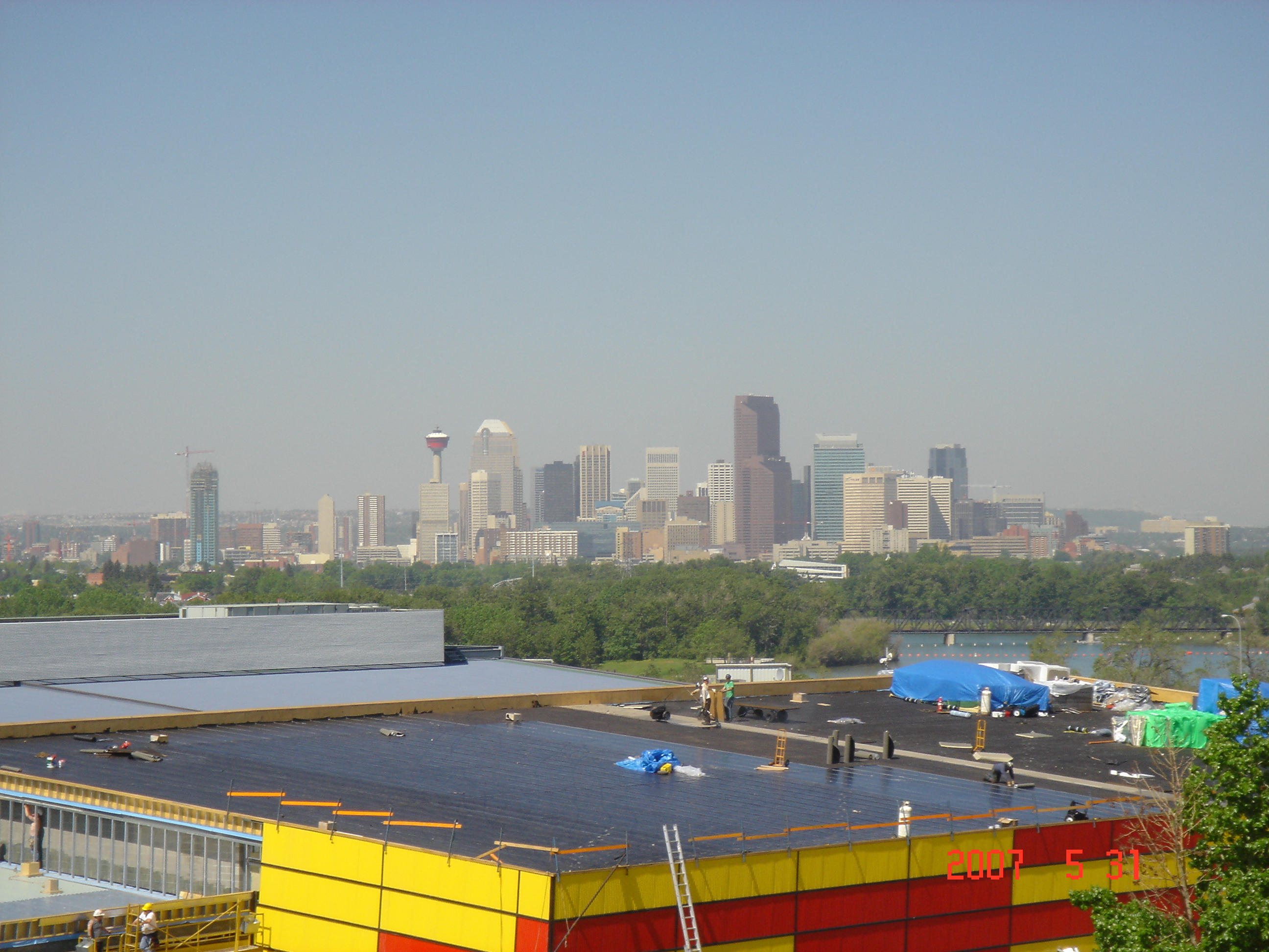
imagesize =
image_caption = Downtown skyline view from Radisson Heights
city_logo =
citylogo_size =
mapsize =
map_caption =
image_dot_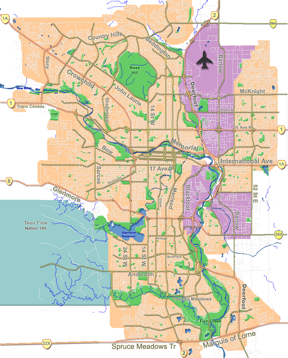
dot_mapsize = 220px
dot_map_caption = Location of Albert Park/Radisson Heights inCalgary
dot_x = 169|dot_y = 114
subdivision_type = Country
subdivision_name = CAN
subdivision_type1 = Province
subdivision_name1 = AB
subdivision_type2 = City
subdivision_name2 = flag|Calgary
subdivision_type3 = Quadrant
subdivision_name3 = SE
subdivision_type4 = Ward
subdivision_name4 = 10
government_footnotes =
government_type =
leader_title = Administrative body
leader_name =Calgary City Council
leader_title1 = Alderman
leader_name1 = Andre Chabot
leader_title2 =
leader_name2 =
established_title = Established
established_date = 1910
established_title2 =
established_date2 =
area_magnitude =
area_footnotes =
area_total_km2 = 1.7
population_as_of = 2006
population_footnotes =
population_total = 6098
population_density_km2 =
population_blank1_title = Average Income
population_blank1 = $38019
timezone =
utc_offset =
latd= 51|latm= 02|lats= 44|latNS= N|longd= 113|longm= 59|longs= 22|longEW= W
elevation_footnotes =
elevation_m = 1085
postal_code_type =
postal_code =
area_code =
blank_name =
blank_info =
blank1_name =
blank1_info =
website = [http://www.calgaryarea.com/se/albertpark/albertpark.htm Albert Park/Radisson Heights Community Association]
footnotes = Albert Park/Radisson Heights is a residential neighborhood in the south-east quadrant ofCalgary ,Alberta . It is bounded to the west by theBow River andDeerfoot Trail , to the north by Memorial Drive and to the south by International Avenue. The community of Forest Lawn lies to the east.This community, established in 1910, enjoys ample open space, is well provided with public and separate schools, has good access to shopping and city-wide transportationroutes, and has views of the
Bow River Valley , the Downtown and theCanadian Rockies .However, like many communities in the
inner city , it suffers from a number of problems such as shortcutting of nonlocal traffic, residential infill development that is insensitive to the block or the community at large. The community has anarea redevelopment plan in place.Cite web| url= http://www.calgary.ca/docgallery/bu/planning/pdf/2444_albert_park_arp_part1of2.pdf | title=Albert Park/Radisson Heights Area Redevelopment Plan| author=City of Calgary Planning| year=2005| accessdate= 2007-05-09]It is represented in the
Calgary City Council by Ward 10Alderman Andre Chabot. [Cite web| author= Federation of Calgary Communities | url= http://www.calgaryarea.com/se/albertpark/albertpark.htm |title= Albert Park/Radisson Heights Community| accessdate= 2007-05-18]Demographics
In 2006 the neighbourhoods of Albert Park and Radisson Heights have a combined population of 6,221. [Cite web| url= http://www.calgary.ca/DocGallery/BU/cityclerks/popcomparisonbycomm.pdf | author= City of Calgary | title= Population by Community] Residents in this community had an
median household income of $38,019 in 2000, and there were 35.1%low income residents living in the neighborhood.Cite web|url=http://www.calgary.ca/docgallery/bu/cns/community_social_statistics/ward_10_profile.pdf|title=Ward 10 Profile|author=City of Calgary|year=2004|accessdate=2007-05-05]As of 2000, 25.9% of the residents were
immigrant s. A proportion of 40.2% of the buildings werecondominium s orapartment s, and 58% of the housing was used forrenting .Cite web| url= http://www.calgary.ca/docgallery/bu/cns/community_social_statistics/albert_park_radisson_heights.pdf| title= Albert Park/Radisson Heights Community Statistics| author= City of Calgary | year= 2006 | accessdate= 2007-05-09]Attractions
Albert Park and Radisson Heights are close to
Downtown Calgary . Inglewood, Fort Calgary Historic Park and theCalgary Zoo , are just moments away. TheMax Bell Centre (ice hockey arena) is located immediately west of Radisson Heights.Education
This neighborhood has one public elementary school: Radisson Park Elementary School. (K-4)
References
External links
* [http://www.calgarycommunities.com/communities/albertpark_radissonheights.php Albert Park-Radisson Heights Community Association]
Canadian City Geographic Location (8-way)
Northwest = Bridgeland/Riverside
North =

Wikimedia Foundation. 2010.