- Martindale, Calgary
-
For other uses, see Martindale (disambiguation).
Martindale — Neighbourhood — Location of Martindale in Calgary Coordinates: 51°07′04″N 113°57′33″W / 51.11778°N 113.95917°W Country  Canada
Province  Alberta
City  Calgary
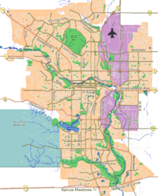
Quadrant NE Ward 3 Established 1983 Annexed 1961 Government[1] - Administrative body Calgary City Council - Alderman Jim Stevenson Area - Total 2.7 km2 (1 sq mi) Elevation 1,095 m (3,593 ft) Population (2006)[2] - Total 11,906 - Average Income $58,750 Website Martindale Community Association Martindale is a residential neighbourhood in the north-east quadrant of Calgary, Alberta. It is bounded to the north by 80 Avenue N, to the east by Falconridge Boulevard, to the south by 64 Avenue N and to the west by 44 Street E. It is planned for a LRT station to be constructed there by 2011[3].
The area was annexed to the City of Calgary in 1961 and Martindale was established in 1983. It is represented in the Calgary City Council by Ward 3 Alderman Jim Stevenson.[4]
Contents
Demographics
In 2006 the neighbourhood had a population of 8,513. Residents in this community had a median household income of $58,750 in 2000, and there were 13.8% low income residents living in the neighborhood.[1] As of 2000, 28.8% of the residents were immigrants. A proportion of 0.9% of the buildings were condominiums or apartments, and 6.8% of the housing was used for renting.[2]
Education
The community is served by the Crossing Park public school.
See also
References
- ^ a b City of Calgary (2004). "Ward 3 Profile". http://www.calgary.ca/docgallery/bu/cns/community_social_statistics/ward_3_profile.pdf. Retrieved 2007-05-17.
- ^ a b City of Calgary (2006). "Martindale Community Statistics". http://www.calgary.ca/docgallery/bu/cns/community_social_statistics/martindale.pdf. Retrieved 2007-05-17.
- ^ http://www.calgary.ca/portal/server.pt/gateway/PTARGS_0_0_780_237_0_43/http%3B/content.calgary.ca/CCA/City+Hall/Business+Units/Transportation+Infrastructure/Construction+Projects/LRT/Northeast+LRT+Extensions/McKnight-Westwinds+Station+to+Saddle+Ridge+Station.htm
- ^ City of Calgary Website. "The City of Calgary: Ward 3". http://www.calgary.ca/portal/server.pt/gateway/PTARGS_0_0_771_200_0_43/http%3B/content.calgary.ca/CCA/City+Hall/Municipal+Government/Office+of+the+Aldermen/Ward+Offices/Ward+3/Ward+3.htm. Retrieved 2007-12-03.
External links

Saddle Ridge Industrial Area Saddle Ridge 
Calgary International Airport 
Taradale  Martindale

Westwinds Industrial Area Castle Ridge Falconridge Coordinates: 51°07′04″N 113°57′33″W / 51.11778°N 113.95917°W
Categories:- Neighbourhoods in Calgary
- Calgary stubs
Wikimedia Foundation. 2010.

