- Mountain View County, Alberta
-
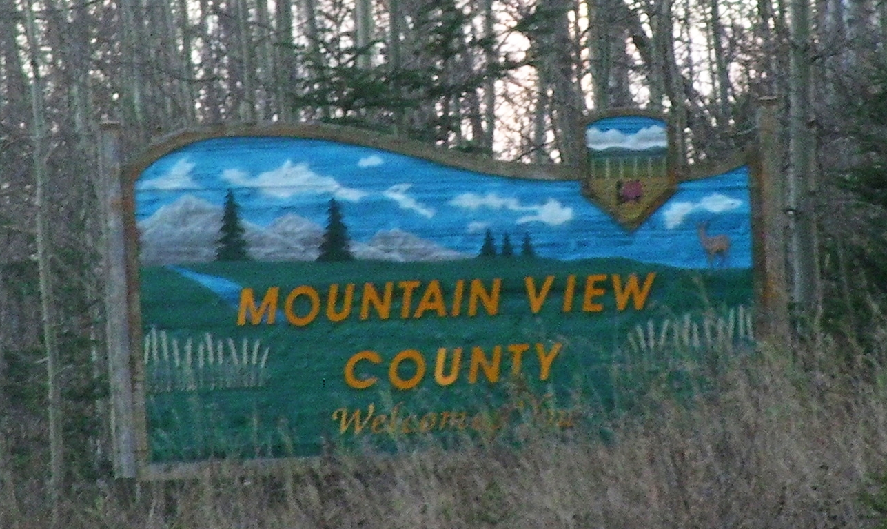
Mountain View County — Municipal district — Welcome sign

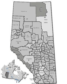
LogoLocation of Mountain View County in Alberta
Coordinates: 51°39′57″N 114°07′52″W / 51.66583°N 114.13111°WCoordinates: 51°39′57″N 114°07′52″W / 51.66583°N 114.13111°W Country  Canada
Province  Alberta
Region Central Alberta Census division No. 6 Established March 15, 1944 as M.D. of Mountain View No. 280 Incorporated January 1, 1961 as County of Mountain View No. 17 Name changed Jaunary 21, 1998 to Mountain View County Government[1] – Reeve Paddy Munro – Governing body Mountain View County Council- Bruce Beattie
- Kevin Good
- Al Kernmere
- Patricia McKean
- Duncan Milne
- Paddy Munro
- Bob Orr
– CAO Tony Martens (interim) – Municipal seat Didsbury Area[2] – Total 3,804.43 km2 (1,468.9 sq mi) Population (2006)[2] – Total 12,391 – Density 3.3/km2 (8.5/sq mi) – Dwellings 5,136 Time zone MST (UTC-7) Website Mountain View County Mountain View County is a municipal district in Division No. 6 in the central Alberta, Canada. It is located between the cities of Calgary and Red Deer within the Calgary-Edmonton corridor. Mountain View County is a member of the Central Alberta Economic Partnership, Alberta Association of Municipal Districts and Counties, and the Municipal Area Partnership. Its municipal seat is the Town of Didsbury.
Oil and gas is the main economic driver of Mountain View County, along with agriculture, forestry and tourism. The municipal district is also home to a commercial/industrial sector, which includes the Netook Crossing development, located at the intersection of Alberta Highway 27 and the Queen Elizabeth II Highway.
Contents
History
The first government surveys of the area between Calgary and Edmonton were not made until 1883, around the time when the Canadian Pacific Railway arrived from Eastern Canada in Calgary, then just a small settlement. Just to the east of where the busy Queen Elizabeth II highway runs today, people and goods travelled between Calgary and Fort Edmonton by wagon along the original Calgary and Edmonton Trail. In 1890, the Calgary and Edmonton Railway was chartered, and construction began, with the line reaching the area now comprising the county by the end of that year.
While a handful of squatters had arrived pre-1890, settlement in the area did not begin in earnest until the arrival of the C & E Railway. On July 27, 1891, the first through train made the trip from Calgary to Strathcona, marking the beginning of regular scheduled passenger train service for the next 60 years. The operation of Calgary & Edmonton Railway passed to the Canadian Pacific Railway, which continues to operate the line as its main Calgary-Edmonton connection.
After 1891, homesteaders began to arrive in the region from across Europe and North America, with settlements sprouting up around the fourth (Carstairs), fifth (Didsbury) and sixth (Olds) sidings.
Settlement in the early days was typified by ethnic and usually religious groups living in close-knit communities or colonies. Notable among them were a group of Mennonite families who homesteaded in the Didsbury area from Europe via Ontario around the turn of the 19th century. A large number of German settlers from the American Midwest also settled around Olds; and a group of Norwegian pioneers blazed a trail westward towards Sundre and Bergen.
As the population grew, so did their needs. This led to the formation of local government, though the creation of local Improvement Districts. These were relatively small administrative units, generally no bigger than 72 square miles (190 km2) in size, and were responsible for a number of limited duties including setting local tax rates, and keeping track of necessary local improvements.
In December 1911 the Alberta government brought forward new legislation designed to introduce greater self government into rural areas of the province. Specifically, the Municipal Act of 1912 encouraged local improvement districts to consolidate with one another to form larger rural municipalities.
Initially the response to the idea of consolidation was unenthusiastic. A majority of rural residents in Mountain View voted against consolidation with other L.I.D.'s in a series of plebiscites held in 1912. Only the Rural Municipality of Mountain View No. 310 would be created out of four improvement districts around Olds and Didsbury, making it one of 55 rural municipalities to come into existence province-wide on December 9, 1912. While Mountain View was the first to consolidate, others would soon follow their lead.
The Municipal District of Mountain View No. 49 was formed into the County of Mountain View No. 17 as of January 1, 1961, with William J. Bagnall of Dogpound was selected as the county's first reeve. A municipal councillor prior to the county’s formation, Bagnall would continue to serve as reeve until 1980.
The newly-formed county chose Didsbury as the seat of government, and in October 1962, a new administration building was opened to house both the county administration and the school board. This building would serve the county until a new state-of-the-art office was built in 2005, near the Olds-Didsbury Airport along Highway 2A.
On January 21, 1998, the County of Mountain View No. 17 officially changed its name to Mountain View County, as it continues to be known today.
Demographics
The population of Mountain View County according to its 2007 municipal census is 12,570.[3]
In 2006, Mountain View County had a population of 12,391 living in 5,136 dwellings, a 2.2% increase from 2001. The county has a land area of 3,804.43 km2 (1,468.90 sq mi) and a population density of 3.3 /km2 (8.5 /sq mi).[2]
In 2001, Mountain View County had a population of 12,134 in 4,851 dwellings, a 7.8% increase from 1996. On a surface of 3,805.06 km² it had a density of 3.2 inhabitants/km².[4]
Education
In the early 1890s the first schools began to organize in the area now comprising Mountain View County. By 1930, almost 90 school districts had been created to serve the region, with the one-room school house remaining a fixture of rural life until 1936, when the Social Credit government allowed for the creation of larger school divisions.
As consolidation of rural municipalities continued throughput the 1940s and 50s, the provincial government moved to amalgamate municipalities and the local school boards. In 1955, the M.D. of Mountain View and Olds School Division No. 39 were made "coterminous" (meaning they shared the same boundaries). With the introduction of the County system of government in 1961, joint administration of municipalities and the school boards was initiated, and would continue until 1994.
Olds School Division No. 39 would eventually evolve into the Chinook's Edge School Division, which continues to serve the county.
Communities
The following communities are located in Mountain View County:[5]
Towns
Villages
Unincorporated communities
- Bearberry
- Bergen
- Dogpound
- Eagle Hill
- Elkton
- Stirlingville
- Water Valley
- Westward Ho
Rural neighbourhoods
In 2008, Mountain View County established 20 districts as rural neighbourhoods.
- Bearberry / Coalcamp
- Bergen
- Dogpound
- Eagle Hill / Westward Ho
- Elkton / Rugby
- Fallentimber
- Hainstock
- Harmattan
- Jackson
- James River
- Lonepine
- McDougal Flats
- Midway
- Netook
- Reed Ranch
- Rosebud
- Water Valley / Winchell Lake
- Wessex
- Westcott
- Westerdale
See also
- List of communities in Alberta
- List of municipal districts in Alberta
References
- ^ "Municipal Officials Search". Alberta Municipal Affairs. November 11, 2011. http://www.municipalaffairs.alberta.ca/mc_municipal_officials_search.cfm. Retrieved November 11, 2011.
- ^ a b c Statistics Canada (Census 2006). "Mountain View County - Community Profile". http://www12.statcan.ca/english/census06/data/profiles/community/Details/Page.cfm?Lang=E&Geo1=CSD&Code1=4806028&Geo2=PR&Code2=48&Data=Count&SearchText=Mountain%20View%20County&SearchType=Begins&SearchPR=01&B1=All&GeoLevel=&GeoCode=4806028. Retrieved 2007-06-11.
- ^ Alberta Municipal Affairs (2009-09-15). "Alberta 2009 Official Population List". http://municipalaffairs.gov.ab.ca/documents/LGS/2009pop.pdf. Retrieved 2010-09-12.
- ^ Mountain View County community profile - Statistics Canada. 2002. 2001 Community Profiles. Released June 27, 2002. Last modified: 2005-11-30. Statistics Canada Catalogue no. 93F0053XIE
- ^ Alberta Municipal Affairs. Municipal Profile
External links

Clearwater County Red Deer County Red Deer County Clearwater County 
Kneehill County  Mountain View County

Municipal District of Bighorn No. 8 Rocky View County Categories:

Wikimedia Foundation. 2010.