- Minburn County No. 27, Alberta
-
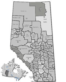
County of Minburn No. 27 — Municipal district — Location of Minburn No. 27 in Alberta
Coordinates: 53°29′34″N 112°03′8″W / 53.49278°N 112.05222°WCoordinates: 53°29′34″N 112°03′8″W / 53.49278°N 112.05222°W Country  Canada
Province  Alberta
Region Central Alberta Census division No. 10 Established 1942 Incorporated 1965 (County) Government – Reeve Eric Anderson – Governing body County of Minburn Council – Municipal seat Vegreville Area – Total 2,911.14 km2 (1,124 sq mi) Population (2006)[1] – Total 3,319 – Density 1.1/km2 (2.8/sq mi) – Dwellings 1,270 Time zone MST (UTC-7) Website County of Minburn No. 27 The County of Minburn No. 27 is a municipal district in east central Alberta, Canada.
It is located in Census Division 10. It was established as a county on Jan 01, 1965 from the former Municipal District of Minburn No. 72. The municipal seat is set in the Town of Vegreville.
Contents
Demographics
In 2006, the County of Minburn No. 27 had a population of 3,319 living in 1,270 dwellings, a -3.4% increase from 2001. The countyhas a land area of 2,911.14 km2 (1,124.00 sq mi) and a population density of 1.1 /km2 (2.8 /sq mi).[1]
In 2001, the municipal district had a population of 3,436 in 1,336 dwellings, a 2.6% decrease from 1996. On a surface of 2,910.42 km² it had a density of 1.2 inhabitants/km².[2]
Communities
The following communities are located in this municipal district:[3]
Towns
Villages
Hamlets
- Lavoy (dissolved as a village in 1999)
- Ranfurly
Designated places
- Prairie Lodge Trailer Court
Other unincorporated communities
- Brush Hill
See also
- List of communities in Alberta
- List of municipal districts in Alberta
References
- ^ a b Statistics Canada (Census 2006). "County of Minburn No. 27 - Community Profile". http://www12.statcan.ca/english/census06/data/profiles/community/Details/Page.cfm?Lang=E&Geo1=CSD&Code1=4810026&Geo2=PR&Code2=48&Data=Count&SearchText=Minburn%20County%20No.%2027&SearchType=Begins&SearchPR=01&B1=All&GeoLevel=&GeoCode=4810026. Retrieved 2007-06-11.
- ^ County of Minburn community profile - Statistics Canada. 2002. 2001 Community Profiles. Released June 27, 2002. Last modified: 2005-11-30. Statistics Canada Catalogue no. 93F0053XIE
- ^ County of Minburn Municipal Profile - Alberta Municipal Affairs
External links
- County of Minburn (official site)

Lamont County County of Two Hills No. 22 Lamont County 
County of Vermilion River  County of Minburn No. 27

Beaver County Beaver County Municipal District of Wainwright No. 61 Categories:- Minburn County, Alberta

Wikimedia Foundation. 2010.