- Taber, Alberta (municipal district)
-
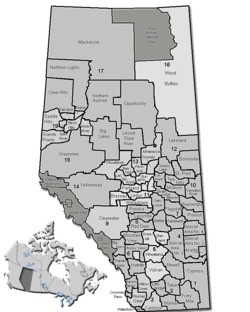
Municipal District of Taber — Municipal district — Location of the Municipal District of Taber in Alberta
Coordinates: 49°47′5″N 112°09′3″W / 49.78472°N 112.15083°WCoordinates: 49°47′5″N 112°09′3″W / 49.78472°N 112.15083°W Country  Canada
Province  Alberta
Region Southern Alberta Census division No. 2 Established 1954 Incorporated 1954 Government[1] – Reeve T. Brian Brewin – Governing body Municipal District of Taber Council – Municipal seat Taber Area – Total 4,204 km2 (1,623.2 sq mi) Population (2006)[2] – Total 6,280 – Density 1.5/km2 (3.9/sq mi) – Dwellings 1,852 Time zone MST (UTC-7) Website Taber The Municipal District of Taber is a municipal district in southern Alberta, Canada. It is located in Census Division 2.
Contents
Demographics
The population of the Municipal District of Taber according to its 2008 municipal census is 6,714.[3]
In 2006, the Municipal District of Taber had a population of 6,280 living in 1,852 dwellings, a 4.5% increase from 2001. The municipal district has a land area of 4,204.38 km2 (1,623.32 sq mi) and a population density of 1.5 /km2 (3.9 /sq mi).[2]
In 2001, the municipal district had a population of 6,012 in 1,840 dwellings, a 0.7% increase from 1996. On a surface of 4,204.35 km² it had a density of 1.4 inhabitants/km².[4]
Communities
The following communities are located in this municipal district:[5]
Towns
Villages
Hamlets
- Enchant
- Grassy Lake
- Hays
- Johnson's Addition
- Purple Springs
- Retlaw
See also
- List of communities in Alberta
- List of municipal districts in Alberta
References
- ^ Alberta Municipal Affairs: Municipal Officials Search
- ^ a b Statistics Canada (Census 2006). "Taber - Community Profile". http://www12.statcan.ca/english/census06/data/profiles/community/Details/Page.cfm?Lang=E&Geo1=CSD&Code1=4802021&Geo2=PR&Code2=48&Data=Count&SearchText=Taber&SearchType=Begins&SearchPR=01&B1=All&GeoLevel=&GeoCode=4802021. Retrieved 2007-06-11.
- ^ Alberta Municipal Affairs (2009-09-15). "Alberta 2009 Official Population List". http://municipalaffairs.gov.ab.ca/documents/LGS/2009pop.pdf. Retrieved 2010-09-12.
- ^ Municipal District of Taber community profile - Statistics Canada. 2002. 2001 Community Profiles. Released June 27, 2002. Last modified: 2005-11-30. Statistics Canada Catalogue no. 93F0053XIE
- ^ Municipal Profile - Alberta Municipal Affairs
External links
- Municipal District of Taber - Official site

Vulcan County County of Newell Cypress County County of Lethbridge 
County of Forty Mile No. 8  Municipal District of Taber

County of Warner No. 5 County of Warner No. 5 County of Forty Mile No. 8 Categories:

Wikimedia Foundation. 2010.