- Grande Prairie County No. 1, Alberta
-
County of Grande Prairie No. 1 — Municipal district — Boundary sign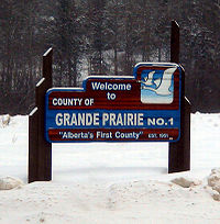
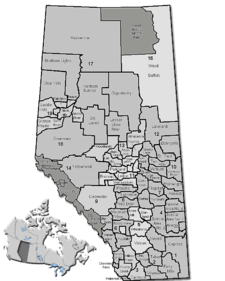
Nickname(s): Alberta's First County Location of Grande Prairie No. 1 in Alberta
Coordinates: 55°16′0″N 118°47′0″W / 55.266667°N 118.783333°WCoordinates: 55°16′0″N 118°47′0″W / 55.266667°N 118.783333°W Country  Canada
Province  Alberta
Region Northern Alberta Census division No. 19 Established 1943 Incorporated 1951 Government[1] – Reeve Everett McDonald – Governing body County of Grande Prairie No. 1 Council- Leanne Beaupre
- Lois Dueck
- Mary Ann Eckstrom
- Richard Harpe
- Patricia Jacobs
- Everett McDonald
- Sharon L. Nelson
- Brock Smith
- Sam Sutherland
– Administrator W.A. Rogan – Municipal seat Clairmont Area – Total 5,883.92 km2 (2,271.8 sq mi) Population (2006)[2] – Total 17,970 – Density 3.1/km2 (8/sq mi) – Dwellings 6,460 Time zone MST (UTC-7) Website County of Grande Prairie No. 1 The County of Grande Prairie No. 1 is a municipal district in northwestern Alberta, Canada in Census Division No. 19.
It is bounded on the south by the Wapiti River, on the east by the Smoky River and on the west by the province of British Columbia.
Contents
Demographics
In 2006, the County of Grande Prairie No. 1 had a population of 17,970 living in 6,460 dwellings, a 14.9% increase from 2001. The county has a land area of 5,883.92 km2 (2,271.79 sq mi) and a population density of 3.1 /km2 (8.0 /sq mi).[2]
The County of Grande Prairie No. 1 also conducted its own municipal census in 2006, which resulted in a population of 17,989.[3]
According to the Canada 2001 Census, the County of Grande Prairie No. 1 had:
- a population of 15,638 living in 5,597 dwellings, a 15.5% increase from 1996;
- a land area of 5,570.02 km²; and
- a population density of 2.8 (persons per km²).[4]
Communities
The County of Grande Prairie No. 1 completely surrounds the City of Grande Prairie and the Horse Lakes 128B Indian reserve.
The following other communities are located within this municipal district:
Towns [5]
Villages [5]
Hamlets [5]
- Bezanson
- Clairmont
- Demmitt
- Dimsdale
- Elmworth
- Goodfare
- Huallen
- La Glace
- Teepee Creek
- Valhalla Centre
- Wedgewood
Other unincorporated communities
- Albright
- Eldoes Trailer Park (designated place)
- Flyingshot Lake (designated place and settlement)
- Lymburn
- Rio Grande
- Riverview Pines Subdivision (designated place)
- Swan City Trailer Court (designated place)
- Sylvester
- Triple-L-Trailer Court (designated place)
- Valhalla
See also
- List of communities in Alberta
- List of municipal districts in Alberta
References
- ^ "Municipal Officials Search". Alberta Municipal Affairs. November 11, 2011. http://www.municipalaffairs.alberta.ca/mc_municipal_officials_search.cfm. Retrieved November 11, 2011.
- ^ a b Statistics Canada (Census 2006). "County of Grande Prairie No. 1 - Community Profile". http://www12.statcan.ca/english/census06/data/profiles/community/Details/Page.cfm?Lang=E&Geo1=CSD&Code1=4819006&Geo2=PR&Code2=48&Data=Count&SearchText=Grande%20Prairie%20County%20No.%201&SearchType=Begins&SearchPR=01&B1=All&GeoLevel=&GeoCode=4819006. Retrieved 2007-06-11.
- ^ Alberta Municipal Affairs (2009-09-15). "Alberta 2009 Official Population List". http://municipalaffairs.gov.ab.ca/documents/LGS/2009pop.pdf. Retrieved 2010-09-12.
- ^ County of Grande Prairie Community Profile - Statistics Canada. 2002. 2001 Community Profiles. Released June 27, 2002. Last modified: 2005-11-30. Statistics Canada Catalogue no. 93F0053XIE
- ^ a b c Alberta Municipal Affairs (2010-04-01). "Specialized and Rural Municipalities and Their Communities". http://www.municipalaffairs.alberta.ca/documents/msb/2010-ruralmun.pdf. Retrieved 2010-08-16.
External links
Categories:- Grande Prairie County, Alberta


Wikimedia Foundation. 2010.