- Banff National Park
Infobox_protected_area | name = Banff National Park
iucn_category = II
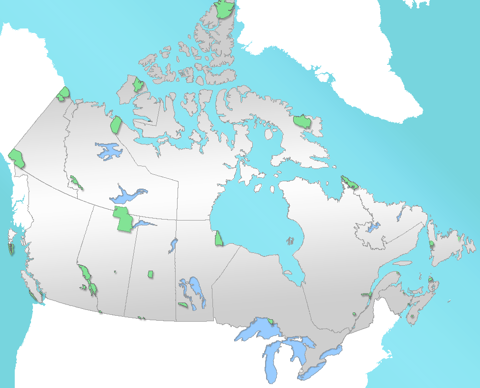
caption = Location of "Banff National Park" in Canada
locator_x = 52
locator_y = 168
location =Alberta , Canada
nearest_city =Calgary ,Alberta
lat_degrees = 51
lat_minutes = 10
lat_seconds = 00
lat_direction = N
long_degrees = 115
long_minutes = 33
long_seconds = 00
long_direction = W
area = 6,641 km² (2,564 sq mi)
established = 1885
visitation_num = 3,927,557
visitation_year = 2004/05
governing_body =Parks Canada
world_heritage_site = [http://whc.unesco.org/en/list/304 304]Banff National Park (pronEng|ˈbæmf) is Canada's oldest national park, established in 1885 in the
Canadian Rockies . The park, located 110-180 kilometres (70-110 mi) west ofCalgary in the province ofAlberta , encompasses 6,641square kilometre s (2,564 sq mi) [cite web |url=http://www.pc.gc.ca/docs/v-g/pm-mp/guidem-mguide/sec15/gm-mg15_e.pdf |title=The Mountain Guide - Banff National Park |publisher=Parks Canada |format=PDF |year=2006] of mountainous terrain, with numerousglacier s andice field s, dense coniferous forest, and alpine landscapes. TheIcefields Parkway extends from Lake Louise, connecting toJasper National Park in the north. Provincial forests andYoho National Park are neighbours to the west, whileKootenay National Park is located to the south andKananaskis Country to the southeast. The main commercial centre of the park is the town of Banff, in theBow River valley.The
Canadian Pacific Railway was instrumental in Banff's early years, building theBanff Springs Hotel andChateau Lake Louise , and attracting tourists through extensive advertising. In the early 20th century, roads were built in Banff, at times by war internees, and throughGreat Depression -era public works projects. Since the 1960s, park accommodations have been open all year, with annual tourism visits to Banff increasing to over 5 million in the 1990s. [cite web |url=http://www.pc.gc.ca/pn-np/ab/banff/docs/routes/chap1/routes1a_e.asp |title=Highway Mitigation Research |publisher=Parks Canada |accessdate=2006-09-01] Millions more pass through the park on theTrans-Canada Highway .cite news |title=A Highway Runs Through It |author=Savage, Candace |publisher=Canadian Geographic |date=July/August 2000 |pages=34–42] As Banff is one of the world's most visited national parks,cite web |url=http://www.pc.gc.ca/pn-np/ab/banff/plan/plan7-05_E.asp#nov03 |title=Park Management, Annual Planning Forum 2005 |publisher=Parks Canada |accessdate=2006-07-12] the health of its ecosystem has been threatened. In the mid-1990s,Parks Canada responded by initiating a two-year study, which resulted in management recommendations, and new policies that aim to preserve ecological integrity.History
Throughout its history, Banff National Park has been shaped by tension between conservation and development interests. The park was established in 1885, in response to conflicting claims over who discovered
hot springs there, and who had the right to develop the hot springs for commercial interests. Instead, prime ministerJohn A. Macdonald set aside the hot springs as a small, protected reserve, which was later expanded to include Lake Louise and other areas extending north to theColumbia Icefield .Early history
Archaeological evidence found at
Vermilion Lakes radiocarbon dates the first human activity in Banff to 10,300 B.P. [cite journal |author=Fedje, Daryl W., James M. White, Michael C. Wilson, D. Erle Nelson, John S. Vogel, John R. Southon |year=1995 |title=Vermilion Lakes Site: Adaptations and Environments in the Canadian Rockies during the Latest Pleistocene and Early Holocene |journal=American Antiquity |volume=60(1) |pages=81–108 |doi=10.2307/282077] Prior to European contact, aboriginals, including the Stoneys, Kootenay, Tsuu T'ina, Kainai, Peigans, andSiksika , were common in the region where they huntedbison and other game.cite paper |author=Hildebrandt, Walter |title=Historical Analysis of Parks Canada and Banff National Park, 1968–1995 |publisher=Banff-Bow Valley Study |year=1995]With the admission of
British Columbia to Canada on 20 July 1871, Canada agreed to build atranscontinental railroad . Construction of the railroad began in 1875, withKicking Horse Pass chosen, over the more northerlyYellowhead Pass , as the route through the Canadian Rockies. Ten years later, the last spike was driven inCraigellachie, British Columbia .Rocky Mountains Park established
With conflicting claims over discovery of hot springs in Banff, Prime Minister John A. Macdonald decided to set aside a small reserve of 26 square kilometres (10 sq mi) around the hot springs at
Cave and Basin as a public park in 1885. Under theRocky Mountains Park Act , enacted on 23 June 1887, the park was expanded to 674 square kilometres (260 sq mi) and named "Rocky Mountains Park". This was Canada's first national park, and the second established in North America, afterYellowstone National Park . The Canadian Pacific Railway built theBanff Springs Hotel andChateau Lake Louise to attract tourists and increase the number of rail passengers.Early on, Banff was popular with wealthy European tourists, who arrived in Canada via trans-Atlantic luxury liner and continued westward on the railroad, as well as upper-class American and English tourists. Some visitors participated inmountaineering activities, often hiring localguide s. Tom Wilson, along with Jim and Bill Brewster, was among the first outfitters in Banff. TheAlpine Club of Canada , established in 1906 byArthur Oliver Wheeler and Elizabeth Parker, organized climbs and camps in the backcountry.By 1911, Banff was accessible byautomobile from Calgary. Beginning in 1916, the Brewsters offeredmotorcoach tours of Banff. [cite web |url=http://www.brewster.ca/About_Brewster/History.asp |title=About Brewster - History |accessdate=2006-08-03] In 1920, access to Lake Louise by road was available, and the Banff-Windermere Road opened in 1923 to connect Banff withBritish Columbia .In 1902, the park was expanded to cover 11,400 square kilometres (4,402 sq mi), encompassing areas around Lake Louise, and the Bow, Red Deer,
Kananaskis , and Spray rivers. Bowing to pressure fromgrazing andlogging interests, the size of the park was reduced in 1911 to 4,663 square kilometres (1,800 sq mi), eliminating many foothills areas from the park. Park boundaries changed several more times up until 1930, when the size of Banff was fixed at 6,697 square kilometres (2,586 sq mi), with the passage of the National Parks Act. The Act also renamed the park as "Banff National Park", named for theCanadian Pacific Railway station, which in turn was named after theBanffshire region in Scotland. [cite web| url=http://www.pc.gc.ca/pn-np/ab/banff/visit/visit1_e.asp#townsite |title=Banff Townsite Area |publisher=Parks Canada |accessdate=2006-06-13] With the construction of a new east gate in 1933, Alberta transferred 0.84 square kilometres (207.5 acres) to the park. This, along with other minor changes in the park boundaries in 1949, set the area of the park at 6,641 square kilometres (2,564 sq mi).cite book |author=Lothian, W.F. |title=A Brief History of Canada's National Parks |publisher=Environment Canada |year=1987]Coal mining
In 1887, local aboriginal tribes signed
Treaty 7 , which gave Canada rights to explore the land for resources. At the beginning of the twentieth century,coal was mined nearLake Minnewanka in Banff. For a brief period, a mine operated at Anthracite, but was shut down in 1904. The Bankhead mine, at Cascade Mountain, was operated by the Canadian Pacific Railway from 1903 to 1922. In 1926, the town was dismantled, with many buildings moved to the town of Banff and elsewhere.cite book |author=Gadd, Benn |title=Bankhead: The Twenty Year Town |publisher=Coal Association of Canada |year=1989]Prison and work camps
During
World War I , immigrants fromAustria ,Hungary , Germany andUkraine were sent to Banff to work ininternment camp s. The main camp was located atCastle Mountain , and was moved to Cave and Basin during winter. Much early infrastructure and road construction was done by Slavic Canadian internees.cite book |author=Waiser, Bill |year=1995 |title=Park Prisoners, The Untold Story of Western Canada's National Parks, 1915–1946 |publisher=Fifth House Publishers]In 1931, the
Government of Canada enacted theUnemployment and Farm Relief Act which providedpublic works projects in thenational parks during theGreat Depression . In Banff, workers constructed a new bathhouse and pool atUpper Hot Springs , to supplement Cave and Basin. Other projects involved road building in the park, tasks around the Banff townsite, and construction of a highway connecting Banff and Jasper. In 1934, thePublic Works Construction Act was passed, providing continued funding for the public works projects. New projects included construction of a new registration facility at Banff's east gate, and construction of an administrative building in Banff. By 1940, the Icefields Parkway reached the Columbia Icefield area of Banff, and connected Banff and Jasper.cite book |title=Summits & Icefields: Alpine Ski Tours in the Canadian Rockies |author=Scott, Chic |publisher=Rocky Mountain Books |year=2003]Internment camps were once again set up in Banff during
World War II , with camps stationed at Lake Louise, Stoney Creek, and Healy Creek. Prison camps were largely composed ofMennonites fromSaskatchewan . Japanese internment camps were not stationed in Banff during World War II, but rather were located inJasper National Park where their detainees worked on theYellowhead Highway and other projects.Winter tourism
Winter tourism in Banff began in February 1917, with the first Banff Winter Carnival. The carnival featured a large ice palace, which in 1917 was built by internees. Carnival events included
cross-country skiing ,ski jumping ,curling ,snowshoe , andskijoring .cite conference|title=Making Banff a Year-Round Park |author=Yeo, Bill |booktitle=Winter Sports in the West |year=1990 |publisher=Alberta Historical Society] In the 1930s, the first downhill ski resort,Sunshine Village , was developed by the Brewsters.Mount Norquay ski area was also developed during the 1930s, with the firstchair lift installed there in 1948.Since 1968, when the Banff Springs Hotel was winterized, Banff has been a year-round destination. [cite web |url=http://www.fairmont.com/banffsprings/ |title=Hotel History |publisher=Fairmont Banff Springs] In the 1960s, the Trans-Canada Highway was constructed, providing another transportation corridor through the Bow Valley, in addition to the Bow Valley Parkway, making the park more accessible. Also in the 1960s,Calgary International Airport was built.Canada launched several bids to host the
Winter Olympics in Banff, with the first bid for the1964 Winter Olympics which were eventually awarded toInnsbruck ,Austria . Canada narrowly lost a second bid, for the1968 Winter Olympics , which were awarded toGrenoble , France. Once again, Banff launched a bid to host the1972 Winter Olympics , with plans to hold the Olympics at Lake Louise. The 1972 bid was most controversial, as environmental lobby groups provided strong opposition to the bid, which had sponsorship fromImperial Oil . Bowing to pressure,Jean Chrétien , then the Minister of Environment, the government department responsible for Parks Canada, withdrew support for the bid, which was eventually lost toSapporo , Japan. The cross-country ski events were held at theCanmore Nordic Centre Provincial Park atCanmore, Alberta , located just outside the eastern gates of Banff National Park on theTrans-Canada Highway , when nearbyCalgary hosted the1988 Winter Olympics .Conservation
Since the original Rocky Mountains Park Act, subsequent acts and policies placed greater emphasis on conservation. With public sentiment tending towards environmentalism,
Parks Canada issued major new policy in 1979, which emphasized conservation. The National Parks Act was amended in 1988, which made preservingecological integrity the first priority in all park management decisions. The act also required each park to produce a management plan, with greater public participation.In 1984, Banff was declared a
UNESCO World Heritage Site , together with the other national andprovincial park s that form theCanadian Rocky Mountain Parks , for the mountain landscapes containing mountain peaks, glaciers, lakes, waterfalls,canyon s and limestone caves as well asfossil s found here. With this designation came added obligations for conservation. [cite web |url=http://whc.unesco.org/en/decisions/&id_decision=371 |title=Advisory Body Evaluation |publisher=UNESCO |year=1992 |format=pdf |accessdate=2006-09-01]During the 1980s, Parks Canada moved to privatize many park services such as golf courses, and added user fees for use of other facilities and services to help deal with budget cuts. In 1990, the Town of Banff was incorporated, giving local residents more say regarding any proposed developments. [cite web |url=http://www.pc.gc.ca/pn-np/ab/banff/docs/plan1/plan1a_E.asp#banff |title=Banff National Park Management Plan |month=May | year=2004 |publisher=Parks Canada |accessdate=2006-09-01]
In the 1990s, development plans for the park, including expansion at Sunshine Village, were under fire with lawsuits filed by
Canadian Parks and Wilderness Society (CPAWS). In the mid-1990s, the Banff-Bow Valley Study was initiated to find ways to better address environmental concerns, and issues relating to development in the park.Geography
Banff National Park is located on Alberta's western border with
British Columbia . Banff is about an hour and half driving distance fromCalgary , and four hours fromEdmonton .Jasper National Park is located to the north, whileYoho National Park is to the west, andKootenay National Park is to the south. Kananaskis Country, which includesBow Valley Wildland Provincial Park ,Spray Valley Provincial Park , andPeter Lougheed Provincial Park , is located to the south and east of Banff.The
Trans-Canada Highway passes through Banff National Park, from eastern boundary near Canmore, through the towns of Banff and Lake Louise, and into Yoho National Park in British Columbia. The Banff townsite is the main commercial center in the national park. The village of Lake Louise is located at the junction of the Trans-Canada Highway and the Icefields Parkway, which extends north to the Jasper townsite.Town of Banff
The Town of Banff, established in 1883, is the main commercial centre in Banff National Park, as well as a centre for cultural activities. Banff is home to several cultural institutions, including the
Banff Centre , theWhyte Museum , theBuffalo Nations Luxton Museum ,Cave and Basin National Historic Site , and several art galleries. Throughout its history, Banff has hosted many annual events, including Banff Indian Days which began in 1889, and the Banff Winter Carnival. Since 1976, The Banff Center has organized theBanff Mountain Film Festival . In 1990, the town was incorporated as a municipality of Alberta, though still subject to the National Parks Act and federal authority in regards to planning and development. [cite web|url=http://www.pc.gc.ca/pn-np/ab/banff/docs/plan1/plan1a_E.asp |title=Banff National Park Management Plan |date=2004, May |publisher=Parks Canada |accessdate=2006-06-20] As of the 2005census , the Town of Banff has a population of 8,352, of which nearly 7,000 are permanent residents. [cite web |title=2005 Banff Municipal Census |url=http://www.banff.ca/banff/banff.nsf/download?Open&docID=8F4DF400CCD166ED8725708A00798D50 |author=Ketterer, Shirley |date=2005, August |publisher=Town of Banff |accessdate=2006-06-20] The Bow River flows through the town of Banff, with theBow Falls located on the outskirts of town.Lake Louise
Lake Louise, a small village located 54 kilometres (32 mi) west of the Banff townsite, is home to the landmark
Chateau Lake Louise at the edge of Lake Louise. Located 15 kilometres (9.3 mi) from Lake Louise,Moraine Lake provides a scenic vista of theValley of the Ten Peaks . This scene was pictured on the back of the $20 Canadian banknote, in the 1969–1979 ("Scenes of Canada") series. TheLake Louise Mountain Resort is also located near the village.Icefields Parkway
The
Icefields Parkway extends 230 kilometres (143 miles), [cite web |url=http://www.pc.gc.ca/pn-np/ab/jasper/visit/visit42_E.asp |title=Jasper National Park - Did you know? |publisher=Parks Canada |accessdate=2006-09-01] connecting Lake Louise to Jasper, Alberta. The Parkway originates at Lake Louise, and extends north up the Bow Valley, pastHector Lake , Bow Lake, andPeyto Lake . The Parkway then crosses a summit, and follows theMistaya River to Saskatchewan Crossing, where it converges with the Howse andNorth Saskatchewan River .The
North Saskatchewan River flows east from Saskatchewan Crossing, out of Banff, into what is known as David Thompson country, and onto Edmonton. The David Thompson Highway follows the North Saskatchewan River, past the man-madeAbraham Lake , and through David Thompson Country. At Saskatchewan Crossing, basic services are available, including gasoline, cafeteria, a gift shop, and small motel.North of Saskatchewan Crossing, the Icefields Parkway follows the North Saskatchewan River up to the
Columbia Icefield . The Parkway crosses into Jasper National Park at Sunwapta Pass at 2,023 metres (6,635 ft) in elevation, [cite book |title=Map of the Columbia Icefield Area, 2nd edition |author=Gem Trek Publishing |year=1999] and continues on from there to the Jasper townsite.Geology
The Canadian Rockies consist of several northwest-southeast trending ranges. Closely following the
continental divide , the Main Ranges form the backbone of the Canadian Rockies. The Front Ranges are located east of the Main Ranges. Banff National Park extends eastward from the continental divide and includes the eastern slope of the Main Ranges and much of the Front Ranges. The latter include the mountains around the Banff townsite. The foothills are located to the east of the Park, between Calgary and Canmore. On the other side of the Park, the Western Ranges pass through Yoho and Kootenay National Parks. Still farther west is theRocky Mountain Trench , the western boundary of the Canadian Rockies region inBritish Columbia .The Canadian Rockies are composed of
sedimentary rock , includingshale ,sandstone ,limestone andquartzite , that originated as deposits in a shallow inland sea. Thegeologic formation s in Banff range in age fromPrecambrian eon to theJurassic period.The mountains were formed 80–120 million years ago, as a product ofthrust fault s.cite book |author=Gadd, Ben |title=Handbook of the Canadian Rockies |year=1992 |publisher=Corax Press] Over the past 80 million years,erosion has taken its toll on the landscape, with more extensive erosion occurring in the foothills and Front Range than in the Main Range. Banff's mountains exhibit several different shapes that have been influenced by the composition of rock deposits, layers, and their structure. Numerous mountains in Banff are carved out of sedimentary layers that slope at 50–60 degree angles. Suchdip slope mountains have one side with a steep face, and the other with a more gradual slope that follows the layering of the rock formations, e.g.,Mount Rundle , near the Banff townsite.Other types of mountains in Banff include complex, irregular, anticlinal, synclinal, castellate, dogtooth, and sawback mountains.cite book |author=Baird, D.M. |title=Banff National Park, How Nature Carved Its Splendor |year=1977 |publisher=Hurtig Publishers]
Castle Mountain exemplifies a castellate shape, with steep slopes and cliffs. The top section of Castle Mountain is composed of a layer ofPaleozoic -era shale,cite book |title=Geology of the Canadian Rockies |author=Langshaw, Rick |publisher=Summerthought |year=1989] sandwiched between two limestone layers. Dogtooth mountains, such asMount Louis , exhibit sharp, jagged slopes. TheSawback Range , which consists of dipping sedimentary layers, has been eroded by cross gullies.Scree deposits are common toward the bottom of many mountains and cliffs.Banff's landscape has also been marked by glacial erosion, with deep
U-shaped valley s and manyhanging valley s that often formwaterfall s. Matterhorn-type mountains, such asMount Assiniboine , have been shaped by glacial erosion that has left a sharp peak. A number of smallgorge s also exist, includingMistaya Canyon andJohnston Canyon .Glaciers and icefields
Banff National Park has numerous large glaciers and icefields, many of which are easily accessed from the Icefields Parkway. Small
cirque glacier s are fairly common in the Main Ranges, situated in depressions on the side of many mountains. As with the majority of mountain glaciers around the world, the glaciers in Banff are retreating. Photographic evidence alone provides testimony to this retreat and the trend has become alarming enough thatglaciologist s have commenced researching the glaciers in the park more thoroughly, and have been analyzing the impact that reduced glacier ice may have on water supplies to streams and rivers. The largest glaciated areas include the Waputik andWapta Icefield s, which both lie on the Banff-Yoho National Park border. Wapta Icefield covers approximately 80 square kilometres (30.9 sq mi) in area.cite paper |author=Ommanney C.S.L. |year=2002 |title=Glaciers of the Canadian Rockies, Professional Paper 1386-J (Glaciers of North America) |url=http://pubs.usgs.gov/prof/p1386j/ |publisher=U.S. Geological Survey] Outlets of Wapta Icefield on the Banff side of the continental divide include Peyto, Bow, andVulture Glacier s. Bow Glacier retreated an estimated 1,100 metres (3,600 ft) between the years 1850 and 1953, and since that period, there has been further retreat which has left a newly formed lake at the terminalmoraine . Peyto Glacier has retreated approximately 2,000 metres (6,561 ft) since 1880, [cite web |title=Glacier Related Impacts of Doubling Atmospheric Carbon Dioxide Concentrations on British Columbia and Yukon |author=Brugman, Melinda M., Paul Raistrick, and Alain Pietroniro |year=1997 |work=Responding to Global Climate Change in British Columbia and Yukon |publisher=British Columbia Ministry of Environment, Lands and Parks |url=http://dsp-psd.communication.gc.ca/Collection/En56-119-1997E.pdf |format=pdf] and is at risk of disappearing entirely within the next 30 to 40 years. [cite web |url=http://adaptation.nrcan.gc.ca/app/filerepository/6BD9CB0B92E64244BA26A1AC6EEC10AD.pdf |title=Climate Change & Banff National Park: Implications for Tourism and Recreation |author=Scott, D. and Jones, B. |year=2005 |format=pdf |publisher=University of Waterloo] Both Crowfoot andHector Glacier s are also easily visible from the Icefields Parkway, yet they are singular glaciers and are not affiliated with any major icesheets.The
Columbia Icefield , at the northern end of Banff, straddles the Banff and Jasper National Park border and extends into British Columbia. Snow Dome, in the Columbia Icefields, forms a hydrological apex of North America, with water flowing from this point in to the Pacific via the Columbia, theArctic Ocean via theAthabasca River , and into theHudson Bay and ultimately into theAtlantic Ocean , via theNorth Saskatchewan River .Saskatchewan Glacier , which is approximately 13 kilometers (8 mi) in length and 30 square kilometres (11.6 sq mi) in area, is the major outlet of the Columbia Icefield that flows into Banff. Between the years 1893 and 1953, Saskatchewan Glacier had retreated a distance of 1,364 metres (4,474 ft), with the rate of retreat between the years 1948 and 1953 averaging 55 meters (180 ft) per year. Overall, the glaciers of the Canadian Rockies lost 25% of their mass during the 20th century. [cite web |title=Going, Going, Gone, Climate Change and Global Glacier Decline |url=http://assets.panda.org/downloads/glacierspaper.pdf#search='Banff%20glaciers%20retreating' |author=WWF International |format= pdf |date= |publisher= | |accessdate=2006-07-12]Climate
Located on the eastern side of the Continental Divide, Banff National Park receives 472 millimetres (19 in) of precipitation annually.cite web |url=http://www.climate.weatheroffice.ec.gc.ca/climate_normals/stnselect_e.html |title=Canadian Climate Normals 1971–2000 |publisher=Environment Canada |accessdate=2006-06-19] This is considerably less than received in Yoho National Park on the western side of the divide in British Columbia, with 884 millimetres (35 in) annual precipitation at
Wapta Lake and 616 millimetres (26.3 in) at Boulder Creek. 234 centimetres (92 in) of snow falls on average falls each winter in the Banff townsite, while 290 centimetres (114 in) falls in Lake Louise.During winter months, temperatures in Banff are moderated, compared to Edmonton and other areas of central and northern Alberta, due to
Chinook wind s and other influences from British Columbia. The mean low temperature during January is −15 °C (6 °F), and the mean high temperature is −5 °C (24 °F) for the Town of Banff. Weather conditions during summer months are pleasant, with high temperatures during July averaging 22 °C (71 °F), and daily low temperatures averaging 7 °C (45 °F).Biology
Ecoregions
Banff National Park spans three
ecoregion s, includingmontane ,subalpine , and alpine. The subalpine ecoregion, which consists mainly of dense forest, comprises 53% of Banff's area. 27% of the park is located above thetree line , in the alpine ecoregion.cite web |url=http://www.pc.gc.ca/pn-np/ab/banff/plan/plan8a_E.asp |title=Ecoregions of Banff National Park |publisher=Parks Canada] The tree line in Banff lies approximately at 2,300 meters (7,544 ft), with openmeadow s at alpine regions and some areas covered by glaciers. A small portion (3%) of the park, located at lower elevations, is in the montane ecoregion.Lodgepole pine forests dominate the montane region of Banff, with Englemann spruce,willow ,aspen , occasionalDouglas-fir and a fewDouglas maple interspersed. Englemann spruce are more common in the subalpine regions of Banff, with some areas of lodgepole pine, andsubalpine fir .cite journal |title=Elk population dynamics in areas with and without predation by recolonizing wolves in Banff National Park, Alberta |author=Hebblewhite, Mark, Daniel H. Pletscher, and Paul C. Paquet |journal=Canadian Journal of Zoology |year=2002 |volume=80 |pages=789–799 |doi=10.1139/z02-058] The montane areas, which tend to be the preferred habitat for wildlife, have been subjected to significant human development over the years.Wildlife
The park has 56 mammal species that have been recorded. Grizzly and Black bears inhabit the forested regions.
Cougar ,Lynx ,Wolverine ,weasel ,Northern River Otter and wolves are the primary predatory mammals.Elk ,Mule Deer , andWhite-tailed Deer are common in the valleys of the park, including around (and sometimes in) the Banff townsite, whileMoose tend to be more elusive, sticking primarily to wetland areas and near streams. In the alpine regions,Mountain Goat s,Bighorn Sheep ,marmot s andpika are widespread. Other mammals such asBeaver ,Porcupine ,squirrel ,chipmunk s are the more commonly observed smaller mammals.cite web |url=http://www.unep-wcmc.org/protected_areas/data/wh/rockies.html |title=Canadian Rocky Mountain Parks |publisher=United Nations Environment Programme |accessdate=2006-07-12] In 2005, a total of 5 caribou were counted, making this species one of the rarest mammals found in the park.Due to the harsh winters, the park has few
reptile s andamphibian s with only one species of toad, three species of frog, one salamander species and two species of snakes that have been identified. At least 280 species of birds can be found in Banff including Bald andGolden Eagle s,Red-tailed Hawk ,Osprey ,Falcon and Merlin, all of which are predatory species. Additionally, commonly seen species such as theGray Jay ,American Three-toed Woodpecker ,Mountain Bluebird ,Clark's Nutcracker ,Mountain Chickadee andpipit are frequently found in the lower elevations. TheWhite-tailed Ptarmigan is a ground bird that is often seen in the alpine zones. Rivers and lakes are frequented by over a hundred different species includingloon s,heron s andmallard s who spend their summers in the park.Endangered species in Banff include the Banff SpringsSnail "Physella johnsoni" which is found in the hot springs of Banff. [cite web |url=http://www.speciesatrisk.gc.ca/search/speciesDetails_e.cfm?SpeciesID=311 |title=Species at risk - Banff Springs Snail |publisher=Environment Canada |accessdate=2006-08-02] Woodland caribou, found in Banff, are listed as athreatened species , as are grizzly bears.Mountain pine beetles
Mountain pine beetle s have caused a number of large-scale infestations in Banff National Park, feeding off of thephloem of mature lodgepole pines. Alberta's first known outbreak occurred in 1940, infecting 43 square kilometres (17 sq mi) of forest in Banff. [cite web|url=http://www.srd.gov.ab.ca/forests/health/pdf/Chap%201.pdf |title=Mountain Pine Beetle Management Guide |publisher=Sustainable Resource Development, Government of Alberta |date=2004, January|format=PDF] A second major outbreak occurred in the late 1970s and early 1980s in Banff and the surrounding Rocky Mountains region.Tourism
Banff National Park is the most visited Alberta tourist destination and one of the most visited national parks in North America, with 3,927,557 visitors in 2004/2005. [cite web |url=http://www.pc.gc.ca/docs/pm-wh/rspm-whsr/rapports-reports/r1_e.asp |title=Report on the State of Conservation of Canadian Rocky Mountain Parks |publisher=Parks Canada |accessdate=2006-06-23] During summer, 42% of park visitors are from Canada (23% from Alberta), while 35% are from the United States, and 20% from Europe. [cite web|url=http://www.pc.gc.ca/pn-np/ab/banff/docs/rap-rep/chap7/rap-rep8_e.asp |title=State of the Park Report: An Assessment of the State of a Place for People |publisher=Parks Canada |accessdate=2006-06-23] Tourism in Banff contributes an estimated C$6 billion annually to the economy.cite paper |url=http://www.whyte.org/time/riveroflife/bveng.pdf |title=Banff-Bow Valley: At the Crossroads - Summary Report |author=Page, Robert, Suzanne Bayley, J. Douglas Cook, Jeffrey E. Green, J.R. Brent Ritchie |publisher=Banff-Bow Valley Task Force |date=1996, October|format=PDF]
A park pass is required for stopping in the park and permit checks are common during the summer months, especially at Lake Louise and the start of the Icefields Parkway. A permit is not required if travelling straight through the park without stopping. Approximately 5 million people pass through Banff annually on the Trans-Canada Highway without stopping.
Attractions in Banff include
Upper Hot Springs , and a 27-holegolf course at Fairmont Banff Springs Hotel, and three ski resorts includingSunshine Village ,Lake Louise Mountain Resort , andMount Norquay ski resort . Day hikes, such as theCory Pass Loop , are popular with visitors. Other activities include alpine and Nordic skiing, andhorseback riding .Backcountry activities in Banff includehiking ,camping ,climbing , andskiing . Parks Canada requires those using backcountry campgrounds, Alpine Club of Canada huts, or other backcountry facilities to purchase a wilderness pass. Reservations for using the campgrounds are also required.Park management
Banff National Park is managed by
Parks Canada , under the National Parks Act which was passed in 1930. Over time, park management policies have increasingly emphasized environmental protection over development. In 1964, a policy statement was issued that reiterated ideals of conservation laid out in the 1930 act. With the controversial bid for the 1972 Winter Olympics, environmental groups became more influential, leading Parks Canada to withdraw its support for the bid. The 1979 Beaver Book was a major new policy, which emphasized conservation. In 1988, the National Parks Act was amended, making the maintenance of ecological integrity the top priority. The amendment also paved the way fornon-governmental organizations to challenge Parks Canada in court, for breaches in adhering to the act. In 1994, Parks Canada established revised "Guiding Principles and Operating Policies", which included a mandate for the Banff-Bow Valley Study to draft management recommendations. As with other national parks, Banff is required to have a Park Management Plan. On a provincial level, the park area and the included communities (other than the Town of Banff which is an incorporated municipality) are administered byAlberta Municipal Affairs as "Improvement District No. 9 (Banff)". [ [http://www.municipalaffairs.gov.ab.ca/cfml/profiles/data/0164_1.htm Improvement District No. 9 (Banff)] - Alberta Municipal Affairs]Human impact
Ecology
Since the 19th century, humans have impacted Banff's ecology through introduction of
non-native species , controls on other species, and development in theBow Valley , among other human activities.Bison once lived in the valleys of Banff, but were hunted by indigenous people and the last bison was killed off in 1858. [cite web |url=http://www.pc.gc.ca/pn-np/ab/banff/visit/visit15_E.asp |title=Wildlife of Banff National Park |publisher=Parks Canada |accessdate=2006-07-19] Elk are not indigenous to Banff, and were introduced in 1917 with 57 elk brought in from Yellowstone National Park.cite web|url=http://www.ourroots.ca/e/toc.aspx?id=4374|title=Banff, Canada's First National Park: a history and a memory of Rocky Mountains park |author=Luxton, Eleanor Georgina |publisher=Summerthought |year=1979] The introduction of elk to Banff, combined with controls oncoyote and wolves by Parks Canada beginning in the 1930s, has caused imbalance of the ecosystem. Other species that have been displaced from the Bow Valley include grizzly bears, cougars, lynx, wolverines, otter, and moose. Beginning in 1985, gray wolves were recolonizing areas in the Bow Valley. [cite book |author=Paquet, P.C., Gibeau, M.L., Herrero, S., Jorgenson, J., and J. Green. |year=1994 |title=Wildlife corridors in the Bow River Valley, Alberta: A strategy for maintaining well-distributed, viable populations of wildlife |work=A report to the Bow River Valley Corridor Task Force] However, the wolf population has struggled, with 32 wolf deaths along the Trans-Canada Highway between 1987 and 2000, leaving only 31 wolves in the area. [cite news |title=Wolves losing mountain park turf to humans: Traffic congestion in Jasper and Banff gravely impacting park populations |author=Struzik, Ed |publisher=Edmonton Journal |date=2000-03-12 |page=A6]The population of
bull trout and other native species of fish in Banff's lakes has also dwindled, with the introduction of non-native species includingbrook trout , andrainbow trout .cite journal |author=Schindler, David W. |title=Aquatic problems caused by human activities in Banff National Park, Alberta, Canada |journal=Ambio |volume=29(7) |year=2000 |pages=401–407]Lake trout ,Westslope cutthroat trout , andChiselmouth are also rare native species, whileChinook salmon ,White sturgeon ,Pacific lamprey , andBanff longnose dace are likely extinct locally.cite news |title=Native fish stocks drastically down in central Rockies |author=Barnett, Vicki |publisher=Calgary Herald |date=1996-03-10 |page=D1] TheBanff longnose dace , once only found in Banff, is now an extinct species.The Trans-Canada Highway, passing through Banff, has been problematic, posing hazards for
wildlife due to vehicletraffic and as an impediment to wildlife migration. Grizzly bears are among the species impacted by the highway, which together with other developments in Banff, has caused fragmentation of the landscape. Grizzly bears prefer the montane habitat, which has been most impacted by development.Wildlife crossing s, including a series ofunderpass es, and two wildlife overpasses, have been constructed at a number of points along the Trans-Canada Highway to help alleviate this problem.Fire management
Parks Canada management practices, notably
fire suppression , since Banff National Park was established have impacted the park's ecosystem. Since the early the 1980s, Parks Canada has adopted a strategy that employedprescribed burn s, which helps to mimic effects of natural fires.Development
In 1978, expansion of Sunshine Village ski resort was approved, with added parking, hotel expansion, and development of Goat's Eye Mountain. Implementation of this development proposal was delayed through the 1980s, while environmental assessments were conducted. In 1989, Sunshine Village withdrew its development proposal, in light of government reservations, and submitted a revised proposal in 1992. This plan was approved by the government, pending environmental review. Subsequently,
Canadian Parks and Wilderness Society (CPAWS) filed a courtinjunction , which halted the development. [cite news |author=Fuller, Patty |title=No ray of light for Sunshine Village |publisher=Alberta Report |date=1994-02-14 ] CPAWS also put pressure on UNESCO to revoke Banff's World Heritage Site status, over concerns that developments were harming the park's ecological health. [cite news |title=Twinning Breaks Pledge, Says Expert |publisher=Calgary Herald |author=Adams, Jeff |date=1993, 16 April |page=B11]Banff-Bow Valley Study
While the National Parks Act and the 1988 amendment emphasize ecological integrity, in practice Banff has suffered from inconsistent application of the policies. In 1994, the Banff-Bow Valley Study was mandated by
Sheila Copps , the minister responsible for Parks Canada, to provide recommendations on how to better manage human use and development, and maintain ecological integrity.cite web |url=http://epe.lac-bac.gc.ca/100/200/301/parkscanada/banff_bow_valley-e/chapter_1-en.pdf |title=Banff-Bow Valley Study, Technical Report, chapter 1|format=PDF] While the two-year Banff-Bow Valley Study was underway, development projects were halted, including the expansion of Sunshine Village, and thetwinning of the Trans-Canada Highway between Castle Junction and Sunshine.The panel issued over 500 recommendations, including limiting the growth of the Banff townsite, capping the town's population at 10,000, placing quotas for popular hiking trails, and curtailing development in the park. Another recommendation was to fence off the townsite to reduce confrontations between people and elk. By fencing off the townsite, this measure was also intended to reduce access to this refuge for elk from predators, such as wolves that tended to avoid the townsite. Upon release of the report, Copps immediately moved to accept the proposal to cap the town population. She also ordered a small
airstrip to be removed, along with a buffalo padlock, and cadet camp, that inhibited wildlife movement.In response to concerns and recommendations raised by the Banff Bow Valley Study, a number of development plans were curtailed in the 1990s. Plans to add nine holes at the Banff Springs Golf Resort were withdrawn in 1996.
Canmore
With the cap on growth in the Town of Banff, Canmore, located just outside the Banff boundary, has been growing rapidly to serve increasing demands of tourists. Major developments proposals for Canmore have included the Three Sisters Golf Resorts, proposed in 1992, which has been subject of contentious debate, with environmental groups arguing that the development would fragment important
wildlife corridor s in the Bow Valley. [cite news |title=Stakes are high for resort |author=Barnett, Vicki |publisher=Calgary Herald |date=1992-07-26 |page=A8]ee also
*
List of National Parks of Canada
*List of Alberta provincial parks
*List of World Heritage Sites in the Americas References
External links
* [http://www.pc.gc.ca/pn-np/ab/banff/ Official Banff National Park website]
* [http://www.banff.ca Official Town of Banff website]
* [http://bivouac.com/ArxPg.asp?ArxId=2022 Banff National Park in Bivouac.com]
* [http://www.whyte.org/harmon/ Historic photographs of Banff] - by Byron Harmon
* [http://hikealberta.com/hike/cat/banff Banff Hiking Trails]
* [http://www.thecanadianencyclopedia.com/index.cfm?PgNm=TCE&Params=A1ARTA0000494 An article on Banff National Park from "The Canadian Encyclopedia"]
Wikimedia Foundation. 2010.