- Warner County No. 5, Alberta
-
County of Warner No. 5 — Municipal district — Last surviving elevator row in Alberta, located in Warner Location of Warner No. 5 in Alberta
Coordinates: 49°16′34″N 112°06′43″W / 49.27611°N 112.11194°WCoordinates: 49°16′34″N 112°06′43″W / 49.27611°N 112.11194°W Country  Canada
Province  Alberta
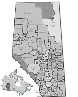
Region Southern Alberta Census division No. 2 Established 1912 Incorporated 1950 Government[1] – Reeve Ross Ford – Governing body County of Warner Council – Municipal seat Warner Area[2] – Total 4,520 km2 (1,745.2 sq mi) Population (2006)[2][3] – Total 3,776 – Density 0.8/km2 (2.1/sq mi) – Dwellings 887 Time zone MST (UTC-7) Website County of Warner No. 5 The County of Warner No. 5 is a municipal district in southern Alberta, Canada.
It is located in Census Division 2, just north of the United States border. Warner was organised as a rural municipality since 1912, and established in the actual borders since 1954. The seat of the municipality is located in Warner.
Contents
Demographics
In 2006, the County of Warner No. 5 had a population of 3,674 living in 887 dwellings, a 3.3% decrease from 2001.[2] However, this population has since been revised by Statistics Canada to 3,776.[3] Using the pre-revised Statistics Canada data, the County of Warner No. 5 had a land area of 4,519.77 km2 (1,745.09 sq mi) and a population density of 0.8 /km2 (2.1 /sq mi).[2]
In 2001, the County of Warner No. 5 had a population of 3,798 in 880 dwellings, a 6.7% increase from 1996. On a surface of 4,516.09 km² it had a density of 0.8 inhabitants/km².[4]
Tourism and attractions
See also: List of attractions and landmarks in Stirling- Stirling Agricultural Village, National Historic Site of Canada
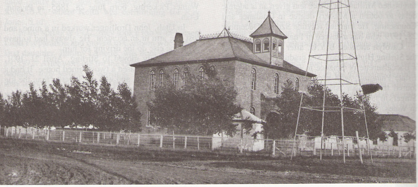
- Warner elevator row, last surviving "Grain Elevator Row" in Alberta.
- Galt Historic Railway Park
- Michelsen Farmstead
- William T. Ogden House
- Lost Frontier Mini-Railway
- Writing-on-Stone Provincial Park,
- Devil's Coulee Dinosaur Heritage Museum
- Centennial Park
- Stirling Elevator
- Neils Hogenson House
- Andrew Larson House
- Temple Hill
- Raymond Golf Club
- Milk River Golf Club
Events
- Stirling Settler Days
- Victorian Prairie Christmas - Galt Railway Park
- Raymond Stampede
History
The County of Warner No. 5 comprises approximately 50 townships, and is bordered on the south by the Canadian-United States border, It is composed of the former Municipal District of Warner No. 36 and a portion of the former Municipal District of Sugar City No. 37.
The following is the events that lead to the incorporation of the County of Warner No. 5:
- January, 1913 - Municipal District of Warner No. 36 incorporated.
- January 23, 1923 - Municipal District of Sugar City No. 37 incorporated.
- 1942 - Sugar City Municipality enlarged to include Local Improvement District
No. 7 and portions of Local Improvement Districts 8, 38 and 67.
- January 6, 1950 - Warner Municipality enlarged to include Milk River, Coutts and Masinasin districts.
- December 31, 1953 - Sugar City dissolved and portion added to the Municipal District of Warner.
- January 1, 1954 - County of Warner No. 5 incorporated.
Communities
The following communities are located in this municipal district:[5]
Towns
Villages
Hamlets
Other unincorporated communities
- Allerston (Doran)
- Conrad
- Clarinda
- Craddock
- Judson
- Knappen
- Lucky Strike
- Masinasin
- Maybutt
- McNab
- One-Seventeen
- St. Kilda[6]
- Two-Fifteen[7]
Education
Westwind School Division No. 74 and Horizon School Division No. 67 provide education within the boundaries of the County of Warner No. 5.
Early school districts
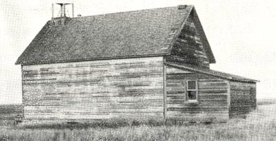
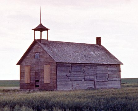
Listed below are the former school districts that once provided education within the County of Warner No. 5.[8]
Name & SD No. Image Location Date Established Date Closed/
DisbandedNotes Galt/Stirling No. 647 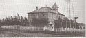
29 - 6 - 19 - W4 19 November 1901 Originally named Galt, the name was changed to Stirling in 1957.[9] Raymond No. 700 8 - 6 - 20 - W4 1 May 1902[10] Mammoth No. 1379 24 - 5 - 20 - W4 9 August 1905[11] Warner No. 1675 10 - 4 - 17 - W4 31 July 1907[12] Tyrells Lake No. 2007 20-5-17-W4 8 July 1909 1939 Demolished 1940s[13] Milk River Valley/Masinasin No. 2024 15 - 2 - 13 - W4 24 August 1909 Originally named Milk River Valley, the name was changed to Masinasin in 1941.[14] Milk River No. 2056 15 - 2 - 13 - W4 8 October 1909[14] Grain No. 2597 15-1-11-W4 25 November 1911[15] West Butte/St. Kilda No. 2747 11-1-12-W4 25 May 1912 Originally named West Butte, the name was changed to St. Kilda in 1920.[16] Indian Rock No. 2540 18-1-12 -W4 moved? to 11 - 1 - 12 - W4 25 August 1911[17] Locke No. 2730 31-1-13 -W4 Moved? to 28 - 2 - 13 - W4 10 May 1912[18] Clarinda No. 2459 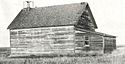
8-1-13 -W4 10 June 1911[19] Verburg No. 2439 33-1-14 -W4 10 May 1911[20] Sexton Creek No. 2510 9-1-14 -W4 moved? to 33 - 1 - 14 - W4 24 July 1911[21] Lind No. 2170 34-1-16 -W4 25 April 1910[22] John Joes No. 2198 24-1-17-W4 26 May 1910 Also spelled John Jo[23] Two Fifteen No. 2153 20-2-15-W4 26 March 1910 March 26 Moved to Milk River for a class room when the district was joined with Milk River Consolidated District 12, December 1945[24] Sleepy Hollow No. 2634 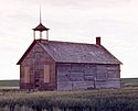
24-2-15-W4 25 January 1912[25] Lucky Strike No. 2589 17-3-11-W4 9 November 1911[26] Prairie Round No. 2152 21-3-12-W4 26 March 1910 March 26[27] Patience No. 2156 23-6-17-W4 26 March 1910[28] Maybutt 32-6-19-W4 1912 Kippen No. 2080 34-2-12-W4 9 December 1909 1933 Kippenville Consolidated 7 created in 1915 by Kippen & Green Villa disorganized in 1933[29] Bankview No. 3042 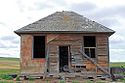
16-1-17-W4 1913 1953 Craddock/Bluesky No. 3456 33 - 81 - 2 - W6 15 February 1917 Originally named Craddock, the name was changed to Bluesky in 1947.[30] Coutts No. 3560 4 - 1 - 15 - W4 30 October 1917[31] North Wrentham No. 3618 7 - 16 - W4 18 February 1918[32] Wrentham No. 3617 36 - 6 - 17 - W4 18 February 1918[33] Conrad No. 4077 11 - 61 - 12 - W4 3 November 1921[34] See also
- List of communities in Alberta
- List of municipal districts in Alberta
References
- ^ "Municipal Officials Search". Alberta Municipal Affairs. November 11, 2011. http://www.municipalaffairs.alberta.ca/mc_municipal_officials_search.cfm. Retrieved November 11, 2011.
- ^ a b c d Statistics Canada (Census 2006). "County of Warner No. 5 - Community Profile". http://www12.statcan.ca/english/census06/data/profiles/community/Details/Page.cfm?Lang=E&Geo1=CSD&Code1=4802001&Geo2=PR&Code2=48&Data=Count&SearchText=Warner%20County%20No.%205&SearchType=Begins&SearchPR=01&B1=All&GeoLevel=&GeoCode=4802001. Retrieved 2007-06-11.
- ^ a b Statistics Canada (2009-02-09). "2006 Census corrections and updates". http://www12.statcan.ca/english/census06/corrections/updatepages/cgen001.cfm?lvl=H. Retrieved 2010-11-28.
- ^ County of Warner community profile - Statistics Canada. 2002. 2001 Community Profiles. Released June 27, 2002. Last modified: 2005-11-30. Statistics Canada Catalogue no. 93F0053XIE.
- ^ Municipal Profile - Alberta Municipal Affairs
- ^ St. Kilda - Our Roots: Local Histories Online - The hills of home
- ^ Two-Fifteen - Our Roots: Local Histories Online - Milk River Country
- ^ Early School Districts - Warner County No. 5, Alberta
- ^ Galt/Stirling S.D. 647 - Glenbow Museum Archives
- ^ Raymond S.D. 700 - Glenbow Museum Archives
- ^ Mommoth S.D. 1379 - Glenbow Museum Archives
- ^ Warner S.D. 1675 - Glenbow Museum Archives
- ^ Pioneering with a piece of chalk : the one-room country schools of Alberta, 1885-1982 - Tyrells Lake SD No. 2007
- ^ a b Milk River Valley/Masinasin S.D. 2024 - Glenbow Museum Archives
- ^ Grain S.D. 2597 - Glenbow Museum Archives
- ^ West Butte/St. Kilda S.D. 2747 - Glenbow Museum Archives
- ^ Indian Rock S.D. 2540 - Glenbow Museum Archives
- ^ Locke S.D. 2730 - Glenbow Museum Archives
- ^ Clarinda S.D. 2730 - Glenbow Museum Archives
- ^ Verburg S.D. 2439 - Glenbow Museum Archives
- ^ Sexton Creek S.D. 2510 - Glenbow Museum Archives
- ^ Lind S.D. 2170 - Glenbow Museum Archives
- ^ [Our Roots] - Pioneering with a piece of chalk : the one-room country schools of Alberta, 1885-1982 - John Joe SD No. 2198
- ^ Pioneering with a piece of chalk : the one-room country schools of Alberta, 1885-1982 - Two Fifteen SD No. 2153
- ^ Sleepy Hollow S.D. 2634 - Glenbow Museum Archives
- ^ Lucky Strike S.D. 2589 - Glenbow Museum Archives
- ^ Prairie Round S.D. 2152 - Glenbow Museum Archives
- ^ Patience S.D. 2156 - Glenbow Museum Archives
- ^ Pioneering with a piece of chalk : the one-room country schools of Alberta, 1885-1982 - Kippen SD No. 2080
- ^ Craddock/Bluesky S.D. 3456 - Glenbow Museum Archives
- ^ Coutts S.D. 3560 - Glenbow Museum Archives]
- ^ North Wrentham S.D. 3618
- ^ Wrentham S.D. 3617
- ^ Conrad No. 4077 - Glenbow Museum Archives
External links

City of Lethbridge County of Lethbridge Municipal District of Taber Cardston County, Alberta 
County of Forty Mile No. 8  County of Warner No. 5

Glacier County Toole County Liberty County Categories:- Warner County, Alberta


Wikimedia Foundation. 2010.