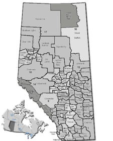
- Bighorn No. 8, Alberta
-
Municipal District of Bighorn No. 8 — Municipal district — Location of Bighorn No. 8 in Alberta Coordinates: 51°21′0″N 115°04′0″W / 51.35°N 115.066667°W Country  Canada
Province  Alberta
Region Calgary Region Census division No. 15 Incorporated 1988 Government[1] – Reeve Dene Cooper – Governing body M.D. of Bighorn Council – Municipal seat Exshaw Area[2] – Total 2,767.94 km2 (1,068.7 sq mi) Population (2006)[2][3] – Total 1,454 – Density 0.5/km2 (1.3/sq mi) – Dwellings 676 Time zone MST (UTC−7) – Summer (DST) MDT (UTC−6) Website Bighorn No. 8 The Municipal District of Bighorn No. 8 is a municipal district situated in Census Division No. 15 of Alberta, Canada. It is located between Calgary and Banff National Park, north of Kananaskis Improvement District. Highway 1 (the Trans-Canada Highway) bisects this county.
It was created as a municipal district on January 1, 1988 from the former Improvement District No. 8,[4] absorbing the Town of Canmore in the early 90's.
Contents
Communities
Bighorn No. 8 includes the five hamlets of Benchlands, Dead Man's Flats, Exshaw, Harvie Heights and Lac des Arcs. The summer villages of Ghost Lake and Waiparous are also located here.
Demographics
In 2006, the Municipal District (M.D.) of Bighorn No. 8 had a population of 1,264 living in 676 dwellings, a 2.6% decrease from 2001.[2] However, this population has since been revised by Statistics Canada to 1,454.[3] Using the pre-revised Statistics Canada data, the M.D. of Bighorn No. 8 had a land area of 2,767.94 km2 (1,068.71 sq mi) and a population density of 0.5 /km2 (1.3 /sq mi) in 2006.[2]
The Canada 2001 Census reported that the M.D. of Bighorn No. 8 had a population of 1,298, scattered over 2,810 km2, with total number of private dwellings being 758. Its population density was 0.5 /km2.[5]
See also
- List of communities in Alberta
- List of municipal districts in Alberta
References
- ^ Alberta Municipal Affairs: Municipal Officials Search
- ^ a b c d Statistics Canada (Census 2006). "Bighorn No. 8 - Community Profile". http://www12.statcan.ca/english/census06/data/profiles/community/Details/Page.cfm?Lang=E&Geo1=CSD&Code1=4815015&Geo2=PR&Code2=48&Data=Count&SearchText=Bighorn%20No.%208&SearchType=Begins&SearchPR=01&B1=All&GeoLevel=&GeoCode=4815015. Retrieved 2007-06-11.
- ^ a b Statistics Canada (2009-02-09). "2006 Census corrections and updates". http://www12.statcan.ca/english/census06/corrections/updatepages/cgen001.cfm?lvl=H. Retrieved 2010-11-28.
- ^ Municipal District of Bighorn No. 8 profile - Alberta Municipal Affairs
- ^ Bighorn No. 8 Community Profile - Statistics Canada. 2002. 2001 Community Profiles. Released June 27, 2002. Last modified: 2005-11-30. Statistics Canada Catalogue no. 93F0053XIE
External links

Clearwater County Mountain View County 
Banff National Park 
Rocky View County  Municipal District of Bighorn No. 8

Kananaskis Improvement District Municipal District of Foothills No. 31 Categories:
Wikimedia Foundation. 2010.

