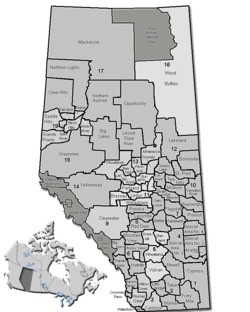
- Peace No. 135, Alberta
-
Municipal District of Peace No. 135 — Municipal district — Location of Peace No. 135 in Alberta Coordinates: 56°08′51″N 117°44′2″W / 56.1475°N 117.73389°WCoordinates: 56°08′51″N 117°44′2″W / 56.1475°N 117.73389°W Country  Canada
Province  Alberta
Region Northern Alberta Census division No. 19 Established 1916 Incorporated 1945 Government – Reeve Veronica Bliska – Governing body M.D. of Peace Council – Municipal seat Berwyn Area – Total 852 km2 (329 sq mi) Population (2006)[1] – Total 1,487 – Density 1.7/km2 (4.4/sq mi) – Dwellings 547 Time zone MST (UTC-7) Website M.D. of Peace No. 135 The Municipal District of Peace No. 135 is a municipal district in northwestern Alberta, Canada.
It is located in Census Division 19. The municipal seat is set in the Village of Berwyn.
Contents
Demographics
In 2006, Peace No. 135 had a population of 1,487 living in 547 dwellings, a -0.6% increase from 2001. The municipal district has a land area of 851.92 km2 (328.93 sq mi) and a population density of 1.7 /km2 (4.4 /sq mi).[1]
In 2001, the municipal district had a population of 1,496 in 559 dwellings, a 4.2% decrease from 1996. On a surface of 857.20 km² it had a density of 1.7 inhabitants/km².[2]
Communities
The following communities are located in this municipal district:[3]
Towns
Villages
- Berwyn (municipal seat)
Hamlets
- Brownvale
Designated places
- Shaftesbury Settlement
Attractions
- Lac Cardinal Recreation Area
- Queen Elizabeth Provincial Park
- Strong Creek Park
- Wilderness Park
Economy
Agriculture is a significant part of the area's economy, with the region being dubbed as most northern agricultural industry oasis in the world.[4] The region has unique growing combination of a northern climate, fertile soils, and a watershed system fed by glacial run offs.
See also
- List of communities in Alberta
- List of municipal districts in Alberta
References
- ^ a b Statistics Canada (Census 2006). "Peace No. 135 - Community Profile". http://www12.statcan.ca/english/census06/data/profiles/community/Details/Page.cfm?Lang=E&Geo1=CSD&Code1=4819071&Geo2=PR&Code2=48&Data=Count&SearchText=Peace%20No.%20135&SearchType=Begins&SearchPR=01&B1=All&GeoLevel=&GeoCode=4819071. Retrieved 2007-06-11.
- ^ M.D. of Peace community profile - Statistics Canada. 2002. 2001 Community Profiles. Released June 27, 2002. Last modified: 2005-11-30. Statistics Canada Catalogue no. 93F0053XIE
- ^ Municipal Profile - Alberta Municipal Affairs
- ^ "Defnining Quality of Peace Country Agriculture". Branding the Peace Country Association. Apr 2009. http://www.nadc.gov.ab.ca/Publications/reports/Branding-Agriculture.pdf.
External links
- Alberta First. District Statistics
Categories:
Wikimedia Foundation. 2010.


