- Paintearth County No. 18, Alberta
-
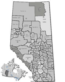
County of Paintearth No. 18 — Municipal district — Location of Paintearth No. 18 in Alberta
Coordinates: 52°13′12″N 111°54′34″W / 52.22°N 111.90944°WCoordinates: 52°13′12″N 111°54′34″W / 52.22°N 111.90944°W Country  Canada
Province  Alberta
Region Central Alberta Census division No. 7 Established 1944 Incorporated 1962 Government[1] – Reeve George Glazier – Governing body County of Paintearth Council – Municipal seat Castor Area – Total 3,287 km2 (1,269.1 sq mi) Population (2006)[2] – Total 2,126 – Density 0.6/km2 (1.6/sq mi) – Dwellings 733 Time zone MST (UTC-7) Website County of Paintearth No. 18 The County of Paintearth No. 18 is a municipal district in east central Alberta, Canada.
It is located in Census Division 7. Incorporated in the current boundaries in 1944 as the Municipal District of Paintearth No. 334, it was established as a county in 1962. The municipal seat is in the Town of Castor.
Contents
Demographics
In 2006, the County of Paintearth No. 18 had a population of 2,126 living in 733 dwellings, a -3.0% increase from 2001. The countyhas a land area of 3,287.24 km2 (1,269.21 sq mi) and a population density of 0.6 /km2 (1.6 /sq mi).[2]
In 2001, the municipal district had a population of 2,192 in 734 dwellings, a 5.4% decrease from 1996. On a surface of 3,286.38 km² it had a density of 0.7 inhabitants/km².[3]
Communities
The following communities are located in the County of Paintearth No. 18:[4]
Towns
Villages
Hamlets
- Brownfield
- Fleet
See also
- List of communities in Alberta
- List of municipal districts in Alberta
References
- ^ Alberta Municipal Affairs: Municipal Officials Search
- ^ a b Statistics Canada (Census 2006). "County of Paintearth No. 18 - Community Profile". http://www12.statcan.ca/english/census06/data/profiles/community/Details/Page.cfm?Lang=E&Geo1=CSD&Code1=4807011&Geo2=PR&Code2=48&Data=Count&SearchText=Paintearth%20County%20No.%2018&SearchType=Begins&SearchPR=01&B1=All&GeoLevel=&GeoCode=4807011. Retrieved 2007-06-11.
- ^ County of Paintearth community profile - Statistics Canada. 2002. 2001 Community Profiles. Released June 27, 2002. Last modified: 2005-11-30. Statistics Canada Catalogue no. 93F0053XIE.
- ^ Municipal Profile - Alberta Municipal Affairs
External links
- County of Paintearth (official website)
- Paintearth Economic Partnership

Flagstaff County Municipal District of Provost No. 52 County of Stettler No. 6 
 County of Paintearth No. 18

Special Area No. 2 Special Area No. 4 Categories:- Paintearth County, Alberta

Wikimedia Foundation. 2010.