- Fort Macleod, Alberta
-
Fort Macleod — Town — Town of Fort Macleod The fort in Fort Macleod Location of Fort Macleod in Alberta
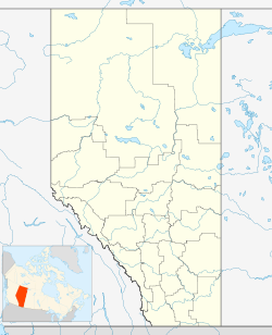
 Fort Macleod
Coordinates: 49°43′32″N 113°23′51″W / 49.72556°N 113.3975°W Country  Canada
Province  Alberta
Region Southern Alberta Census division 3 Municipal District Willow Creek Settled 1884 Government[1] – Mayor Shawn Patience – Governing body Fort Macleod Town Council – Manager Gloria Schwindt (acting) – MP Ted Menzies (Macleod-Cons) – MLA Evan Berger Area[2] – Total 23.34 km2 (9 sq mi) Elevation 945 m (3,100 ft) Population (2006)[3] – Total 3,072 – Density 131.6/km2 (340.8/sq mi) Time zone MST (UTC−7) – Summer (DST) MDT (UTC−6) Postal code span T0L Area code(s) +1-403 Website Town of Fort Macleod Fort Macleod is a town in the southwest corner of the province of Alberta, Canada. It was founded as a North-West Mounted Police barracks, and is named in honour of the North-West Mounted Police Colonel James Macleod. The town's current mayor is Shawn Patience.
Contents
History and heritage preservation
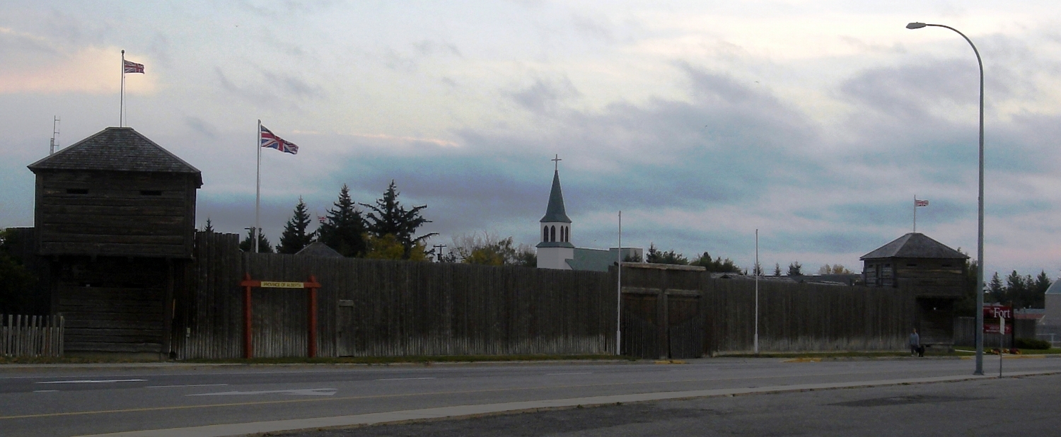
The fort was built as a 70 by 70 meters square (233 by 233 ft) on October 18, 1874. The east side held the men's quarters and the west side held those of the Mounties. Buildings such as hospitals, stores, and guardrooms were in the south end. Stables and the blacksmith's shop were in the north end.
The town grew on the location of the Fort Macleod North-West Mounted Police (NWMP) Barracks, the second headquarters of the NWMP after Fort Livingstone was abandoned in 1876.[4] Fort Macleod was originally established in 1874 on an island on the Oldman River, then moved in 1884 to the present town location.[5] The Museum of the North-West Mounted Police is located in Fort Macleod.[6]
Once agricultural settlement and the railway came to the region, Macleod boomed. The town became a CPR divisional point and frontier wood construction began to be replaced by brick and sandstone. In 1906 a fire devastated the downtown and destroyed most of the wooden buildings. From 1906 to 1912 Macleod had its greatest period of building, as more new brick and stone building replaced the destroyed wooden ones. Then in 1912 the CPR moved the divisional point and 200 jobs to Lethbridge, devastating the local economy. Fort Macleod ceased to grow, and in 1924 was forced to declare bankruptcy. Until the 1970s, the town's economy stagnated and the buildings from the turn-of-the-century remained untouched.[7]
In 1978 Alberta Culture started to inventory the downtown buildings, and in 1982 the downtown became Alberta's first "Provincial Historic Area". As well, Heritage Canada started a Main Street Restoration Project in 1982, aiming to preserve the sandstone and brick buildings, some dating back to 1878.[8][7]
Fort Macleod UFO incident
On August 27, 1956, while an RCAF squadron leader and a flight Lieutenant were attempting to set a speed record in an F-86 and flying over Fort Macleod, a stationary object in the sky was observed. It was brighter than the sunlight and distinctly disk-shaped. A photograph was taken of the object. Possible explanations that the object was a cloud, a sun dog, or a reflection have been ruled out because it was found to be a definite light source as it was equally bright on the side facing the sun as of its other side. Some scientists have explained the sighting as ball lightning, but others say this is unlikely due to its shape and size.[9]
Geography
The town is located in the Municipal District of Willow Creek, at the intersection of Highway 2 and Highway 3, on the Oldman River. It lies west of the larger community of Lethbridge, near the reserves of the Peigan and Kainah First Nations. It is also located close to the Waterton Lakes National Park.
The town is located 8 kilometres (5.0 mi) north of the McBride Lake Wind Farm, one of the largest wind farms in Alberta. The wind farm has a capacity of 75 megawatts of electricity.
Climate
Fort Macleod experiences a humid continental climate (Köppen climate classification Dfb).
Climate data for Fort Macleod Month Jan Feb Mar Apr May Jun Jul Aug Sep Oct Nov Dec Year Record high °C (°F) 19.4
(66.9)20
(68)27.8
(82.0)32.2
(90.0)34.5
(94.1)38.3
(100.9)42.8
(109.0)37.2
(99.0)36.7
(98.1)30
(86)26.1
(79.0)25
(77)42.8
(109.0)Average high °C (°F) −1.3
(29.7)1.9
(35.4)6.7
(44.1)12.7
(54.9)18
(64)22.4
(72.3)25.6
(78.1)24.8
(76.6)19.1
(66.4)14.3
(57.7)4.2
(39.6)−0.2
(31.6)12.4 Daily mean °C (°F) −7.1
(19.2)−4.3
(24.3)0.4
(32.7)6
(43)11.1
(52.0)15.4
(59.7)18
(64)17.2
(63.0)11.8
(53.2)7.2
(45.0)−1.2
(29.8)−5.8
(21.6)5.7 Average low °C (°F) −13
(9)−10.4
(13.3)−5.9
(21.4)−0.8
(30.6)4.1
(39.4)8.3
(46.9)10.4
(50.7)9.5
(49.1)4.4
(39.9)0
(32)−6.7
(19.9)−11.5
(11.3)−1 Record low °C (°F) −45
(−49)−45
(−49)−36.7
(−34.1)−23.3
(−9.9)−15
(5)−10
(14)0
(32)−2.2
(28.0)−17.8
(0.0)−25
(−13)−38.9
(−38.0)−45
(−49)−45
(−49)Precipitation mm (inches) 21
(0.83)17.8
(0.701)27.5
(1.083)37.7
(1.484)57.2
(2.252)61.2
(2.409)46.5
(1.831)50
(1.97)46.2
(1.819)18.9
(0.744)20.2
(0.795)20.9
(0.823)425
(16.73)Source: Environment Canada[10] Demographics
In 2006, Fort Macleod had a population of 3,072 living in 1,278 dwellings, a 2.7% increase from 2001. The town has a land area of 23.34 km2 (9.01 sq mi) and a population density of 131.6 /km2 (341 /sq mi).[3]
In 2001, Fort Macleod had a population of 2,990, a 1.5% decrease from 1996.[2]
Notable people
- Joni Mitchell, musician
- Henrietta Muir Edwards, women's rights activist
- Frederick Maurice Watson Harvey, VC, MC- Irish-Canadian soldier & rugby union athlete died here in 1980
- Sir Frederick Haultain, former premier of the North-West Territories
Sports
The town is home to the Fort Macleod Mustangs hockey team of the Ranchland Hockey League.[11]
Media
Newspapers
- Fort Macleod Gazette[12]
Historical newspapers
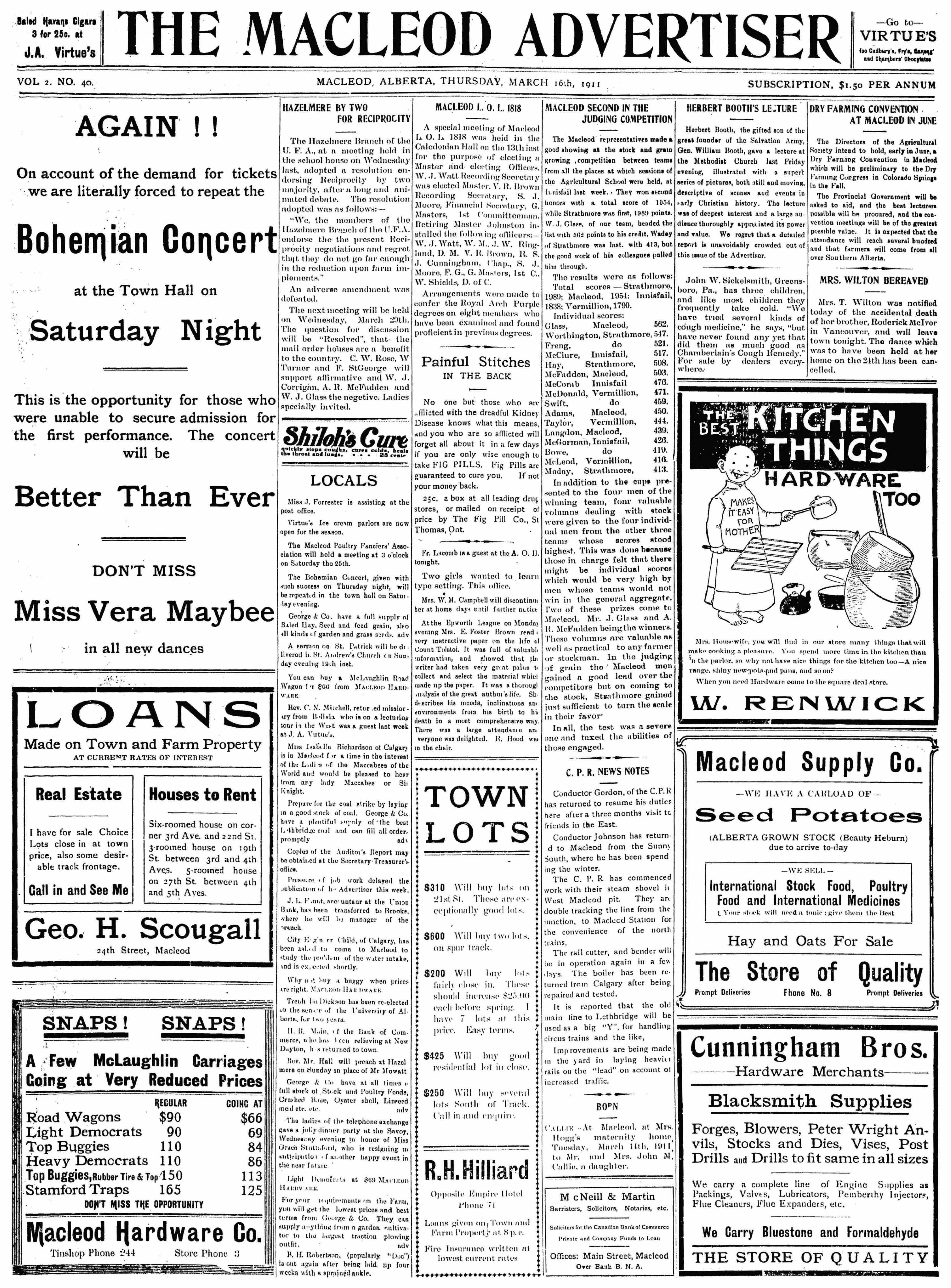
- Macleod Advertiser -- The Macleod Advertiser was published May 25, 1909, through September 11, 1913.[13]
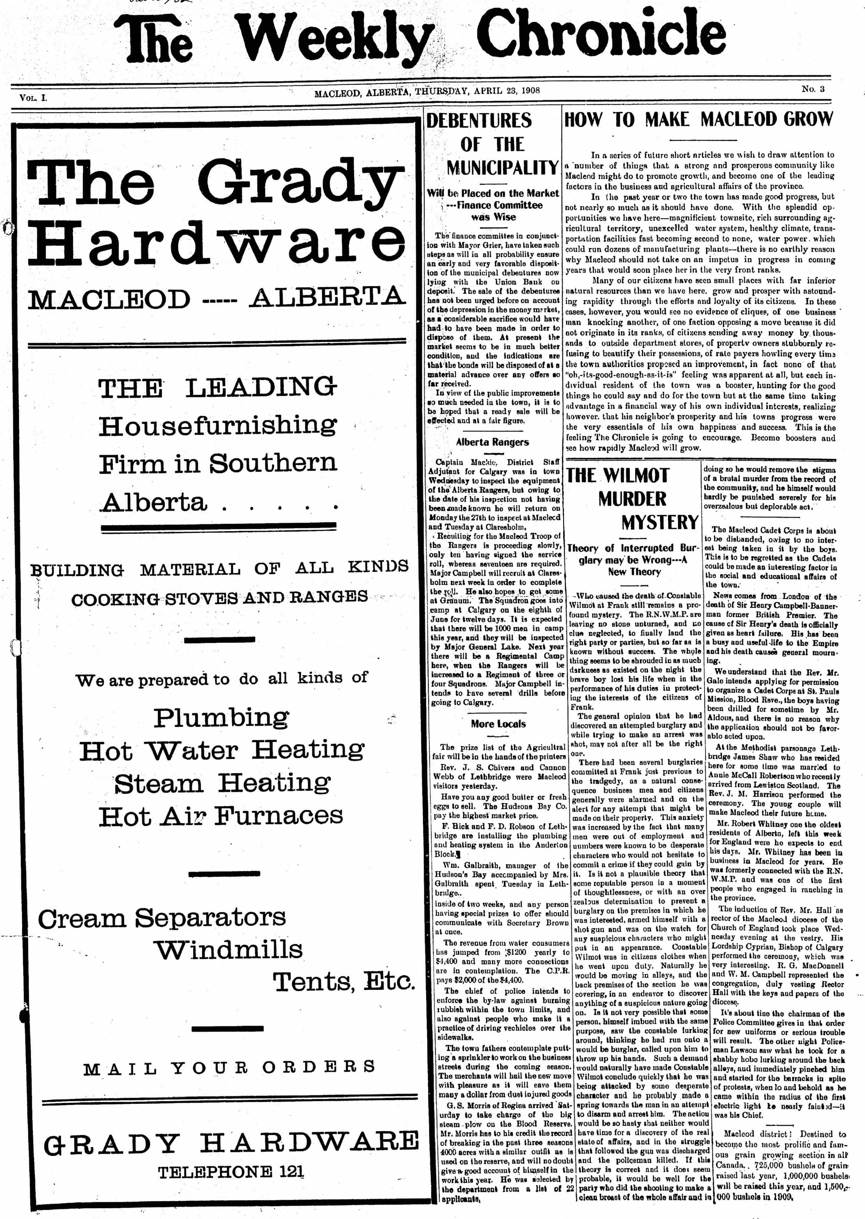
- Macleod Chronicle -- The Macleod Chronicle, in print July 1908 through June 1909 (dates are rough approximations).
- Macleod Gazette -- Early issues of the Macleod Gazette entitled The Macleod Gazette and Alberta Stock Record.
- Macleod News -- The Macleod News ran from November 2, 1916, through to June 1919.
- Macleod Spectator -- The Spectator lasted from April 30, 1912 until October 26, 1916.
A selection of historical newspapers from Fort Macleod have been digitized from microfilm and are available in the Southern Alberta Newspaper Collection from the University of Lethbridge Library digitized collections. Included are: Macleod Advertiser (1908-1913), Macleod Chronicle (1908-1909), Macleod Gazette (1897-1907), Macleod News (1916-1919), & Macleod Spectator (1912-1916).
Film location
Ang Lee's Academy Award-winning movie Brokeback Mountain was filmed in part in Fort Macleod. The laundry apartment is located at 2422 Third Avenue, where a sign is posted marking the "passionate reunion" of Jack and Ennis. Passchendaele was also filmed in Fort Macleod's historic downtown, which acted as a stand-in for Calgary circa 1915.
See also
- List of communities in Alberta
- List of towns in Alberta
References
- ^ "Municipal Officials Search". Alberta Municipal Affairs. November 11, 2011. http://www.municipalaffairs.alberta.ca/mc_municipal_officials_search.cfm. Retrieved November 11, 2011.
- ^ a b Fort Macleod profile - Statistics Canada. 2002. 2001 Community Profiles. Released June 27, 2002. Last modified: 2005-11-30. Statistics Canada Catalogue no. 93F0053XIE
- ^ a b Statistics Canada (Census 2006). "Fort Macleod - Community Profile". http://www12.statcan.ca/english/census06/data/profiles/community/Details/Page.cfm?Lang=E&Geo1=CSD&Code1=4803019&Geo2=PR&Code2=48&Data=Count&SearchText=Fort%20Macleod&SearchType=Begins&SearchPR=01&B1=All&GeoLevel=&GeoCode=4803019. Retrieved 2007-06-11.
- ^ Historic Fort Livingstone
- ^ Fort Macleod history
- ^ Museum of the North West Mounted Police
- ^ a b http://www.fortmacleod.com/visiting/attractions/Main%20Street%20History.cfm
- ^ Alberta First. Fort Macleod Overview
- ^ The Canadian UFO Report:The Best Cases Revealed, Chris Rutkowski and Geoff Dittman, 2006, ISBN 1-55002-621-6
- ^ Environment Canada—Canadian Climate Normals 1971–2000, accessed 3 April 2010
- ^ "RHL – About Us". Ranchland Hockey League. http://www.ranchlandhockey.com/about-us-s12467. Retrieved 2011-03-09.
- ^ Fort Macleod Gazette
- ^ Strathern, Gloria M. (1988). Alberta Newspapers, 1880-1982: An Historical Directory. University of Alberta. ISBN 0888641370.
External links

Claresholm Granum Nobleford Cowley 
Coalhurst  Fort Macleod

Pincher Creek Glenwood Magrath Coordinates: 49°43′32.1″N 113°23′51.1″W / 49.725583°N 113.397528°W
Categories:- Towns in Alberta
- North-West Mounted Police forts
- National Historic Sites in Alberta
- Hudson's Bay Company trading posts
- Provincial Historic Areas of Alberta
- Willow Creek No. 26, Alberta
- Fort or trading post National Historic Sites of Canada

Wikimedia Foundation. 2010.