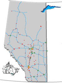
- Oyen, Alberta
-
Oyen — Town — Town of Oyen Location of Oyen in Alberta Coordinates: 51°21′08″N 110°28′26″W / 51.35222°N 110.47389°WCoordinates: 51°21′08″N 110°28′26″W / 51.35222°N 110.47389°W Country  Canada
Province  Alberta
Region Central Alberta Census division 4 Special Area No. 3 Government – Mayor Paul Christianson – Governing body Oyen Town Council – MLA Area – Total 4.93 km2 (1.9 sq mi) Elevation 770 m (2,526 ft) Population (2006)[1] – Total 1,015 – Density 205.9/km2 (533.3/sq mi) Time zone MST (UTC−7) – Summer (DST) MDT (UTC−6) Postal code span T0J 2J0 Highways Highway 9
Highway 41
Highway 895Website Town of Oyen Oyen is a small town in eastern Alberta, close to the Saskatchewan boundary, north of Medicine Hat. The town is located on Highway 41, 4 km (2.5 mi) south of its junction with Highway 9, and is the first major centre within Alberta for travellers entering from nearby Saskatchewan.
Oyen is the service centre for a large but sparsely populated dryland farming area. In the surrounding area wheat, barley, and canola are important crops, and beef cattle are raised.
Contents
Amenities
Oyen has a hospital, grain elevators, farm equipment dealerships, stores, a golf course, a local museum, and a number of churches. The regional public high school is found here, and it has a small Catholic elementary school.
A major highway rest stop is located north of the town at the junction of Highway 41 and Highway 9. It is developed with a service station, a restaurant, a motel and a Travel Alberta Visitor Information Centre.
Climate
Oyen experiences a semi-arid climate (Köppen climate classification BSk). Winters are long, cold and dry, while summers are short and warm. Precipitation is low, with an annual average of 322 mm, and is heavily concentrated in the warmer months.
Climate data for Oyen Month Jan Feb Mar Apr May Jun Jul Aug Sep Oct Nov Dec Year Record high °C (°F) 11
(52)14.5
(58.1)21.5
(70.7)30.5
(86.9)35.5
(95.9)37.5
(99.5)37.5
(99.5)39
(102)36
(97)28
(82)21
(70)13.5
(56.3)39
(102)Average high °C (°F) −8
(18)−4.7
(23.5)1.7
(35.1)12
(54)18
(64)22.4
(72.3)25.5
(77.9)24.8
(76.6)18.8
(65.8)11.7
(53.1)0.7
(33.3)−5.7
(21.7)9.8 Daily mean °C (°F) −12.8
(9.0)−9.4
(15.1)−3.3
(26.1)5.4
(41.7)11.2
(52.2)15.6
(60.1)18.4
(65.1)17.4
(63.3)12
(54)5.6
(42.1)−4.1
(24.6)−10.4
(13.3)3.8 Average low °C (°F) −17.6
(0.3)−14
(7)−8.3
(17.1)−1.3
(29.7)4.3
(39.7)8.8
(47.8)11.1
(52.0)9.9
(49.8)5.2
(41.4)−0.6
(30.9)−9
(16)−15.1
(4.8)−2.2 Record low °C (°F) −40
(−40)−40.5
(−40.9)−31.1
(−24.0)−23.3
(−9.9)−7.5
(18.5)−6.5
(20.3)3.5
(38.3)0
(32)−8.5
(16.7)−24.5
(−12.1)−35
(−31)−42
(−44)−42
(−44)Precipitation mm (inches) 11
(0.43)7.4
(0.291)13.2
(0.52)17.6
(0.693)45.6
(1.795)70.3
(2.768)53
(2.09)33.8
(1.331)29.9
(1.177)13.6
(0.535)12.5
(0.492)13.6
(0.535)321.5
(12.657)Source: Environment Canada[2] Demographics
The population of the Town of Oyen according to its 2009 municipal census is 1,190.[3]
In 2006, Oyen had a population of 1,015 living in 404 dwellings, a 0.5% decrease from 2001. The town has a land area of 4.93 km2 (1.90 sq mi) and a population density of 205.9 /km2 (533 /sq mi).[1]
See also
- List of communities in Alberta
- List of towns in Alberta
References
- ^ a b Statistics Canada (Census 2006). "Oyen – Community Profile". http://www12.statcan.ca/english/census06/data/profiles/community/Details/Page.cfm?Lang=E&Geo1=CSD&Code1=4804014&Geo2=PR&Code2=48&Data=Count&SearchText=Oyen&SearchType=Begins&SearchPR=01&B1=All&GeoLevel=&GeoCode=4804014. Retrieved 2007-06-12.
- ^ Environment Canada—[1]. Retrieved 6 April 2010.
- ^ Alberta Municipal Affairs (2009-09-15). "Alberta 2009 Official Population List". http://municipalaffairs.gov.ab.ca/documents/LGS/2009pop.pdf. Retrieved 2010-09-14.
External links

Coronation Consort Kerrobert 
Cereal 
Eatonia  Oyen
Oyen 

Brooks Medicine Hat Leader Categories:- Towns in Alberta
- Municipal seats in Alberta
- Special Area No. 3, Alberta
Wikimedia Foundation. 2010.

