- Cereal, Alberta
-
Cereal — Village — Village of Cereal Location in Alberta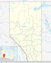

Coordinates: 51°24′56.1″N 110°47′59.5″W / 51.415583°N 110.799861°WCoordinates: 51°24′56.1″N 110°47′59.5″W / 51.415583°N 110.799861°W Country  Canada
Province  Alberta
Region Central Alberta Census division 4 Special Area No. 3 Government - Mayor Allen Buetter - Governing body Cereal Village Council - MLA Area[1] - Total 0.95 km2 (0.4 sq mi) Elevation 765 m (2,510 ft) Population (2006)[1] - Total 126 - Density 133/km2 (344.5/sq mi) Time zone MST (UTC-7) Highways Highway 9
Highway 886Cereal is a village in central Alberta east of Drumheller.
Contents
Demographics
In 2006, Cereal had a population of 126 living in 68 dwellings, a 32.6% decrease from 2001. The Village has a land area of 0.95 km2 (0.37 sq mi) and a population density of 133.2 /km2 (345 /sq mi).[1]
See also
- List of communities in Alberta
- List of villages in Alberta
References
- ^ a b c Statistics Canada (Census 2006). "Cereal - Community Profile". http://www12.statcan.ca/english/census06/data/profiles/community/Details/Page.cfm?Lang=E&Geo1=CSD&Code1=4804016&Geo2=PR&Code2=48&Data=Count&SearchText=Cereal&SearchType=Begins&SearchPR=01&B1=All&GeoLevel=&GeoCode=4804016. Retrieved 2007-06-06.
External links
Categories:- Villages in Alberta
- Special Area No. 3, Alberta
- Central Alberta geography stubs

Wikimedia Foundation. 2010.