- Clyde, Alberta
-
Clyde — Village — Village of Clyde Location in Alberta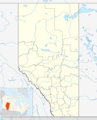

Coordinates: 54°09′07″N 113°38′20″W / 54.15194°N 113.63889°W Country  Canada
Province  Alberta
Region Northern Alberta Census division 13 County Westlock Incorporated (village) 1914 Government – Mayor Wayne Wilcox – Governing body Clyde Village Council – MLA Area[1] – Total 1.36 km2 (0.5 sq mi) Elevation 650 m (2,133 ft) Population (2006)[1] – Total 470 – Density 346.4/km2 (897.2/sq mi) Time zone MST (UTC-7) Highways Highway 2
Highway 18Website Village of Clyde Clyde is a village in northern Alberta, Canada. It is located north of Edmonton and east of Westlock, near the junction of Highway 18 and Highway 2.
It was incorporated in 1914 and named after the River and Firth of Clyde in Scotland.
Contents
Demographics
The population of the Village of Clyde according to its 2009 municipal census is 493.[2]
In 2006, Clyde had a population of 470 living in 195 dwellings, a 4.3% increase from 2001. The village had a land area of 1.36 square kilometres (0.53 sq mi) and a population density of 346.4 /km2 (897 /sq mi).[1]
See also
- List of communities in Alberta
- List of villages in Alberta
References
- ^ a b c Statistics Canada (Census 2006). "Clyde - Community Profile". http://www12.statcan.ca/english/census06/data/profiles/community/Details/Page.cfm?Lang=E&Geo1=CSD&Code1=4813032&Geo2=PR&Code2=48&Data=Count&SearchText=Clyde&SearchType=Begins&SearchPR=01&B1=All&GeoLevel=&GeoCode=4813032. Retrieved 2007-06-06.
- ^ Alberta Municipal Affairs (2009-09-15). "Alberta 2009 Official Population List". http://municipalaffairs.gov.ab.ca/documents/LGS/2009pop.pdf. Retrieved 2010-09-12.
External links
- AlbertaFirst - Clyde - Statistics
Coordinates: 54°09′07″N 113°38′20″W / 54.15191°N 113.63876°W
Categories:- Villages in Alberta
- Westlock County, Alberta
- Northern Alberta geography stubs

Wikimedia Foundation. 2010.