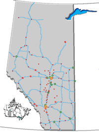
- Onoway, Alberta
-
Onoway — Town — Town of Onoway Nickname(s): Hub of the Highways Location of Onoway in Alberta Coordinates: 53°42′04″N 114°11′53″W / 53.70111°N 114.19806°WCoordinates: 53°42′04″N 114°11′53″W / 53.70111°N 114.19806°W Country  Canada
Province  Alberta
Region Central Alberta Census division 13 County Lac Ste. Anne Incorporated:[1]
- Village
June 25, 1923- Town September 1, 2005 Government[2] – Mayor Dale Krasnow – Governing body Onoway Town Council – MLA Area – Total 3.34 km2 (1.3 sq mi) Population (2006) – Total 875 – Density 262.4/km2 (679.6/sq mi) Time zone MST (UTC-7) Postal code span T0E 1V0 Area code(s) -1+780 Highways Highway 43
Highway 37Waterway Lac Ste. Anne
Sturgeon RiverWebsite Town of Onoway Onoway is a town in central Alberta, Canada. It is located west of Edmonton at the junction of Highway 37 and Highway 43.
The Canadian National Railway tracks run through the town, which is situated immediately east of Lac Ste. Anne and south of the Sturgeon River. Onoway built and opened a new Elementary school, but the fate of the existing school has not yet been confirmed. Every June, Onoway has a fair weekend, called "Heritage Days".
Contents
Demographics
The population of the Town of Onoway according to its 2010 municipal census is 1,021.[3]
In 2006, Onoway had a population of 875 living in 355 dwellings, a 3.3% increase from 2001. The town has a land area of 3.34 km2 (1.29 sq mi) and a population density of 262.4 /km2 (680 /sq mi).[4]
According to the 2001 census:
- Population: 847 (788 in 1996); 1,036 (2005)
- Land area: 3.34 km²
- Median family income: $37,039
- Average value of private dwelling: $89,847
See also
- List of communities in Alberta
- List of towns in Alberta
References
- ^ Alberta Municipal Affairs. "Onoway Municipal Profile". http://www.municipalaffairs.gov.ab.ca/cfml/MunicipalProfiles/index.cfm?fuseaction=BasicReport&MunicipalityType=TOWN&stakeholder=240&profileType=HIST. Retrieved 2011-05-21.
- ^ "Municipal Officials Search". Alberta Municipal Affairs. November 11, 2011. http://www.municipalaffairs.alberta.ca/mc_municipal_officials_search.cfm. Retrieved November 11, 2011.
- ^ "2010 Official Population List". Alberta Municipal Affairs. 2010-09-15. http://www.municipalaffairs.alberta.ca/documents/msb/2010pop.pdf. Retrieved 2011-01-19.
- ^ Statistics Canada (Census 2006). "Onoway - Community Profile". http://www12.statcan.ca/english/census06/data/profiles/community/Details/Page.cfm?Lang=E&Geo1=CSD&Code1=4813014&Geo2=PR&Code2=48&Data=Count&SearchText=Onoway&SearchType=Begins&SearchPR=01&B1=All&GeoLevel=&GeoCode=4813014. Retrieved 2007-06-12.
External links

Sangudo Barrhead Legal 
Entwistle 
St. Albert
Edmonton Onoway

Wabamun Thorsby Spruce Grove Categories:- Towns in Alberta
- Lac Ste. Anne County, Alberta
- Central Alberta geography stubs
Wikimedia Foundation. 2010.

