- Coaldale, Alberta
-
For other uses, see Coaldale (disambiguation).
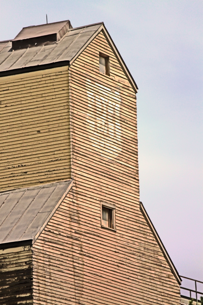
Coaldale — Town — Town of Coaldale Parrish & Heimbecker elevator along the CPR tracks.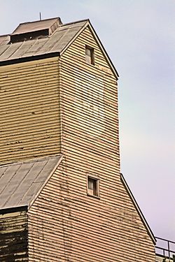
FlagLocation of Coaldale in Alberta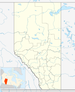
 Coaldale
Coordinates: 49°43′40″N 112°37′06″W / 49.72778°N 112.61833°W Country  Canada
Province  Alberta
Region Southern Alberta Census division 2 Municipal district County of Lethbridge Government[1] - Mayor Kim Craig - Governing body Coaldale Town Council - MLA Area - Total 7.95 km2 (3.1 sq mi) Elevation 865 m (2,838 ft) Population (2006)[2] - Total 6,177 - Density 777.2/km2 (2,012.9/sq mi) Time zone MST (UTC-7) Highways Highway 3
Highway 845Waterway Chin Lakes Website Town of Coaldale Coaldale is a town in southern Alberta, Canada, located 11 km (6.8 mi) east of Lethbridge, along the Crowsnest Highway.
Contents
Attractions
The main attractions are the Alberta Birds of Prey Centre,[3] the Land o' Lakes Golf Course, and the Gem of the West Museum.[4]
Chin Lakes are located 20 minutes east of Coaldale, and offers such recreational services as waterskiing and campfire pits. The Indian Hills Golf Course is another golf course, 9 holes, and is approximately 15 minutes south-west of Coaldale. Across the road is a small campground and a lake, which is commonly regarded as an ideal place for fishing.
McCain Foods has a processing plant in Coaldale, which was opened in 2000.
Stafford Lake is located approximately 10 minutes east of the town.
The Coaldale Copperheads playing out of the Heritage Junior Hockey League call the Sportsplex (The SnakePit) home and have one of the best attended home crowds in the HJHL.[citation needed] They relocated from Lethbridge in 2007.
Demographics
The population of the Town of Coaldale according to its 2009 municipal census is 6,943.[5]
In 2006, Coaldale had a population of 6,177 living in 2,289 dwellings, a 2.8% increase from 2001. The town has a land area of 7.95 km2 (3.07 sq mi) and a population density of 777.2 /km2 (2,013 /sq mi).[2]
Notable people
- B. B. Janz, Mennonite minister[6]
- Theo Tams, Canadian Idol Winner
- Kyle McLaren, NHL hockey player
- Rudy Wiebe, Canadian author
- Joy Kogawa, Canadian author
See also
- List of communities in Alberta
- List of towns in Alberta
References
- ^ Alberta Municipal Affairs: Municipal Officials Search
- ^ a b Statistics Canada (Census 2006). "Coaldale - Community Profile". http://www12.statcan.ca/english/census06/data/profiles/community/Details/Page.cfm?Lang=E&Geo1=CSD&Code1=4802019&Geo2=PR&Code2=48&Data=Count&SearchText=Coaldale&SearchType=Begins&SearchPR=01&B1=All&GeoLevel=&GeoCode=4802019. Retrieved 2007-06-10.
- ^ Alberta Birds of Prey Centre
- ^ Gem of the West Museum
- ^ Alberta Municipal Affairs (2009-09-15). "Alberta 2009 Official Population List". http://municipalaffairs.gov.ab.ca/documents/LGS/2009pop.pdf. Retrieved 2010-09-14.
- ^ Wiebe, Katie Funk and Richard D. Thiessen (2005). "Janz, Benjamin B. (1877-1964)". Global Anabaptist Mennonite Encyclopedia Online. http://www.gameo.org/encyclopedia/contents/J3691ME.html. Retrieved 2008-07-31.
External links

Picture Butte Lomond Vauxhall Lethbridge 
Barnwell  Coaldale

Glenwood Raymond Stirling Categories:- Towns in Alberta
- Lethbridge County, Alberta

Wikimedia Foundation. 2010.