- Notikewin, Alberta
-
 Notikewin
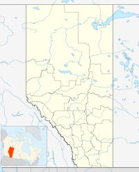
Notikewin is a hamlet in northern Alberta, Canada within the County of Northern Lights.[1]
It is located along the Mackenzie Highway (Highway 35), approximately 6 kilometres (3.7 mi) north of the Town of Manning.
The name derives from nôtinikewin, the Cree word for "battle".[2][3] The name is shared with the Notikewin River, and is lent to the Notikewin Member, a stratigraphical unit of the Western Canadian Sedimentary Basin.
Climate data for Notikewin Month Jan Feb Mar Apr May Jun Jul Aug Sep Oct Nov Dec Year Record high °C (°F) 10
(50)17
(63)14
(57)29.4
(84.9)32.2
(90.0)34.4
(93.9)34
(93)36
(97)33
(91)26
(79)31.5
(88.7)12
(54)36
(97)Average high °C (°F) −12.4
(9.7)−8.9
(16.0)−0.2
(31.6)10.2
(50.4)17.6
(63.7)21.4
(70.5)23
(73)21.7
(71.1)15.8
(60.4)8.6
(47.5)−4.1
(24.6)−9.8
(14.4)6.9 Daily mean °C (°F) −18.8
(−1.8)−16.3
(2.7)−7.7
(18.1)3
(37)9.8
(49.6)14.2
(57.6)15.9
(60.6)14.2
(57.6)8.6
(47.5)2.1
(35.8)−9.6
(14.7)−16
(3)−0.1 Average low °C (°F) −24.9
(−12.8)−23.5
(−10.3)−15.1
(4.8)−4.3
(24.3)1.9
(35.4)6.9
(44.4)8.8
(47.8)6.7
(44.1)1.2
(34.2)−4.4
(24.1)−15.1
(4.8)−22.1
(−7.8)−7 Record low °C (°F) −50.6
(−59.1)−47.8
(−54.0)−44.4
(−47.9)−30.6
(−23.1)−7.2
(19.0)−5
(23)0.5
(32.9)−3.9
(25.0)−18.9
(−2.0)−33
(−27)−40
(−40)−47.8
(−54.0)−50.6
(−59.1)Precipitation mm (inches) 23.9
(0.941)18.4
(0.724)16.2
(0.638)13.2
(0.52)36.5
(1.437)66
(2.6)71.3
(2.807)51.1
(2.012)35.7
(1.406)21.5
(0.846)20.7
(0.815)16.5
(0.65)390.9
(15.39)Source: Environment Canada[4] See also
- List of communities in Alberta
- List of hamlets in Alberta
References
- ^ Alberta Municipal Affairs (2010-04-01). "Specialized and Rural Municipalities and Their Communities". http://municipalaffairs.gov.ab.ca/documents/msb/2010-ruralmun.pdf. Retrieved 2010-07-03.
- ^ ePodunk. "Notikewin". http://ca.epodunk.com/profiles/alberta/notikewin/2004712.html. Retrieved 2010-03-17.
- ^ Cree dictionary. "nôtinikewin". http://www.creedictionary.com/search/index.php?q=n%C3%B4tinikewin&scope=1&cwr=45168. Retrieved 2010-03-17.
- ^ Environment Canada—[1]. Retrieved 6 April 2010.
 Subdivisions of Alberta
Subdivisions Regions · Census divisions · Municipal districts (counties) · Specialized municipalities · School districts · Regional health authoritiesCommunities Cities · Towns · Villages · Summer villages · Hamlets · Indian reserves · Métis settlements · Ghost towns · Designated placesCities and Urban
Service AreasAirdrie · Brooks · Calgary · Camrose · Cold Lake · Edmonton (capital) · Fort McMurray · Fort Saskatchewan · Grande Prairie · Lacombe · Leduc · Lethbridge · Lloydminster · Medicine Hat · Red Deer · Sherwood Park · Spruce Grove · St. Albert · Wetaskiwin Category ·
  Portal ·
  WikiProject
Coordinates: 56°58′29″N 117°37′30″W / 56.97472°N 117.625°W
Categories:- Hamlets in Alberta
- Northern Lights County, Alberta
- Northern Alberta geography stubs

Wikimedia Foundation. 2010.