- Spirit River Formation
-
Spirit River Formation
Stratigraphic range: middle Albian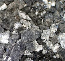
Falher graywake and shaleType Geological formation Unit of Fort St. John Group Sub-units Notikewin Member, Falher Member, Wilrich Member Underlies Peace River Formation Overlies Bluesky Formation Thickness up to 348 feet (110 m)[1] Lithology Primary sandstone, shale, siltstone Other coal, ironstone, greywacke Location Named for Spirit River Named by Badgley, 1952 Coordinates 55°46′30″N 118°54′22″W / 55.775°N 118.906°WCoordinates: 55°46′30″N 118°54′22″W / 55.775°N 118.906°W Region  Alberta,
  British Columbia
Country  Canada
The Spirit River Formation is a stratigraphical unit of middle Albian age in the Western Canadian Sedimentary Basin.
It takes the name from the Spirit River, and was first described in Imperial Oil Spirit River No. 1 well by Badgley in 1952.[2]
Contents
Lithology
The Spirit River Formation consists, from bottom to top of fine to medium grained argillaceous sandstone, dark shale, ironstone, greywacke, shale, siltstone, coal and dark shale with thin sandstone and siltstone stringers.[1]
Hydrocarbon production
Gas is produced from channels developed in the Falher Member in northern Alberta.
Distribution
The Spirit River Formation reaches a maximum thickness of 348 metres (1,140 ft). It is found in the sub-surface in the Peace River Country, in an area stretching from Fort St. John, British Columbia to the Lesser Slave Lake from west to east, and from Grande Prairie, Alberta to Manning, Alberta from south to north.
Relationship to other units
The Spirit River Formation is conformably overlain by the Peace River Formation and conformably underlain by the Bluesky Formation. It grades laterally to the Buckinghorse Formation shales to the north-east, and into the sandy facies of the Malcolm Creek Formation south of the Wapiti River. It is equivalent to the upper Mannville Formation in Central Alberta and to the Clearwater Formation and Grand Rapids Formation in the upper Athabaska River area.[1]
Subdivisions
The Spirit River Formation is composed of the following sub-divisions from base to top:
Sub-unit Lithology Max
ThicknessReference Notikewin Member fine to medium grained argillaceous sandstone, dark shale, ironstone 28 metres (90 ft) [3] Falher Member greywacke, shale, siltstone, coal 215 metres (710 ft) [4] Wilrich Member dark shales thin sandstone and siltstone stringers 154 metres (510 ft) [5] References
- ^ a b c Lexicon of Canadian Geologic Units. "Peace River Formation". http://cgkn1.cgkn.net/weblex/weblex_litho_detail_e.pl?00053:011614. Retrieved 2009-02-11.
- ^ Badgley, Peter C., 1952. Notes on the subsurface stratigraphy and oil and gas geology of the Lower Cretaceous series in central Alberta (Report and seven figures); Geological Survey of Canada, Paper No. 52-11, 12 p.
- ^ Lexicon of Canadian Geologic Units. "Notikewin Member". http://cgkn1.cgkn.net/weblex/weblex_litho_detail_e.pl?00053:011050. Retrieved 2009-02-11.
- ^ Lexicon of Canadian Geologic Units. "Falher Member". http://cgkn1.cgkn.net/weblex/weblex_litho_detail_e.pl?00053:004811. Retrieved 2009-02-11.
- ^ Lexicon of Canadian Geologic Units. "Wilrich Member". http://cgkn1.cgkn.net/weblex/weblex_litho_detail_e.pl?00053:016545. Retrieved 2009-02-11.
Western Canadian Sedimentary Basin Hydrocarbon history Depositional Regions Southern Alberta · Central Alberta · Northwestern Alberta Plains · South-central Canadian Rockies foothills · North-east Plains · North-central foothills · Liard River · Fort Nelson · Northern Rocky Mountains · Fort St. John · Saskatchewan · Western ManitobaNorthwest Plains Paskapoo FM · Scollard FM · Wapiti GRP · Smoky GRP (Puskwaskau FM · Badheart FM · Muskiki FM · Cardium FM · Kaskapau FM · Pouce Coupe MBR · Doe Creek MBR) · Dunvegan FM · Fort St. John GRP (Shaftesbury FM · Peace River FM · Spirit River FM) · Bullhead GRP (Bluesky FM · Gething FM · Cadomin FM) · Nikanassin FM · Fernie GRP (Rock Creek MBR · Poker Chip Shale · Nordegg MBR) · Schooler Creek GRP (Baldonnel FM · Charlie Lake FM · Halfway FM) · Doig FM · Montney FM · Belloy FM · Stoddart GRP (Taylor Flat FM · Kiskatinaw FM · Golata FM) · Rundle GRP (Debolt FM · Shunda FM · Pekisko FM) · Banff FM · Exshaw FM · Wabamun FM · Trout River FM · Kakisa FM · Redknife FM (Jean Marie MBR) · Woodbend GRP (Irteton FM · Fort Simpson FM · Leduc FM) · Beaverhill Lake GRP (Waterways FM · Swan Hills FM · Fort Vermilion FM) · Elk Point GRP (Watt Mountain FM · Gillwood MBR · Presqu’ile FM · Sulphur Point FM · Pine Point FM · Muskeg FM · Zama MBR · Black Shale · Keg River FM · Rainbow MBR · Chinchaga FM · Cold Lake FM · Ernestina FM · Basal Red Beds · Granite Wash) · Canadian ShieldCategories:- Stratigraphy of Alberta
- Stratigraphy of British Columbia
- Geologic formation stubs

Wikimedia Foundation. 2010.