- Nashua River Watershed
-
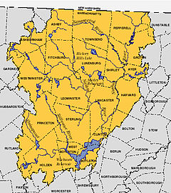 Massachusetts Nashua River Watershed
The Nashua River Watershed is a major Massachusetts watershed.
Contents
Description
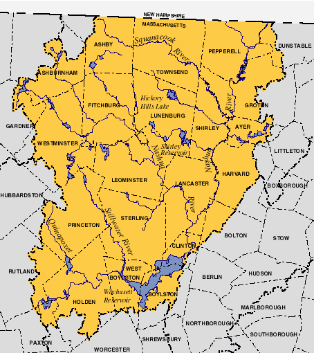
From its impoundment at the Wachusett Reservoir in Clinton, Massachusetts, the South Branch of the Nashua River flows north and joins the North Branch of the Nashua River in Lancaster, Massachusetts. The North Branch of the Nashua River flows southeast from Fitchburg and Leominster, Massachusetts to Lancaster. The Nashua river flows northward from Lancaster, meandering its way through the north-central Massachusetts towns of Harvard, Groton, Dunstable, and Pepperell, before eventually emptying into the Merrimack River at Nashua, New Hampshire. The Nashua River Watershed has a total drainage area of approximately 538 square miles (1393 km²), with 454 square miles (1176 km²) of the watershed occurring in Massachusetts and 74 square miles (192 km²) in New Hampshire. The Nashua River flows for approximately 56 miles (90 km), with approximately 46 of those miles (74 km) flowing through Massachusetts. The Squannacook, Nissitissit, Stillwater, Quinapoxet, North Nashua, and South Nashua Rivers feed it. The watershed encompasses all or part of thirty-one communities, seven in southern New Hampshire and twenty-four in central Massachusetts. The watershed’s largest water body is the Wachusett Reservoir, which provides drinking water to two-thirds of the Commonwealth's population[1].
Major watershed components
Because the Nashua River Watershed comprises so many elements, some criteria was necessary for selecting its major components. Certainly, there should not be an encyclopedia entry for every brook and stream. The criterion used was visibility, i.e., if an item is missing, its effect upon other items should be minimal.
Nashua River Watershed Component Link Wachusett Reservoir is the largest water body Wachusett Reservoir Stillwater River feeds Wachusett Reservoir Stillwater River Quinapoxet River feeds Wachusett Reservoir Quinapoxet River Wachusett Reservoir Dam impounds Nashua River Wachusett Dam North Branch of Nashua River joins main at Lancaster Nashua River The Squannacook River joins the Nashua River Squannacook River The Nissitissit River joins the Nashua River Nissitissit River Major river systems in the basin
Nashua River Basin River System Drainage Area Communities Stillwater River 39.3 mi² (101.79 km²) Princeton, Boylston, Sterling, and Westminster, Massachusetts Quinapoxet River 57 mi² (147.6 km²) Boylston, Worcester, Holden, Paxton, and Rutland, Massachusetts Nashua River 108 mi² (279.7 km²) Boylston, Clinton, Leominster, Fitchburg, Groton, Northborough, Dunstable, and Pepperell, Massachusetts plus Nashua, New Hampshire Squannacook River 73 mi² (189.1 km²) Greenville, New Ipswich, and Mason, New Hampshire plus West Groton and Townsend, Massachusetts Nissitissit River 23 mi² (59.57 km²) Brookline, Hollis, New Hampshire and Pepperell, Massachusetts See also
- Chicopee River Watershed
References
- ^ "Nashua River Watershed". http://www.mass.gov/envir/water/nashua/nashua.htm. Retrieved 2007-01-03.
External links
Categories:- Watersheds of Massachusetts
- Landforms of Middlesex County, Massachusetts
- Landforms of Worcester County, Massachusetts
Wikimedia Foundation. 2010.