Nissitissit River

Nissitissit River
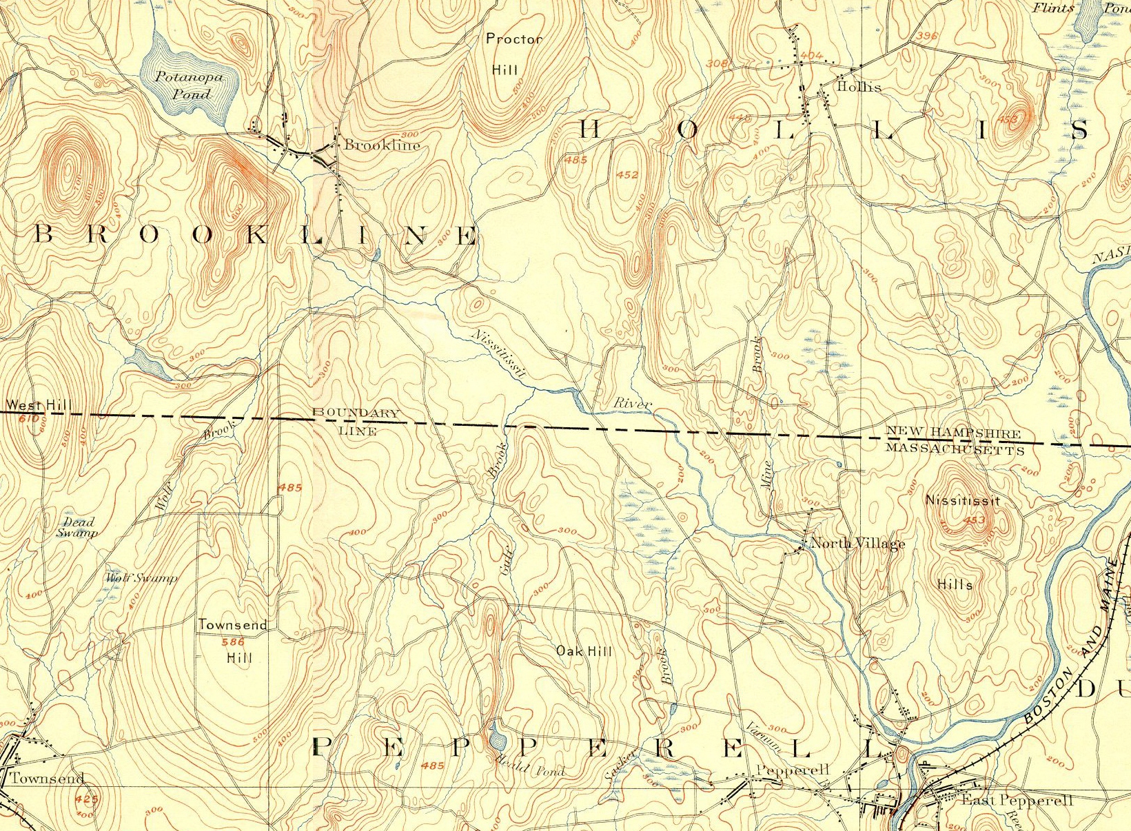
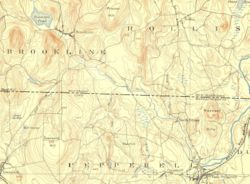
Nissitissit River and environs
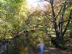
Nissitissit River in Pepperell, Massachusetts

The Nissitissit River is a 10.5-mile-long (16.9 km)[1] river located in southern New Hampshire and northern Massachusetts in the United States. It is a tributary of the Nashua River, itself a tributary of the Merrimack River, which flows to the Gulf of Maine. This river is part of the Nashua River Watershed.

The Nissitissit River begins at the outlet of Potanipo Pond in the town of Brookline, New Hampshire. It flows southeast at a very mild gradient, crossing the southwest corner of Hollis, New Hampshire before entering Massachusetts, where it joins the Nashua River in the town of Pepperell.

References

Coordinates: 42°40′20″N 71°33′53″W / 42.67222°N 71.56472°W / 42.67222; -71.56472


Wikimedia Foundation. 2010.

Игры ⚽ Поможем решить контрольную работу

Look at other dictionaries:

  • Nashua River Watershed — Massachusetts Nashua River Watershed The Nashua River Watershed is a major Massachusetts watershed. Contents 1 Description …   Wikipedia

  • Mystic River — For other uses, see Mystic River (disambiguation). Mystic River River …   Wikipedia

  • Neponset River — with Granite Avenue in background Basin countries United States Length 29 mi (47 …   Wikipedia

  • Nashua River Rail Trail — The Nashua River Rail Trail at the Groton School Pond in Groton, MA The Nashua River Rail Trail is a 12.5 mile (20.1 km) paved mixed use rail trail in northern Massachusetts and southern New Hampshire under control of the Massachusetts… …   Wikipedia

  • Charles River Reservation — Charles River Basin Historic District U.S. National Register of Historic Places U.S. Historic district …   Wikipedia

  • Mashpee River Reservation — is a park in Mashpee, Massachusetts on the Mashpee River. The Trustees of Reservations owns and maintains the park. Pristine shoreline, natural spawning areas, and excellent water quality make the Mashpee River one of Massachusetts finest sources …   Wikipedia

  • Connecticut River Greenway State Park — consists of a number of separate state land holdings in the Pioneer Valley of western Massachusetts. The park includes critical wildlife and plant habitat as well as areas providing public access to the Connecticut River. The Department of… …   Wikipedia

  • Charles River Peninsula — The Charles River Peninsula is a 30 acre (12 ha) nature preserve in Needham, Massachusetts owned and managed by the Trustees of Reservations. The Charles River turns nearly 180 degrees, creating the peninsula. A 20 acre (8 ha)… …   Wikipedia

  • Mystic River Reservation — The Mystic River Reservation is a publicly owned nature preserve located along the Mystic River in Massachusetts, United States. It forms part of the 75 square mile (190 km2) Mystic River Watershed, and runs through the towns of Arlington,… …   Wikipedia

  • Otter River State Forest — Coordinates: 42°37′27.24″N 72°4′39.39″W / 42.6242333°N 72.0776083°W / 42.6242333; 72.0776083 …   Wikipedia

Share the article and excerpts

Direct link
Do a right-click on the link above
and select “Copy Link”