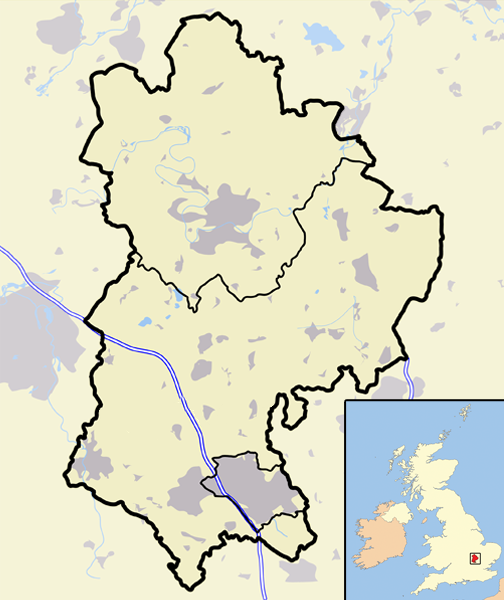
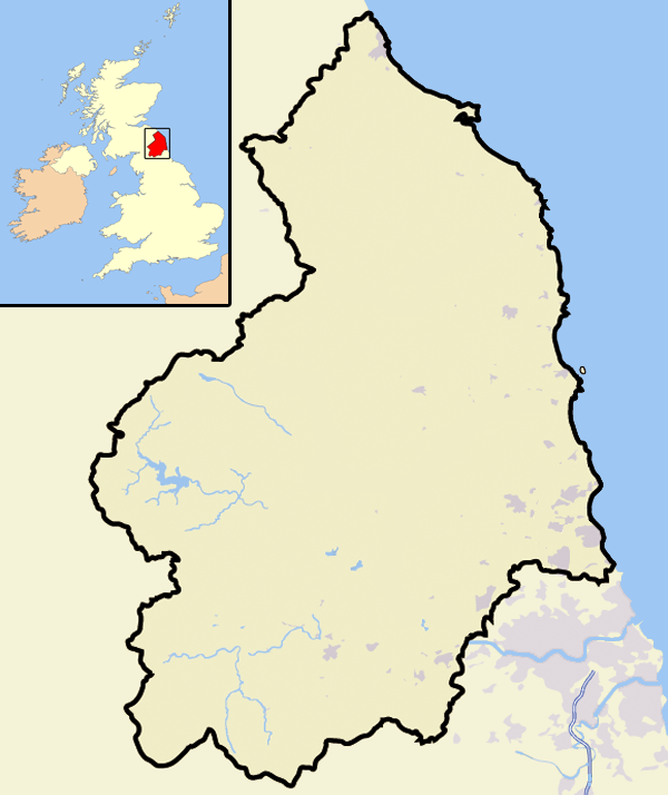
- North Cornwall
-
For the UK Parliament constituency, see North Cornwall (UK Parliament constituency).
North Cornwall District 
Geography Status District HQ Wadebridge ONS code 15UE History Origin *Borough of Bodmin
*Borough of Launceston
*Bude-Stratton Urban District
*Camelford Rural District
*Launceston Rural District
*Stratton Rural District
*Wadebridge and Padstow Rural DistrictCreated 1 April 1974 Abolished 31 March 2009 Succeeded by Cornwall Council unitary authority Demography 1973 population 58,689[1] 2001 population 80,529[2] Politics Governance District council 
Subdivisions Type Civil parishes 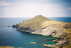
North Cornwall was the largest of the six local government districts of Cornwall, United Kingdom. Its council was based in Wadebridge 50°30′58″N 4°50′06″W / 50.516°N 4.835°WCoordinates: 50°30′58″N 4°50′06″W / 50.516°N 4.835°W. Other towns in the district included Bude, Bodmin, Launceston, Padstow, and Camelford. The district was formed on 1 April 1974 by a merger of the boroughs of Bodmin and Launceston, along with Bude-Stratton urban district and Camelford Rural District, Launceston Rural District, Stratton Rural District and Wadebridge and Padstow Rural District. However it was abolished as part of the 2009 structural changes to local government in England on 1 April (succeeded by Cornwall unitary authority).
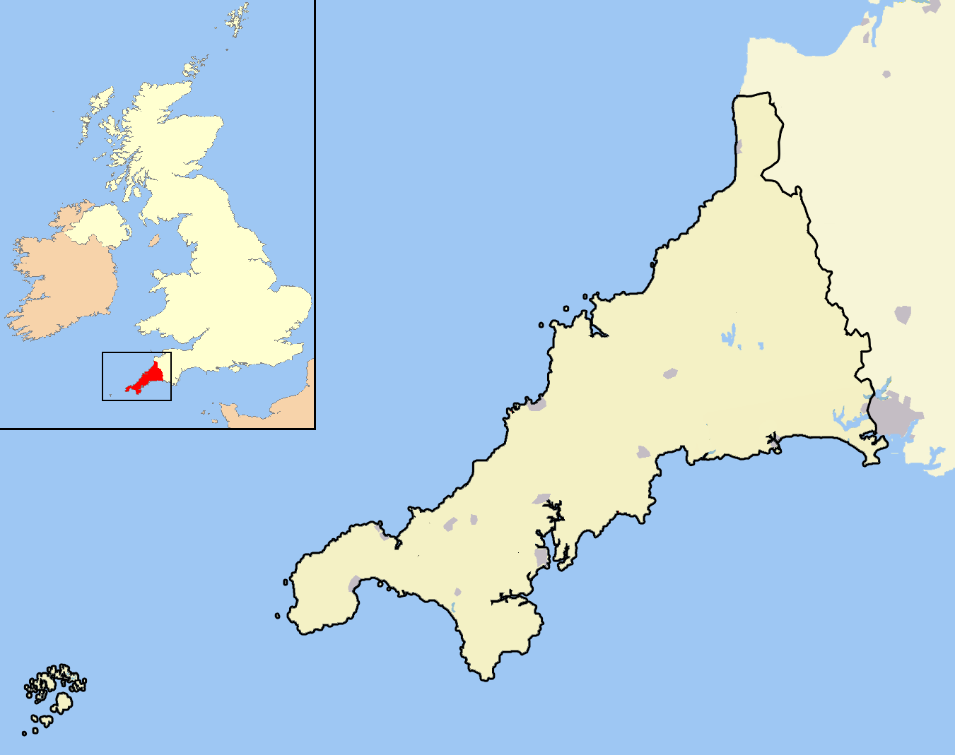
North Cornwall is an area of outstanding natural beauty that is of important geological and scientific interest. It includes the only part of Cornwall that is formed of carboniferous rocks, the northern area of North Cornwall District. The rest of the district lies on Devonian sedimentary strata and the granite of Bodmin Moor. A similar area is covered by the North Cornwall parliamentary constituency.
Contents
Parishes of North Cornwall
- Lewannick
- Lezant
- Marhamchurch
- Michaelstow
- Morwenstow
- North Hill
- North Petherwin
- North Tamerton
- Otterham
- Padstow
- Poundstock
- St Breock
- St Breward
- St Clether
- St Endellion
- St Ervan
- St Eval
- St Gennys
- St Issey
- St Juliot
- St Kew
- St Mabyn
- St Merryn
- St Minver Highlands
- St Minver Lowlands
- St Stephens by Launceston Rural
- St Teath
- St Thomas the Apostle Rural
- St Tudy
- South Petherwin
- Stoke Climsland
- Tintagel
- Tremaine
- Treneglos
- Tresmeer
- Trevalga
- Trewen
- Wadebridge
- Warbstow
- Week St Mary
- Werrington
- Whitstone
- Withiel
Geography
See also: Geography of Cornwall and Geology of Cornwall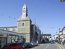 The Platt in Wadebridge looking at the Clock Tower
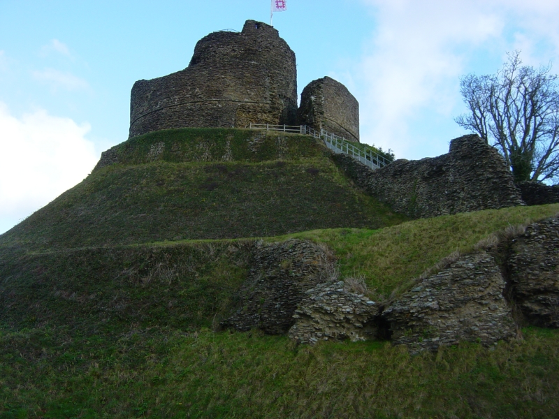
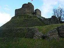 The motte at Launceston Castle
North Cornwall has a stretch of coastline that borders the Celtic Sea to the north. The Carboniferous sandstone cliffs that surround Bude (and stretch down as far south as Crackington Haven) were formed during the Carboniferous period, around 300 million years ago. They are part of what are known to geologists as the Culm Measures which continue eastwards across north Devon. The folded and contorted stratification of shale and sandstone is unique in southern England. During the Variscan Orogeny, which affected the entire Cornish coast, the cliffs were pushed up from underneath the sea, creating the overlapping strata. As the sands and cliffs around Bude contain calcium carbonate (a natural fertiliser), farmers used to take sand from the beach, for spreading on their fields. The cliffs around Bude are the only ones in Cornwall that are made of Carboniferous sandstone, as most of the Cornish coast is geologically formed of Devonian slate, granite and Precambrian metamorphic rocks). The stratified cliffs of Bude gave their name to a geological event called the Bude Formation.[3] Many formations can be viewed from the South West Coast Path which passes through the town.
The larger harbours are at Padstow and Bude and on the intervening coast Port Isaac, Port Gaverne, Port Quin, Port William, Tintagel, Bossiney and Boscastle have all been used either for fishing or the export of slate. There are good beaches at Polzeath, Trebarwith Strand and Bude. At Delabole the large Delabole Quarry has been works for many centuries and there were once in the parish of Tintagel many other slate quarries. Granite and elvan have also been important minerals: there are major granite quarries in the parish of St Breward and also some china clay works on the edges of Bodmin Moor e.g. at Stannon near Camelford.
Most of the lowland areas have good agricultural land used either for mixed or dairy farming. At Davidstow much of the milk is processed into Davidstow cheese.
See also
References
- ^ Local government in England and Wales: A Guide to the New System. London: HMSO. 1974. pp. 38. ISBN 0117508470.
- ^ "Census 2001: North Cornwall". Census 2001. Office for National Statistics. 2001-04-01. http://www.statistics.gov.uk/census2001/pop2001/north_cornwall.asp. Retrieved 2009-01-05.
- ^ Whalley, J. S.; Lloyd, G. E.. "Tectonics of the Bude Formation". http://jgs.geoscienceworld.org/cgi/content/abstract/143/1/83. Retrieved 2009-09-26.
- Jenkin, A. K. Hamilton (1970) Mines and Miners of Cornwall. XVI: Wadebridge, Camelford and Bude. Penzance: Federation of Old Cornwall Societies
- Maclean, Sir John (1872) The Parochial History of the Deanery of Trigg Minor. 3 vols. London: Nichols & Co., 1872–79
External links
- North Cornwall Guide and Directory
- North Cornwall Focus and Forum
- North Cornwall Town and Village Guide
- North Cornwall District Council
- Postcards of North East Cornwall
- Online Catalogue for North Cornwall District Council at the Cornwall Record Office
Civil Parishes of the former North Cornwall District  Advent • Altarnun • Blisland • Bodmin • Boyton • Bude-Stratton • Camelford • Cardinham • Davidstow • Egloshayle • Egloskerry • Forrabury and Minster • Helland • Jacobstow • Kilkhampton • Laneast • Lanhydrock • Lanivet • Launcells • Launceston • Lawhitton Rural • Lesnewth • Lewannick • Lezant • Marhamchurch • Michaelstow • Morwenstow • North Hill • North Petherwin • North Tamerton • Otterham • Padstow • Poundstock • South Petherwin • St Breock • St Breward • St Clether • St Endellion • St Ervan • St Eval • St Gennys • St Issey • St Juliot • St Kew • St Mabyn • St Merryn • St Minver Highlands • St Minver Lowlands • St Stephen by Launceston Rural • St Teath • St Thomas the Apostle Rural • St Tudy • Stoke Climsland • Tintagel • Tremaine • Treneglos • Tresmeer • Trevalga • Trewen • Wadebridge • Warbstow • Week St Mary • Werrington • Whitstone • Withiel
Geography of Cornwall Cornwall Portal Unitary authorities Major settlements Bodmin • Bude • Callington • Camborne • Camelford • Falmouth • Fowey • Hayle • Helston • Launceston • Liskeard • Looe • Lostwithiel • Marazion • Newlyn • Newquay • Padstow • Par • Penryn • Penzance • Porthleven • Redruth • Saltash • St Austell • St Blazey • St Columb Major • St Ives • St Just-in-Penwith • St Mawes • Stratton • Torpoint • Truro • Wadebridge
See also: Civil parishes in CornwallRivers Topics History • Status debate • Flag • Culture • Places • People • The Duchy • Diocese • Politics • Hundreds/shires • Places of interest • full list...Bedfordshire Abolished NewExisting (1990s)
Cheshire Abolished NewExisting (1990s)Warrington • Halton
Cornwall Abolished NewExisting (1890s)
County Durham Abolished NewExisting (1990s)
Northumberland Abolished NewExisting (1990s)None
Shropshire Abolished NewExisting (1990s)
Wiltshire Abolished NewWiltshireExisting (1990s)Categories:
- Local government districts in Cornwall
- English districts abolished in 2009
- Former non-metropolitan districts of Cornwall


Wikimedia Foundation. 2010.