- North Tamerton
-
Coordinates: 50°45′04″N 4°23′39″W / 50.75111°N 4.39430°W
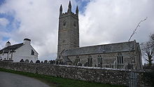 North Tamerton church
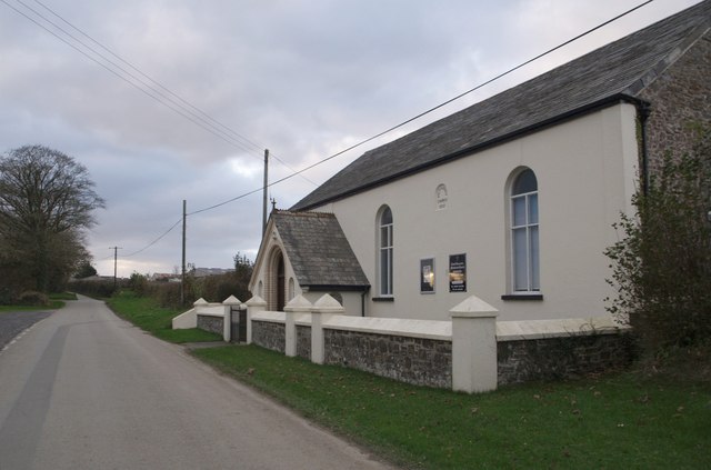
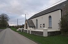 North Tamerton Methodist Church
North Tamerton (Cornish: Tre war Damer) is a civil parish and village in east Cornwall, United Kingdom. The village is situated approximately eight miles (13 km) southeast of Bude and eight miles (13 km) north of Launceston.[1]
North Tamerton is a thinly populated rural parish and is in the registration District of Stratton. It is bounded to the east by the River Tamar which delineates Cornwall's border with Devon but the border extends across the river making North Tamerton the only parish in Cornwall which extends east of the Tamar.[2] North Tamerton is the only village in the parish, the other settlements being farmsteads and hamlets
The name Tamerton derives from 'estate on the Tamar'. To the west, the parish is bounded by the Cornish parishes of Whitstone and Week St Mary and population at the 2001 census was 288[2].
The village of North Tamerton on high ground above the confluence of the River Tamar and its tributary the River Deer[1]. The 15th century church is dedicated to St Denis and is located at grid reference SX 311 973. The church has a chancel, nave, south aisle and a granite ashlar battlemented tower 70 feet (21 m) in height. The belfry houses a ring of five bells[2].
The Bude Canal ran through the parish and there was a canal wharf at North Tamerton. The canal was unusual in using six inclined planes instead of locks to climb from sea level to its maximum altitude of 433 feet (132 m): one of the six inclines was south of Tamerton wharf. (See also Bude Canal.)
References
External links
 Media related to North Tamerton at Wikimedia Commons
Geography of Cornwall Cornwall Portal Unitary authorities Major settlements Bodmin • Bude • Callington • Camborne • Camelford • Falmouth • Fowey • Hayle • Helston • Launceston • Liskeard • Looe • Lostwithiel • Marazion • Newlyn • Newquay • Padstow • Par • Penryn • Penzance • Porthleven • Redruth • Saltash • St Austell • St Blazey • St Columb Major • St Ives • St Just-in-Penwith • St Mawes • Stratton • Torpoint • Truro • Wadebridge
See also: Civil parishes in CornwallRivers Topics History • Status debate • Flag • Culture • Places • People • The Duchy • Diocese • Politics • Hundreds/shires • Places of interest • full list...Civil parishes of North Cornwall constituency  Advent • Altarnun • Blisland • Bodmin • Boyton • Bude–Stratton • Camelford • Cardinham • Davidstow • Egloshayle • Egloskerry • Forrabury and Minster • Helland • Jacobstow • Kilkhampton • Laneast • Lanhydrock • Lanivet • Launceston • Launcells • Lawhitton Rural • Lesnewth • Lewannick • Lezant • Marhamchurch • Michaelstow • Morwenstow • North Hill • North Petherwin • North Tamerton • Otterham • Padstow • Poundstock • South Petherwin • St Breock • St Breward • St Clether • St Endellion • St Ervan • St Eval • St Gennys • St Issey • St Juliot • St Kew • St Mabyn • St Merryn • St Minver Highlands • St Minver Lowlands • St Stephens by Launceston Rural • St Teath • St Thomas the Apostle Rural • St Tudy • Stoke Climsland • Tintagel • Tremaine • Treneglos • Tresmeer • Trevalga • Trewen • Wadebridge • Warbstow • Week St Mary • Werrington • Whitstone • Withiel
Cornwall Portal Categories:- Villages in Cornwall
- Civil parishes in Cornwall
- Cornwall geography stubs

Wikimedia Foundation. 2010.