- Forrabury and Minster
-
Coordinates: 50°41′02″N 4°41′31″W / 50.684°N 4.692°W
Forrabury and Minster is a civil parish on the north coast of Cornwall.[1] The parish was originally divided between the coastal parish of Forrabury and inland parish of Minster until they were united in 1779.
The parish is in the Registration District of Camelford. It is bounded to the north by the Atlantic; to the east by the parishes of St Juliot, Lesnewth and Davidstow; to the south by Camelford parish (ecclesiastical parish of Lanteglos by Camelford); and to the west by Trevalga parish. The population of Forrabury and Minster parish in the 2001 census was 888.
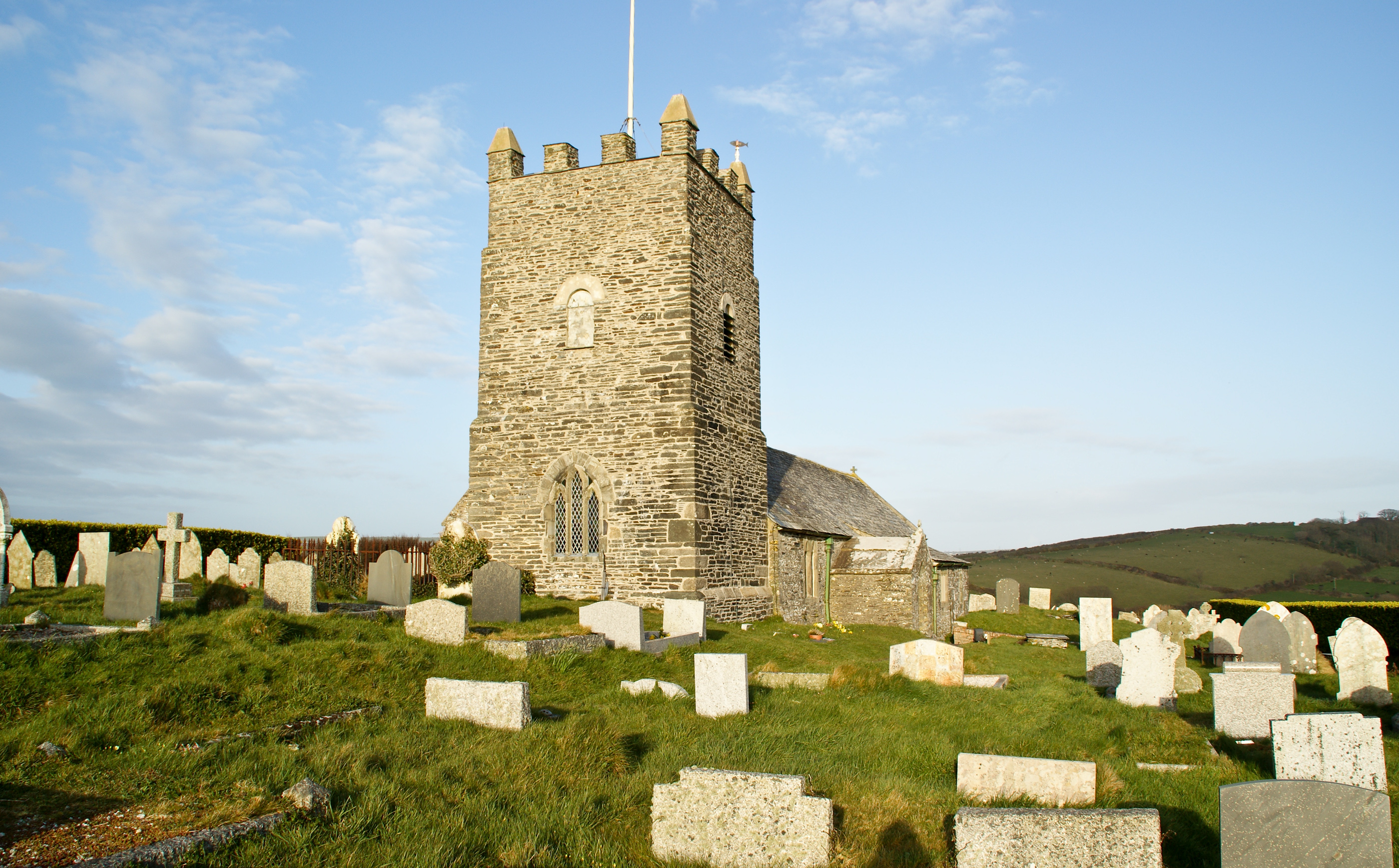
 Forrabury Parish Church
Contents
Settlements and churches
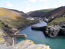 The harbour at Boscastle
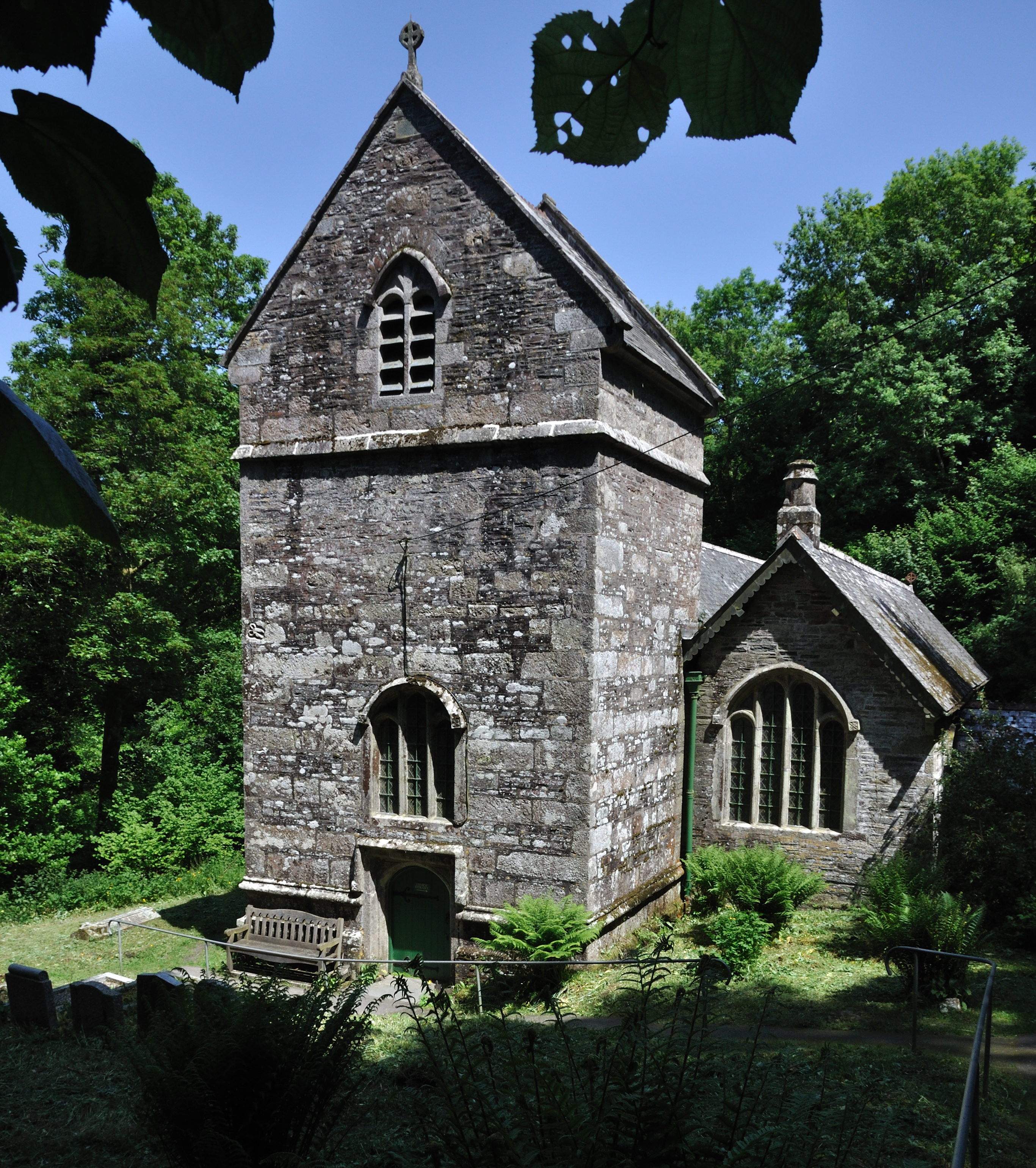
 Minster Church
Boscastle is the principal settlement in the parish of Forrabury and Minster. It is 14 miles (23 kilometres) south of Bude and 5 miles (8 kilometres) north-east of Tintagel. Forrabury parish church, dedicated to St Symphorian, is in Boscastle at grid reference SX 095 908.
However, the mother church of Boscastle is dedicated to St Materiana and nestles among the trees of Minster Wood in the valley of the River Valency half-a-mile east of Boscastle at grid reference SX 110 904. The original Forrabury / Minster boundary crossed the river so the harbour end of the village was in Forrabury and the upriver area in Minster. The churches were established some time earlier than the settlement at Boscastle (in Norman times when a castle was built there). The Celtic name of Minster was Talkarn but it was renamed Minster in Anglo-Saxon times because of a monastery on the site. Until the Reformation St Materiana's tomb was preserved in the church. (Another spelling of her name sometimes used is 'Mertheriana' but the usual Latin form is Materiana.) For many years the Anglican parishes of Forrabury and Minster have been in the charge of a Rector who is responsible for a group of adjoining parishes as well as these. Minster Church was damaged by the flood of August 2004 and in the following year archaeological work was done at the church to obtain a clearer idea of the history of the building.[2]
Notable buildings and antiquities
Minster church was built in Norman times (some late medieval additions and restoration work carried out in the 19th century): it is listed Grade I.[3] Forrabury church also has some Norman work but the tower was added in 1750. The Rev R. S. Hawker wrote a poem on "The Bells of Forrabury": it was based on a local legend arising from the absence of a peal of bells in the tower. At Welltown in Forrabury parish is a manor house dating from about 1640 and at Worthyvale and Redevallen in Minster parish are two manor houses also of the 17th century. Not far from Worthyvale is an inscribed stone (Latini [h]ic iacit filius Macari = Latin son of Macarus lies here). This stone is popularly known as King Arthur's Grave due to the erroneous identification of Slaughter Bridge with the site of Camlann. At Waterpit Down (on the road towards Launceston in Minster parish) are the remains of a cross probably from the 10th century.[4] Camelford railway station (now occupied by the British Cycling Museum) was built in 1893 and was closed in 1966. (Though named after nearby Camelford it was in Minster parish.)
Views in Forrabury and Minster
-

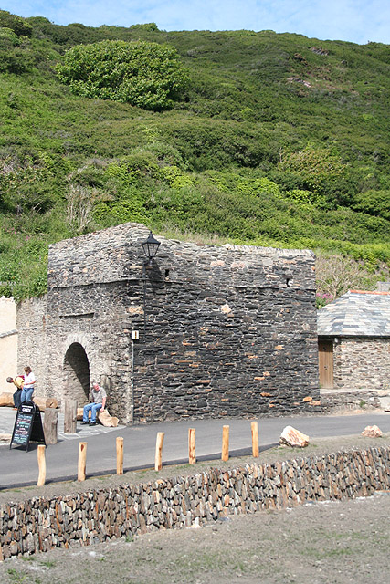
Forrabury and Minster: old lime kiln, Boscastle
-
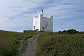
Forrabury and Minster: Coastwatch station, Willapark
-

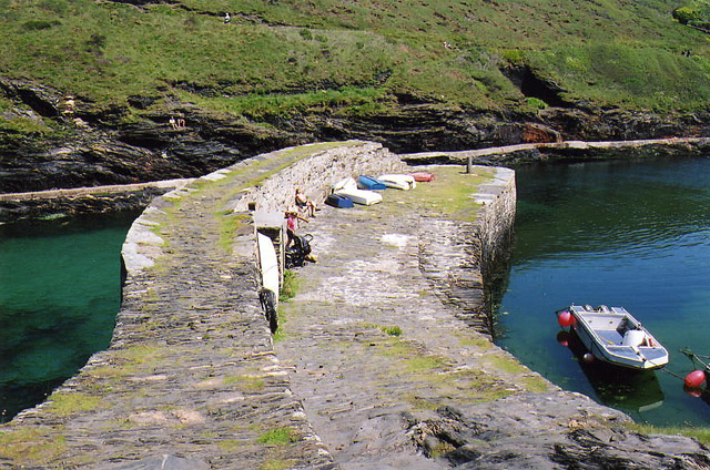
Forrabury and Minster: Boscastle pier
-

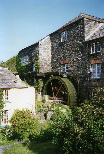
Forrabury and Minster: Boscastle Old Mill or Bridge Mill
References and bibliography
- ^ Ordnance Survey: Landranger map sheet 190 Bude & Clovelly ISBN 9780319231456
- ^ Allan, John (2008) After the Flood: building recording at Minster Church, Boscastle, in 2005, in: Cornish Archaeology; 43-44 (2004-05), pp. 145-158
- ^ "Minster Church". http://www.boscastlecornwall.org.uk/church_minster_info.htm. Retrieved 2009-03-19.
- ^ Pevsner, Nikolaus (1970) [1951]. Enid Radcliffe. ed. Cornwall (2nd ed.). Penguin Books. pp. 69 & 120. ISBN 0140710019.
- Armstrong, W. J. C. (1931) A rambler's guide to Boscastle; together with St Juliot, Lesnewth [and] Trevalga. 2nd ed. [Boscastle: the Author]
External links
Geography of Cornwall Unitary authorities Major settlements Bodmin • Bude • Callington • Camborne • Camelford • Falmouth • Fowey • Hayle • Helston • Launceston • Liskeard • Looe • Lostwithiel • Marazion • Newlyn • Newquay • Padstow • Par • Penryn • Penzance • Porthleven • Redruth • Saltash • St Austell • St Blazey • St Columb Major • St Ives • St Just-in-Penwith • St Mawes • Stratton • Torpoint • Truro • Wadebridge
See also: Civil parishes in CornwallRivers Topics History • Status debate • Flag • Culture • Places • People • The Duchy • Diocese • Politics • Hundreds/shires • Places of interest • full list...Civil parishes of North Cornwall constituency  Advent • Altarnun • Blisland • Bodmin • Boyton • Bude–Stratton • Camelford • Cardinham • Davidstow • Egloshayle • Egloskerry • Forrabury and Minster • Helland • Jacobstow • Kilkhampton • Laneast • Lanhydrock • Lanivet • Launceston • Launcells • Lawhitton Rural • Lesnewth • Lewannick • Lezant • Marhamchurch • Michaelstow • Morwenstow • North Hill • North Petherwin • North Tamerton • Otterham • Padstow • Poundstock • South Petherwin • St Breock • St Breward • St Clether • St Endellion • St Ervan • St Eval • St Gennys • St Issey • St Juliot • St Kew • St Mabyn • St Merryn • St Minver Highlands • St Minver Lowlands • St Stephens by Launceston Rural • St Teath • St Thomas the Apostle Rural • St Tudy • Stoke Climsland • Tintagel • Tremaine • Treneglos • Tresmeer • Trevalga • Trewen • Wadebridge • Warbstow • Week St Mary • Werrington • Whitstone • WithielCategories:
- Villages in Cornwall
- Civil parishes in Cornwall
-


Wikimedia Foundation. 2010.