- Bude
-
For other uses, see Bude (disambiguation).
Coordinates: 50°49′26″N 4°32′31″W / 50.824°N 4.542°W
Bude Cornish: Bud 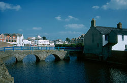
 Bude
Bude
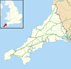
Bude shown within CornwallPopulation 9,242 (2001 Census[1]) OS grid reference SS215065 Parish Bude-Stratton Unitary authority Cornwall Ceremonial county Cornwall Region South West Country England Sovereign state United Kingdom Post town BUDE Postcode district EX23 Dialling code 01288 Police Devon and Cornwall Fire Cornwall Ambulance South Western EU Parliament South West England UK Parliament North Cornwall List of places: UK • England • Cornwall Bude (Cornish: Bud) is a small seaside resort town in North Cornwall, England, at the mouth of the River Neet (also known locally as the River Strat). It lies just south of Flexbury, north of Widemouth Bay and west of Stratton and is located along the A3073 road off the A39. Bude is twinned with Ergué-Gabéric in Brittany, France. Bude's coast faces the Atlantic Ocean.
Its earlier importance was as a harbour, and then a source of sea sand useful for improving the moorland soil. The Victorians favoured it as a watering place, and it was a popular seaside destination in the 20th century.
Notable buildings include the Perpendicular parish church (St Olaf's) in the village of Poughill just outside of Bude, the parish church of St Michael and All Angels (built in 1835 and enlarged in 1876) and the town's oldest house, Quay Cottage in the centre of town. Bude Castle was built about 1830 for Victorian inventor Sir Goldsworthy Gurney and is now a heritage centre.
Contents
Geography
It lies just south of Flexbury and north of Widemouth Bay and is located along the A3073 road off the A39 road. Many ships have been wrecked on the jagged reefs which fringe their base. The figurehead of one of these, the "Bencoolen" lost in 1862, is preserved in the churchyard.
Bude Coast SSSI (Site of Special Scientific Interest), located between Compass Cove to the south and Furzey Cove to the north, is noted for its geological and biological interest.[2] Carboniferous sandstone cliffs surround Bude. During the Variscan Orogeny the strata were heaily faulted and folded. As the sands and cliffs around Bude contain calcium carbonate (a natural fertiliser), farmers used to take sand from the beach, for spreading on their fields. The cliffs around Bude are the only ones in Cornwall that are made of Carboniferous sandstone, as most of the Cornish coast is formed of Devonian slate, granite and Precambrian metamorphic rocks).[2] The stratified cliffs of Bude give their name to a sequence of rocks called the Bude Formation. Many formations can be viewed from the South West Coast Path which passes through the town.
Climate
As with the rest of the British Isles and South West England, Bude experiences a maritime climate with cool summers and mild winters. Temperature extremes at the Met Office weather station at Bude range from −11.1 °C (12.0 °F) during February 1969[3] to 32.2 °C (90.0 °F) in July 1976[4]
Climate data for Bude 15m asl, 1971-2000, Extremes 1960- Month Jan Feb Mar Apr May Jun Jul Aug Sep Oct Nov Dec Year Record high °C (°F) 15.5
(59.9)16.7
(62.1)21.1
(70.0)25.3
(77.5)27.1
(80.8)32.2
(90.0)31.7
(89.1)31.6
(88.9)27.9
(82.2)24.0
(75.2)18.1
(64.6)17.2
(63.0)32.2
(90.0)Average high °C (°F) 9.0
(48.2)8.9
(48.0)10.2
(50.4)12.0
(53.6)15.1
(59.2)17.2
(63.0)19.3
(66.7)19.6
(67.3)17.7
(63.9)14.9
(58.8)11.8
(53.2)10.0
(50.0)13.8 Average low °C (°F) 3.6
(38.5)3.3
(37.9)4.4
(39.9)4.9
(40.8)7.6
(45.7)10.4
(50.7)12.6
(54.7)12.6
(54.7)10.4
(50.7)8.6
(47.5)6.0
(42.8)4.6
(40.3)7.5 Record low °C (°F) −10.6
(12.9)−11.1
(12.0)−7.8
(18.0)−3.8
(25.2)−1.7
(28.9)1.1
(34.0)4.2
(39.6)3.9
(39.0)1.4
(34.5)−2.5
(27.5)−5
(23)−8.9
(16.0)−10.6
(12.9)Precipitation mm (inches) 97.6
(3.843)76.4
(3.008)68.7
(2.705)55.0
(2.165)51.6
(2.031)57.2
(2.252)54.9
(2.161)70.6
(2.78)81.0
(3.189)98.2
(3.866)105.2
(4.142)106.2
(4.181)922.6
(36.323)Sunshine hours 56.4 76.8 115.0 175.8 213.3 181.8 196.2 191.6 152.7 107.6 70.5 48.7 1,586.4 Source no. 1: MetOffice[5] Source no. 2: Royal Dutch Meteorological Institute/KNMI[6] The town
Present-day Bude is a pleasant small town with character. It has two beaches with excellent broad sands close to the town itself, and is a good centre for adjacent beaches. Its sea front faces west and the Atlantic rollers make for good surfing when conditions are right. The main access road in and out of Bude is the Atlantic Highway (A39).
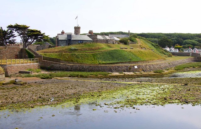
Notable buildings include the Perpendicular parish church (St Olaf's) in the village of Poughill just outside of Bude, the parish church of St Michael and All Angels (built in 1835 and enlarged in 1876; the architect was George Wightwick), Ebbingford Manor,[7] and the town's oldest house, Quay Cottage in the centre of town. Bude Castle was built about 1830 for Victorian inventor Sir Goldsworthy Gurney and is now a heritage centre.[8]
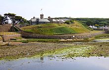 Bude Castle
Bude Canal, which once ran to Launceston, now runs only a few miles inland. Sadly, several historic wharf buildings were demolished in the 1980s but in May 2009 a £5 million scheme funded by Objective One, Heritage Lottery Fund and the South West of England Regional Development Agency to restore the historic canal itself was completed, making the waterway open to boats for several miles inland and also paying for the gentrification of the remaining harbourside area.[citation needed] Until the start of the twentieth century, the neighbouring town of Stratton was dominant, and a local saying is "Stratton was a market town when Bude was just a furzy down", meaning Stratton was long established when Bude was just gorse-covered downland. (A similar saying is current at Saltash about Plymouth.) The local senior school Budehaven Community College suffered a major fire in October 1999 destroying most of the older parts of the school. This meant the school was forced to close for several weeks until temporary classoms could be brought in. The damaged part of the school was rebuilt with interactive classrooms.[9]
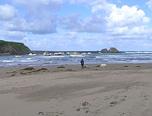
Beaches
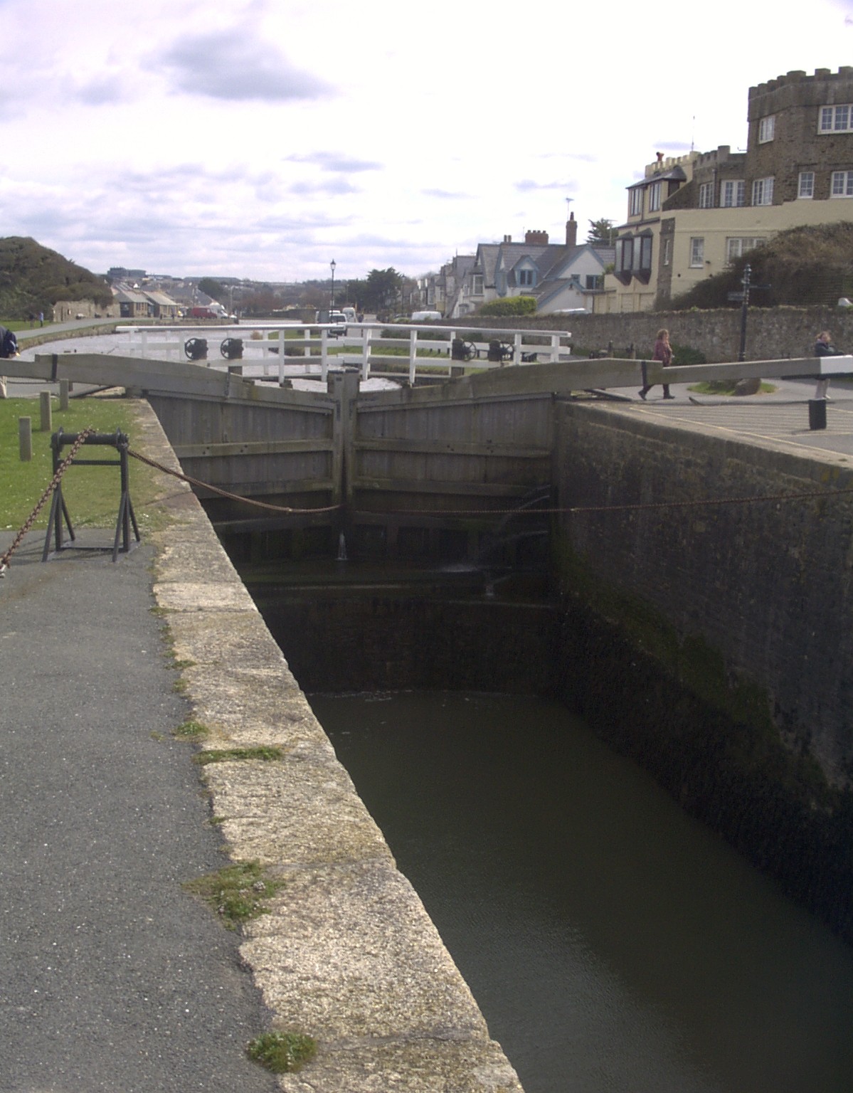
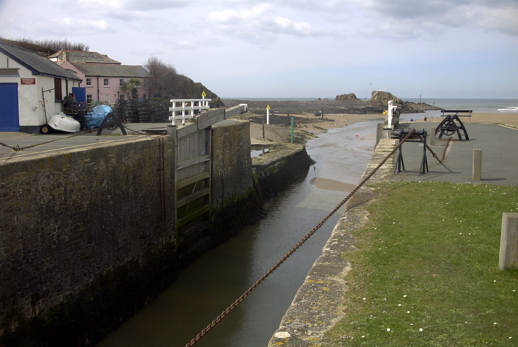
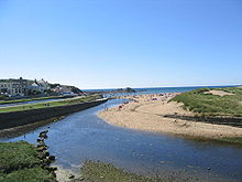 View of the beach in Bude and the canal coming to an end as it reaches the sea lock (on left of image)
 The sea lock on Bude Canal
 View looking towards the sea "Haven" from the sea lock
There are a number of good beaches in the Bude area, many of which offer good surfing conditions. Bude was the founder club in British Surf Life Saving.
- Summerleaze, Crooklets and 'middle' beaches are both within the town;
- Widemouth Bay is a few miles south of the town and offers a long, wide sandy beach;
- Sandymouth Beach is owned by the National Trust, and has spectacular cliffs and rock formations with shingle below the cliffs and a large expanse of sand at low tide. There are also a number of other coves and beaches to be found and explored in the local area.
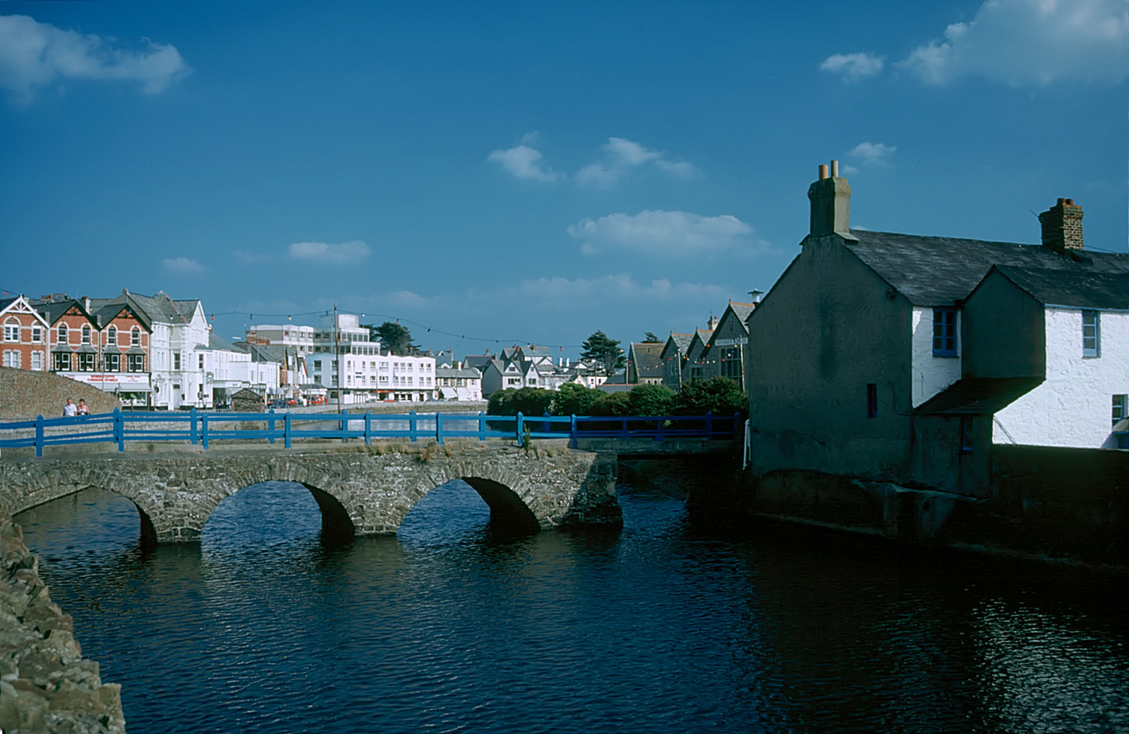
Bude Harbour and Canal
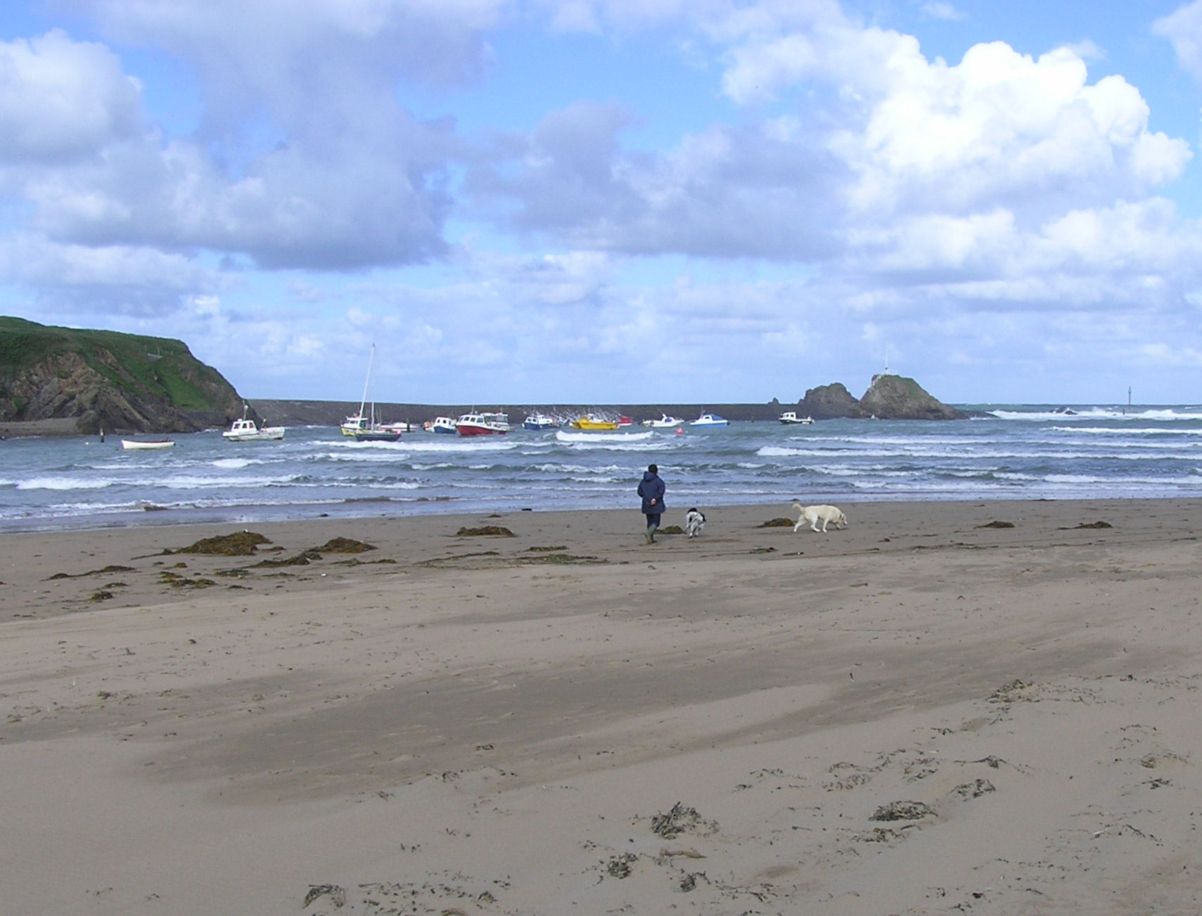
In the eighteenth century there was a small unprotected tidal harbour at Bude, but it was difficult whenever the sea was up. The Bude Canal Company built a canal and improved the harbour. Around twenty small boats use the tidal moorings of the original harbour during the summer months. Most are sport fishermen, but there is also some small-scale, semi-commercial, fishing for crab and lobster.
There is a wharf on the Bude Canal about half a mile from the sea lock that links the canal to the tidal haven. This can be opened only at or near high tide, and then only when sea conditions allow. North Cornwall District Council [1] administers the canal, harbour and lock gates. These gates were recently renewed, as the originals were damaged in a storm. They are the only manually-operated sea lock gates in England. The pier head by the locks is a Grade II listed structure.
The canal is one of the few of note in south-west England. Its original purpose was to take small tub boats of mineral-rich sand from the beaches at Bude and carry them inland for agricultural use on fields. A series of inclined planes carried the boats over 400 vertical feet to Red Post, where the canal branched south along the upper Tamar Valley towards Launceston, east to Holsworthy and north to the Tamar Lakes, that fed the canal. The enterprise was always in financial difficulty, but it carried considerable volumes of sand and also coal from south Wales. The arrival at Holsworthy of the railway, and the production of cheap manufactured fertiliser undermined the canal's commercial purpose, and it was closed down and sold to the district municipal water company. However the wharf area and harbour enjoyed a longer success, and coastal sailing ships carried grain across to Wales and coal back to Cornwall.
In 2005 a major project to re-develop the canal was approved. Work included improving the banks and opening-up a long-closed section of canal.[citation needed]
Victorian resort
 The Haven, the Atlantic Ocean and the beach at Bude
In the latter part of Queen Victoria's reign, the middle classes were discovering the attractions of sea bathing, and the romantic movement encouraged an appreciation of wild scenery and the Arthurian Legend. To serve this desire, a railway line was extended to Bude in 1898. This encouraged the holiday trade, but Bude never rivalled Newquay or the resorts in south Cornwall and Devon.
Railway
From 1879 Bude's nearest railway station was at Holsworthy, ten miles away. The railway came to Bude itself in 1898.[10] The line was built by the London and South Western Railway, but was incorporated into the Southern Railway in 1923 and British Railways in 1948.
Bude railway station was served by the Atlantic Coast Express, providing a direct service to/from London (Waterloo); the "ACE" was discontinued in 1964. Bude station and the entire Bude branch line closed on 1 October 1966 as part of the Beeching Axe.
Bude now finds itself rather distant from the rail network. Barnstaple (35 miles north east) and Bodmin Parkway (32 miles south) are the nearest National Rail stations. There is also a "rail link" coach service that runs from Exeter St Davids railway station to Bude Strand via Okehampton and Holsworthy.
Temple of the Winds
At the northernmost point of Efford Down Farm, overlooking Summerleaze Beach and the breakwater, a former coastguard lookout stands. Known as Compass Point and built by the Acland family in 1840 of local sandstone, it is based on the Temple of Winds in Athens. It was moved to its current position in 1880. It is so called as it has points of the compass carved in each of its octagonal sides.[11]
Industry
Tourism is the main industry in the Bude area whilst some fishing is carried on. In the past, the staple trade was the export of sand, which, being highly charged with carbonate of lime, was much used for manure. There are also golf links in the town. There is some local debate as to the origins of the golf course. It has been suggested the land the course occupies was given to the town for leisure use and that a few wealthy individuals took it to create a golf course excluding most of the townspeople from full enjoyment of the land.[citation needed]
Bude has an industrial estate which houses Bott Ltd, who manufacture racking and tool holding accessories and storage systems for vans and workshops. It was the home of Tripos Receptor Research, which produced prototypes of drugs for the pharmaceutical industry. However, the company ceased trading in 2008 as a result of the global economic downturn and the purpose-built building it once occupied is now empty.
Local government
Bude is in the North Cornwall parliamentary constituency. It developed from the much older market town of Stratton, 1 1/8 miles inland to the east. Since Cornwall became a unitary authority in 2009 there has been a two-tier structure of local government: Cornwall Council (administers, for example, schools and highways, housing, social services, canal and harbour, refuse and recycling collection, street cleanliness); and Bude-Stratton Town Council (local children's playground, Bude "castle"). There was some local argument when the town council adopted the name Bude-Stratton, as it was previously Stratton-Bude. Bude's population in 1901 was 2308; by 2001 it had risen to 4674.[12]
Notable residents
Pamela Colman Smith (1878—1951), artist, illustrator, and writer, best known for designing the Rider-Waite-Smith deck of divinatory tarot cards for Arthur Edward Waite, lived in Bude, and died here on 18 September 1951. American singer-songwriter Tori Amos has a home and studio here. Phil Vickery, World Cup winning England rugby player comes from Bude. Former World Squash Rackets Champion Jonah Barrington comes from Bude. Step-brothers George Mills (writer), the children's book author, and Arthur F. H. Mills, the crime and adventure novelist, were born in Bude, where their grandfather Arthur Mills (MP) lived nearby at the Efford Down House. Stanley Lucas was a supercentenarian who served as a Bude town councillor.
References
 This article incorporates text from a publication now in the public domain: Chisholm, Hugh, ed (1911). Encyclopædia Britannica (11th ed.). Cambridge University Press.
- ^ "Bude-Stratton CP (Parish) Information on Bude-Stratton CP (Parish)". National Statistics Online. http://neighbourhood.statistics.gov.uk/dissemination/LeadTableView.do?a=3&b=792820&c=Bude&d=16&e=15&g=430641&i=1001x1003x1004&o=1&m=0&enc=1&dsFamilyId=779. Retrieved 2007-10-05.
- ^ a b "Bude Coast". Natural England. 1987. http://www.sssi.naturalengland.org.uk/citation/citation_photo/1001539.pdf. Retrieved 26 October 2011.
- ^ "1969 temperature". KNMI. http://eca.knmi.nl/utils/monitordetail.php?seasonid=8&year=1969&indexid=TNn&stationid=1817.
- ^ "1976 temperature". KNMI. http://eca.knmi.nl/utils/monitordetail.php?seasonid=12&year=1976&indexid=TXx&stationid=1817.
- ^ "Bude Climate". UKMO. http://www.metoffice.gov.uk/climate/uk/averages/19712000/sites/bude.html. Retrieved 12 Nov 2011.
- ^ "Bude extremes". KNMI. http://eca.knmi.nl/utils/mapserver/anomaly.php?indexcat=**&indexid=TNn&year=1962&seasonid=18&create_image=true&minx=-1111428.5714287&miny=-4687142.8571429&maxx=621904.76190476&maxy=-3387142.8571428&MapSize=560%2C420&imagewidth=560&imageheight=420&mainmap.x=243&mainmap.y=372&CMD=QUERY_POINT&CMD=QUERY_POINT#bottom. Retrieved 12 Nov 2011.
- ^ Pevsner, N. (1970) Cornwall; 2nd ed. Penguin; pp. 47 (in the main the house is mid 18th century though there was a manor house here in the 14th century)
- ^ "Bude Castle". British Listed Buildings Online. http://www.britishlistedbuildings.co.uk/en-64739-the-castle-and-walls-to-the-north-west-an. Retrieved 8 May 2011.
- ^ http://www.bude-cornwall.co.uk/classof79/oldindex.htm
- ^ Wroe, D. J. (1988), The Bude Branch. Southampton: Kingfish Railway Productions, ISBN 0-946184-43-7
- ^ Efford Down Stables, Camping, and Business Park , Bude, Cornwall, UK
- ^ http://www.ncdc.gov.uk/media/adobe/ACF1C8D.pdf ncdc.gov.uk
External links
- Bude at the Open Directory Project
- Bude Tourist Information Website
- Cornwall Record Office Online Catalogue for Bude
- British Pathé News footage of Surf Guard training at Crooklets Beach in 1961
Geography of Cornwall Unitary authorities Major settlements Bodmin • Bude • Callington • Camborne • Camelford • Falmouth • Fowey • Hayle • Helston • Launceston • Liskeard • Looe • Lostwithiel • Marazion • Newlyn • Newquay • Padstow • Par • Penryn • Penzance • Porthleven • Redruth • Saltash • St Austell • St Blazey • St Columb Major • St Ives • St Just-in-Penwith • St Mawes • Stratton • Torpoint • Truro • Wadebridge
See also: Civil parishes in CornwallRivers Topics History • Status debate • Flag • Culture • Places • People • The Duchy • Diocese • Politics • Hundreds/shires • Places of interest • full list...Categories:- Seaside resorts in Cornwall
- Towns in Cornwall
- Surfing locations in Cornwall
- Populated coastal places in Cornwall
- Sites of Special Scientific Interest in Cornwall


Wikimedia Foundation. 2010.