- North Petherwin
-
Coordinates: 50°40′50″N 4°26′02″W / 50.6805°N 4.4339°W
North Petherwin Cornish: Paderwynn Gledh 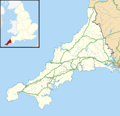
 North Petherwin
North Petherwin shown within CornwallPopulation 655 (Civil Parish, 1991) OS grid reference SX282896 Parish North Petherwin Unitary authority Cornwall Ceremonial county Cornwall Region South West Country England Sovereign state United Kingdom Post town LAUNCESTON Postcode district PL15 Dialling code 01566 Police Devon and Cornwall Fire Cornwall Ambulance South Western EU Parliament South West England UK Parliament North Cornwall List of places: UK • England • Cornwall North Petherwin (Cornish: Paderwynn Gledh) is a civil parish and village in east Cornwall, United Kingdom. The village is situated five miles (8 km) northwest of Launceston on a ridge above the River Ottery valley.[1]
North Petherwin is a rural parish which has transferred between Devon and Cornwall in the past. Historically, the Dukes of Bedford have been major land owners in the parish. As well as the church town, settlements include Hellescott, Brassacott, and Maxworthy.
The Tamar Otter and Wildlife Centre is North Petherwin's main tourist attraction. As well as having European and Asian Short Clawed otters it has a duck pond, a nature trail where owls can be seen, a restaurant area and a gift shop[2].
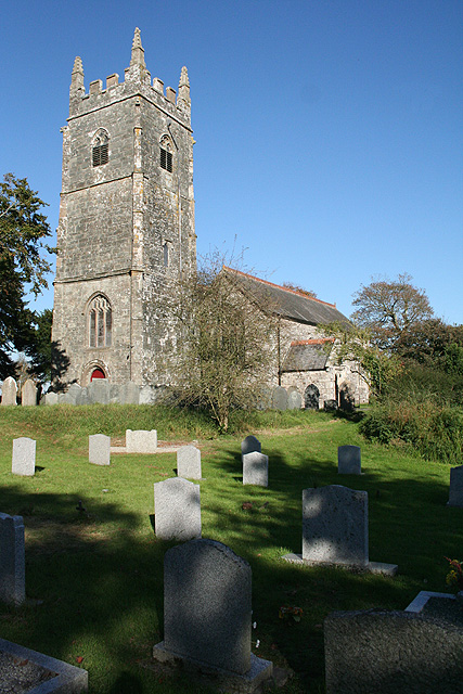
Parish church and school
 North Petherwin parish church
The parish church is dedicated to St Paternus (see also South Petherwin) and is unusually grand for a small village church. It was described in White's Devonshire Directory of 1850 as: ... an ancient structure, with a tower and five bells... (containing)... memorials of the Yeo and other families.[3] The north aisle is Norman and the south Perpendicular and many of the windows, including those of the clerestory, are 13th century in style. There is some old woodwork including a communion rail dated 1685.
The village has a school, North Petherwin Primary School,[4] dating back to 1878. The school is coeducational and has been expanded in recent years.
References
External links
Geography of Cornwall Unitary authorities Major settlements Bodmin • Bude • Callington • Camborne • Camelford • Falmouth • Fowey • Hayle • Helston • Launceston • Liskeard • Looe • Lostwithiel • Marazion • Newlyn • Newquay • Padstow • Par • Penryn • Penzance • Porthleven • Redruth • Saltash • St Austell • St Blazey • St Columb Major • St Ives • St Just-in-Penwith • St Mawes • Stratton • Torpoint • Truro • Wadebridge
See also: Civil parishes in CornwallRivers Topics History • Status debate • Flag • Culture • Places • People • The Duchy • Diocese • Politics • Hundreds/shires • Places of interest • full list...Civil parishes of North Cornwall constituency  Advent • Altarnun • Blisland • Bodmin • Boyton • Bude–Stratton • Camelford • Cardinham • Davidstow • Egloshayle • Egloskerry • Forrabury and Minster • Helland • Jacobstow • Kilkhampton • Laneast • Lanhydrock • Lanivet • Launceston • Launcells • Lawhitton Rural • Lesnewth • Lewannick • Lezant • Marhamchurch • Michaelstow • Morwenstow • North Hill • North Petherwin • North Tamerton • Otterham • Padstow • Poundstock • South Petherwin • St Breock • St Breward • St Clether • St Endellion • St Ervan • St Eval • St Gennys • St Issey • St Juliot • St Kew • St Mabyn • St Merryn • St Minver Highlands • St Minver Lowlands • St Stephens by Launceston Rural • St Teath • St Thomas the Apostle Rural • St Tudy • Stoke Climsland • Tintagel • Tremaine • Treneglos • Tresmeer • Trevalga • Trewen • Wadebridge • Warbstow • Week St Mary • Werrington • Whitstone • WithielCategories:
- Villages in Cornwall
- Civil parishes in Cornwall
- Holy wells

Wikimedia Foundation. 2010.