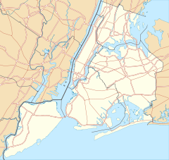
- Ditmas Park Historic District
-
Ditmas Park Historic District
Location: Bounded by Marlborough Rd., Dorchester, Ocean, and Newkirk Aves., New York, New York Coordinates: 40°38′19″N 73°57′40″W / 40.63861°N 73.96111°WCoordinates: 40°38′19″N 73°57′40″W / 40.63861°N 73.96111°W Area: 35 acres (14 ha) Built: 1902 Architectural style: Colonial, Queen Anne, Bungalow Governing body: Private NRHP Reference#: 83001688
[1]Added to NRHP: September 30, 1983 Ditmas Park Historic District is a national historic district in Ditmas Park, Brooklyn, New York, New York. It consists of 172 contributing, largely residential buildings built between 1902 and 1914. It includes fine examples of Colonial Revival, Bungalow/Craftsman, and Queen Anne style single family homes. Also in the district is one church, the brick Neo-Georgian Flatbush Congregational Church (1910).[2]
It was listed on the National Register of Historic Places in 1983.[1]
References
- ^ a b "National Register Information System". National Register of Historic Places. National Park Service. 2009-03-13. http://nrhp.focus.nps.gov/natreg/docs/All_Data.html.
- ^ Larry Gobrecht (August 1983). "National Register of Historic Places Registration:Ditmas Park Historic District". New York State Office of Parks, Recreation and Historic Preservation. http://www.oprhp.state.ny.us/hpimaging/hp_view.asp?GroupView=3235. Retrieved 2011-03-12. See also: "Accompanying 23 photos". http://www.oprhp.state.ny.us/hpimaging/hp_view.asp?GroupView=3234.
External links
Categories:- Historic districts in New York City
- Houses on the National Register of Historic Places in New York City
- Historic districts in New York
- Queen Anne architecture in New York
- Colonial Revival architecture in New York
- Kings County, New York Registered Historic Place stubs
Wikimedia Foundation. 2010.


