- Milford Haven
-
Coordinates: 51°42′51″N 5°02′34″W / 51.71418°N 5.04274°W
Milford Haven Welsh: Aberdaugleddau 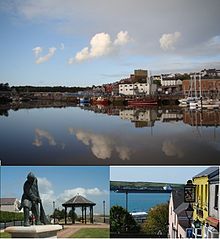
Clockwise from top: view of Milford Haven Docks from Hakin; view of Haven from town; the Tribute to Fishermen on The Rath.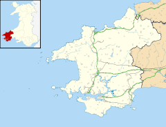
 Milford Haven
Milford Haven shown within PembrokeshirePopulation 13,096 OS grid reference SM899061 Principal area Pembrokeshire Ceremonial county Dyfed Country Wales Sovereign state United Kingdom Post town MILFORD HAVEN Postcode district SA73 Dialling code 01646 Police Dyfed-Powys Fire Mid and West Wales Ambulance Welsh EU Parliament Wales UK Parliament Preseli Pembrokeshire Welsh Assembly Preseli Pembrokeshire List of places: UK • Wales • Pembrokeshire Milford Haven (
 /ˈmɪlfəd ˈheɪvən/; Welsh: Aberdaugleddau, meaning "mouth of the two Rivers Cleddau") is a town and community in Pembrokeshire, Wales. It is situated on the north side of the Milford Haven Waterway, a natural harbour used as a port since the Middle Ages. The town was founded in 1790 on the north side of the Waterway, from which it takes its name. Designed to a grid pattern, it was originally intended by the founder, Sir William Hamilton, to be a whaling centre, though by 1797 it was developing as a Royal Navy dockyard which it remained until the dockyard was transferred to Pembroke in 1814. It then became a commercial dock, with the focus moving in the 1960s, after the construction of an oil refinery built by the Esso Company, to logistics for fuel oil and liquid gas. By 2010 the town's port has become the fourth largest in the United Kingdom in terms of tonnage,[1] and plays an important role in the United Kingdom's energy sector with several oil refineries and one of the biggest LNG terminals in the world.
Milford Haven is the second largest settlement in Pembrokeshire, with a population of 12,830;[2] while with 13,086 people its community boundaries make it the most populous in the county.[3] As a Welsh local government community, Milford Haven takes in the town of Milford Haven itself and some of the surrounding villages, including Hakin, Hubberston, Liddeston, and Steynton.[4]
The natural harbour of the Waterway was known as a safe port, and was exploited for several historical military operations throughout the second millennium. Campaigns conducted from the Haven included part of Henry II's Invasion of Ireland in 1171 and Cromwell's own attack on Ireland in 1649; while forces which have disembarked at the point include Jean II de Rieux's 1405 reinforcement of the Glyndŵr Rising and in 1485 Henry VII landed at the Milford Haven Waterway before marching on England.
Contents
History
Main article: History of Milford HavenThe town of Milford Haven was founded in 1793, after Sir William Hamilton obtained an Act of Parliament in 1790 to establish the port at Milford, and takes its name from the natural harbour of Milford Haven Waterway which was used for several hundred years as a staging point on sea journeys to Ireland, and as a shelter by Vikings. It was known as a safe port,[5] and is mentioned in Shakespeare's Cymbeline as "blessed Milford".[6] It was used as the base for several military operations, such as Henry II's Invasion of Ireland in 1171,[7] and Oliver Cromwell's own invasion of Ireland in 1649;[8] while forces which have disembarked at the point include Jean II de Rieux's 1405 reinforcement of the Glyndŵr Rising and Henry VII's 1485 landing at the waterway before marching on England. By the late 18th century the two local creeks were being used to load and unload goods,[9] and surrounding settlements were established, including the medieval chapel, and Summer Hill Farm, the only man-made structures on the future site of Milford.[10]
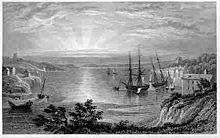 Engraving of Milford Haven in 1829 by Henry G. Gastineau
Sir William Hamilton, the town's founder, had acquired the land from his wife, Catherine Barlow of Slebech.[10] His nephew, the Hon. Charles Francis Greville, invited seven Quaker families from Nantucket and Martha's Vineyard to settle in the new town and develop a whaling fleet,[11][12] and then, in 1797, he persuaded the Navy Board to create a dockyard for building warships.[11][13] Seven royal vessels were eventually launched from the dockyard, including HMS Surprise and HMS Milford.[14] The town was built on a grid pattern, thought to have been to the design of Jean Louise Barrallier, who was in charge of building the harbour.[15][16]
A church was consecrated in October 1808 and dedicated to St Catherine of Alexandria in the underdeveloped eastern side of the town, it remained a chapel of ease until 1891 when Milford became a parish, until that time competing with St Peter and St Cewydd in Steynton.[10] By the turn of the century, a mail coach was operating between London and Hubberston,[17] and in 1800 the short lived Milford and Pembrokeshire Bank was established by Thomas Phillips, operating from a branch in the town. It collapsed in 1810.[18]
 View Of Milford Haven From Hakin - 1860 by Wenhart
In 1814 the Royal Dockyard was transferred to Pembroke Dock;[19] though, when Robert Fulke Greville inherited the estate in 1824, a commercial dock was started which became the home of a successful fishing industry.[20] By 1849, the district of Hakin was described as a considerable centre of boat building,[21] and by 1906, Milford had become the sixth largest fishing port in the UK, and its population rose. The Pembrokeshire Herald claimed in 1912 that "the fish trade is Milford's sole industry....the population of the town has doubled by means of it".[22]

In 1863, the railway network came to Milford, linking it to the Haverfordwest line and beyond. In 1866, work was completed on an additional extension which provided access to the docks and mining depot on the eastern side of the town.[23] Between 1875 and 1886 The Great Eastern was a permanent fixture at Milford Docks, remaining there for lengthy repairs.[24] Her arrival into the docks was heralded as an example of the scale of vessel which the town could expect to attract.[10]
In the late 1850s, work began on a network of forts on both sides of the Milford Haven estuary, as a direct result of the Royal Commission on the Defence of the United Kingdom. They were designed with the intention of defending the United Kingdom against French invasion, although were never used for this purpose. Notable examples in the town were Fort Hubberstone in Gelliswick and Scoveston Fort to the north east of the town.[25][26]
By 1901, the town's population had reached 5,102, and by 1931 had doubled to 10,104.[27] The early 20th century saw a period of increased urbanization of the area; in the period from the First World War to 1937, 312 council houses were built, and public services, such as electricity supplies and sewerage, were completed.[10] The steep gradient of the Rath was at this time constructed, and in 1939 a Town Hall was opened on Hamilton Terrace, at that time possessing an inbuilt fire station. 1939 also saw the opening of an outdoor swimming pool on the Rath.[10]
During the Second World War Milford Haven was chosen as a base for allied American troops, and roughly 1,000 American military personnel were housed in the town at this time. They manned an amphibious base which included a hospital built in Hakin and a docks complex at Newton Noyes. The base had a complement of 71 officers and 902 enlisted men, and played a role in preparations for D Day.[28] Despite its strategic importance as the home of a large fish market, a mines depot, a flax factory, and housing numerous military personnel, Milford escaped serious damage from German bombings during the Second World War. In the summer of 1941 a bomb fell in fields near Priory Road, and later that year, a bomb damaged a house in Brooke Avenue. In neither instance were there casualties.[29]
In 1960, the Esso Company completed work on an oil refinery near the town, which opened despite environmental objections.[30] This was followed by similar developments by many other chief oil companies in a 10 year period. In 1974, Milford could boast an oil trade of 58,554,000 tons, which was three times the combined trade of all the other ports of Wales. In 1996 the area hit the headlines internationally when the oil tanker Sea Empress ran aground, causing a substantial oil spill.[31] By the early 1980s, the Esso refinery was the second largest in the UK.[32]
Toponymy
Milford Haven is an Anglicization of an old Scandinavian name "Melrfjordr" that was first applied to the waterway - the Old Norse Melr, meaning sandbank, and fjordr, meaning inlet, developing into "Milford"; then later the term "Haven" from the Germanic word Haven for port or harbour was added.[33][34] The town was named Milford after the waterway, and, as with the waterway, Haven was added later - in this case around 1868, when the railway terminus was built.[35] The Welsh for Milford Haven, "Aberdaugleddau", refers to the estuary which is the meeting point of the "White River Cleddau" (Afon Cleddau Wen) and the "Black River Cleddau" (Afon Cleddau Ddu). The term "Aber" is associated with the 'pouring out' of a river, hence the description of the two rivers meeting and forming an estuary. Cleddau itself may make reference to the action of a weapon or tool cutting through the land.[34]
Geography
Milford Haven Climate chart (explanation) J F M A M J J A S O N D 1153990388741061512527156710175312209312191021017131814130511126510Average max. and min. temperatures in °C Precipitation totals in mm Source: The Met Office Imperial conversion J F M A M J J A S O N D 4.538473.537463.439492.44154245592.650632.154683.75466450635.246575.1425254149Average max. and min. temperatures in °F Precipitation totals in inches The town of Milford Haven lies on the north bank of the Milford Haven waterway, which is a ria or drowned valley.[36] This is a landscape of low-lying wooded shorelines, creeks and mudflats.[37] There has been a great deal of loss and degradation of local mudflat habitat as a result of industrial and commercial development - one study indicated a 45 per cent loss in Hubberston Pill.[38]
The town itself has a historic late 18th and 19th centuries core based on a grid pattern, located between Hubberston Pill and Castle Pill and extending inland for 500 metres (1,600 ft). Milford Haven's 20th century expansion took in several other settlements.[39] Hakin and Hubberston are older, and situated to the west of the main town. Steynton is a medieval village to the north, no longer separated due to the expansion of houses. Lower Priory, with the remains of a very early religious priory, is located in a natural valley near the village of Thornton.


A panoramic view of Milford Haven, as seen from the north west of the town near Havens Head. Milford to left, and Hakin to right of picture. Climate
Milford Haven enjoys a mild climate. Its proximity to the coast contributes to wet winters, but it enjoys a generous amount of sunshine with around 1,800 hours of sunshine a year being recorded for the nearby village of Dale.[40] This is comparable to the South Coast of England, and the highest annual average level of sunshine in Wales.
The nearest official MetOffice weather station is at Milford Haven Conservancy Board.
Climate data for Milford C.B. 37m asl, 1971-2000, Dale Fort (Sunshine/Rainfall), 1961-1990 Month Jan Feb Mar Apr May Jun Jul Aug Sep Oct Nov Dec Year Average high °C (°F) 8.3
(46.9)8.0
(46.4)9.4
(48.9)11.6
(52.9)14.5
(58.1)16.7
(62.1)18.9
(66.0)18.9
(66.0)16.8
(62.2)13.9
(57.0)11.0
(51.8)9.3
(48.7)13.11
(55.59)Average low °C (°F) 4.0
(39.2)3.5
(38.3)4.5
(40.1)5.4
(41.7)8.1
(46.6)10.6
(51.1)12.8
(55.0)13.0
(55.4)11.4
(52.5)9.3
(48.7)6.5
(43.7)5.0
(41.0)7.84
(46.12)Precipitation mm (inches) 86
(3.39)63
(2.48)66
(2.6)50
(1.97)46
(1.81)52
(2.05)44
(1.73)67
(2.64)71
(2.8)93
(3.66)95
(3.74)96
(3.78)829
(32.64)Sunshine hours 59.8 78.9 131.2 190.3 228.5 215.2 224.0 206.8 153.7 104.9 72.6 52.0 1,717.9 Source no. 1: YR.NO[41] Source no. 2: MetOffice[42] Governance
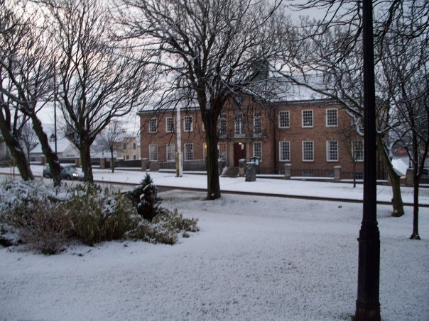
 View of Milford Haven town hall in winter
The community of Milford Haven covers an area of 1,573 hectares (6.07 sq mi)[43] and includes the Milford Central, East, Hakin, Hubberston, North and West wards.[44] The community has its own town council.[45] The Lord Mayor is Councillor Councilor David Friend and the Deputy Lord Mayor is Councillor G Woodham .[46] The six wards comprising Milford Haven community each elect one councillor to Pembrokeshire County Council.[47] Milford Haven was part of the historic county of Pembrokeshire, abolished in 1974,[48] which was reconstituted as a unitary authority when local government in Wales was reorganised in 1996. Between 1974 and 1996, Milford Haven was part of the Preseli Pembrokeshire district of Dyfed.[48] Milford Haven is part of the Preseli Pembrokeshire National Assembly for Wales constituency and UK Parliamentary constituency. The local Assembly Member is Paul Davies of the Conservative Party [49] and the local Member of Parliament is Stephen Crabb, also a Conservative.[50]
Economy
 Milford Haven Port Authority
Milford Haven has experienced a history of boom and slump in shipbuilding, fishing, as a railhead and an ocean terminal.[36] At the height of the fishing boom, it was said that "every day was a pay day".[51] In 1921, 674 people were identified as working in the fishing industry,[52] the leading occupation in the town, followed by transport and communication with 600 employees. The development of the oil industry also helped to boost the town's fortunes. However, the slumps have been just as severe, the area being scheduled as 'distressed' in the inter-war period.[53] During the 1980s and 1990s, the unemployment rate at times topped 30%, and the major industry of oil refining created no more than 2,000 direct or indirect jobs.[10] Into the new millennium, its fortunes have risen, as can be witnessed in the activity surrounding the LNG terminal, and the new building works which accompanied it and its connection to the controversial South Wales Gas Pipeline.[54] In February 2003, Pembrokeshire Council granted outline planning permission to Petroplus for an LNG storage depot at Waterston, and in March 2004, an additional site was approved at South Hook for ExxonMobil.[55] International tourism has also increased, with the arrival of transatlantic liners and the revenue they introduce to the town. The Port Authority is aiming to double the number of cruise ships it handles in the period to 2011.[56] The waterway transports 25% of Britain's requirement for motor fuel, and the port handled 53 million tonnes of shipping in 2008, making it the largest port in Wales, and the sixth largest in the UK.[57] There are two major commercial centres: Charles Street in the historic town centre, and the Havens Head Retail Park located at the foot of the docks area.[58]
Post-war Milford Haven was not considered a promising location for tourism: a 1964 study commissioned by the District Council highlighted the lack of nearby beaches, proximity of the town to heavy industrialization, and a shortage of tourist facilities such as restaurants and hotels.[10] However, in the 1980s, a series of steps to beautify certain parts of the town commenced. The outdoor swimming pool, which had remained disused for some years, was transformed into a watergarden and officially opened in 1990 by Margaret Thatcher. In 1991, the Tall Ships Race came to Milford,[59] and this coincided with an overhaul of the docks. Subsequently, it was rebranded as a marina, and a number of attractions including cafes, restaurants and retail outlets sprung up.[60] A Tourist Information Centre is located near the retail park[61] and the local museum, in the old custom house, focuses on the maritime history of the area.[62]
Demographics
Population growth in Milford Haven since 1841 Year 1841 1851 1861 1871 1881 1891 1901 1911 1921 1931 1951 1961 1971 2001 Population 2,377 2,837 3,007 2,836 3,812 4,070 5,102 6,399 7,772 10,104 11,710 12,802 13,760 13,096 Source: Vision of Britain[27] & Field Studies Journal[22] By the 1950s, the fishing industry was in decline, and unemployment in the area had reached 11%. There had been a housing boom however in the years following Second World War. The District Council took advantage of recently lifted restrictions, and built over 1,000 new homes to accommodate the rising population.[10] A new wave of hope however arrived with the prospect of a booming oil industry. The industry however was not labour intensive, and did not provide huge labour opportunities for locals, in the 1970s employing only 2,000 workers."[63] The nature of large construction projects meant that workers were attracted from outside the local area, and the decline of the fishing industry was to a certain extent masked. However, this employment was not permanent. On completing the construction of construction projects such as the Esso refinery and the Cleddau Bridge, those who decided to relocate to the town were faced with what the Preseli District Council called in 1977 "the area's serious unemployment problem".[10]
Milford Haven is not ethnically diverse, with 99.2% of people identifying themselves as white.[64]
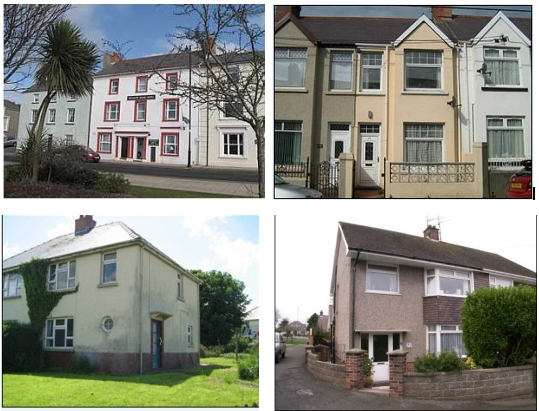
 Architecture in Milford Haven, 1: Georgian town house, 2: Terrace house from 19th century, 3: Council house from 1930s, 4: Private house built 1960s
Welsh language
Milford Haven is located within the geographical and historic area known as Little England Beyond Wales, which has predominately used English for many centuries.[65] Although it is the most westerly point of the country and the part of the county furthest from the English border, a relatively small proportion of the community knows the Welsh language. In the 2001 census, of the 1,872 residents polled in the Milford Central ward, only 7% (140) claimed that they can speak, read and write the language,[66] in contrast to the Pembrokeshire county as a whole where roughly 18% of the population are able to read, write and speak Welsh, while in the neighbouring county of Carmarthenshire around 40% of people express a similar level of fluency in Welsh.[67] Local disconnection from the Welsh language was highlighted in November 2008, when Milford Haven Town Council unsuccessfully demanded the right to opt out of a scheme in which official documents had to be translated into Welsh if requested; the council was allegedly one of about 10 that opposed having to make such translations.[68]
Architecture
Architecture in Milford Haven can be divided into roughly three broad periods of building. The number of buildings which pre-date the town's official foundation in 1790 are scarce. These include the Medieval priory,[69] and a 12th century 'beacon chapel'.[70]
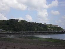 Fort Hubberstone, named as one of the most endangered buildings in the UK
The initial phase of construction from the late 18th century is located in the area central to the town, the three parallel streets of Hamilton Terrace, Charles Street And Robert Street.[10] Three-storey Georgian domestic and commercial properties are set along the northern side of the main road through the town, and overlook the harbour and waterway.[69]
By the late 19th century, the land directly above this central area was being developed. To house the growing population, rows of terrace houses were built, which slowly encompassed the area north up to Marble Hall Road, and east to Pill, examples including Shakespeare Avenue and Starbuck Road.[10] The Great North Road took a northerly route which sliced this new district in two. By the turn of the 20th century, there was a recognized need to provide accommodation to poorer families. As a result, much former agricultural land was bought, and new Council Housing was built.[69] These were frequently in large estates of houses, such as Howarth Close, Haven Drive and The Glebelands Estate. They transformed previously rural areas into an urban landscape, and considerably increased Milford's density. Council estates were built throughout the 20th century, one of the most recent and largest examples being The Mount Estate, which has been the scene of a number of anti-social incidents.[71][72]
Landmarks
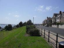 The Rath, with view of the Haven estuary
Attractions in the town include Fort Hubberstone, built in 1863 to defend the Haven as part of the recommendations of the Royal Commission on the Defence of the United Kingdom. Located in Gelliswick bay, it occupies a prominent position to the west of the town overlooking the Haven. Owned by Milford Haven Port Authority, the site is not currently open to the public, and has been the scene of non-fatal injuries to trespassers.[73] In 2011 it was named as the fifth most endangered archaeological site in the UK by British Archaeology Magazine.[74][75] The ruins of an observatory, originally intended to be part of "The College of King George the Third founded at Milford", can be found in Hakin. Construction of the building was abandoned in 1809. The town museum, located centrally in the docks area, is housed in the town's oldest building, the Custom House which dates back to 1797. Designed by Swansea architect, Jernigan, it was built for the storage of whale oil awaiting shipment for sale in London.[76]
The Rath is a landscaped street on high ground, with panoramic views of the Haven. The land was used in the 18th century as a gun battery, and its eastern edge was the site of the Royalist fort constructed by Charles I. In the 1930s it became the home of an outdoor swimming pool, which was converted into a water gardens in 1990. Milford Haven Waterway is the natural harbour on which the town stands and from which the town takes its name.
Culture and community
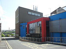 Torch Theatre
The Torch Theatre, opened in 1977 and designed by local architect Monty Minter, is one of only three repertory theatres in Wales, and possesses its own independent theatre company.[77] Annual events in the town include the Pembrokeshire Fish Week in June,[78] and the carnival in July.[79] Milford Haven library, recently relocated to Havens Head Retail Park offers a full lending service and internet access.[80] Milford Haven museum, located in the marina, houses a collection which focusses on the maritime history of the town.[81]
The Milford & West Wales Mercury weekly newspaper covers the Milford Haven and West Pembrokeshire area. It was founded in 1992 and following a merger of its editorial team with that of the Western Telegraph, its local office was closed in 2008.[82] The town is also home to several charities, including PATH and Gwalia.
Milford Haven is twinned with Romilly-sur-Seine, France and Uman, Ukraine.[83]
Sport and leisure
The town possesses a number of venues for sports and leisure. Milford Haven Leisure Centre offers facilities for a variety of sporting activities, including a 25 metre indoor swimming pool, squash and tennis courts, a bowls hall and dance studio.[84] The Thornton Hall, located at Milford Haven School, comprises an indoor sports hall and artificial turf pitch. Local rugby union and association football clubs are found in the town, and nautical activities centre around the marina and Pembrokeshire Yacht Club, which is located in Gelliswick and dates back to 1923.[85] There is a golf club on the outskirts of the town, which was founded in 1913[86]
Milford Marina, the site of the former working docks, was rebranded in 1991 and offers retail facilities, the town museum and entertainment. The Marina itself houses 360 berths for private boats.[87]
Education
Primary and pre school education in Milford Haven is served by six state infant and primary schools and St Francis, a Roman Catholic primary school. Milford Haven town is served by junior, Infant, and nursery schools. Hakin pupils can attend Hakin Junior School, Hakin Infants and Nursery, and the voluntarily controlled Hubberston Church in Wales VC Nursery and Primary.[88] Secondary education is provided by Milford Haven School, a large comprehensive school with an enrollment of around 1200 pupils including the 6th form.[89]
The MITEC School of Boatbuilding & Marine Engineering, a branch of Pembrokeshire College located in Milford Docks, offers courses in boatbuilding and marine engineering.[90]
Places of worship
 Priory Road Methodist Church, opened 1902
Milford Haven identifies itself as almost exclusively Christian.[91] The earliest known religious building in the area was the Benedictine priory which was dissolved during Henry VIII's reign. Other early buildings included the Catholic St. Thomas a Becket chapel, a later 'beacon church', built around the 12th century which fell into disrepair but was reconsecrated in the 20th century.
The first religious building raised after Milford Haven was founded was St. Katharine and St. Peter, an Anglican church, it is considered to be the town's parish church due to its central position within the town and the fact that it was built by Charles Francis Greville the founder of Milford Haven.[92] Other Anglican buildings include St. David's in Hubberston, St. Mary's (1927) and the Church of the Holy Spirit (1971) in Hakin and St. Peter and St. Cewydd in Steynton. St. David's is a Norman church and is believed to be the oldest building in Milford to be in regular use.[92] St. Mary's was built in 1927 largely by funds from the local residents of Hakin.[92]
In 2000, the church of St. Claires in Hakin closed, leaving one Roman Catholic church in Milford Haven, St. Francis of Assisi on Priory Road. Baptists congregate at North Road Baptist Church which is one of the older religious buildings of the community, built in 1878.[92] Near the waterfront in Milford Haven is the Quakers Friends Meeting House, built in 1811 by the original Quaker whalers who were central to the early growth of the town. Quakers travel from distances around Pembroke to worship at the Friends House.[92] Members of United Reformed Church worship at Priory Road Methodist Church (1902), Hakin Point, and the URC Tabernacle.
Transport
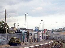 View of Milford Haven Railway Station
The main road to the town is the A4076 from Haverfordwest, which connects with the A40.[93] The town centre's road system is based on a grid pattern. The route to Hakin and the western side of the town is along the A4076 via Victoria Bridge over the docks.[94]
Bus routes passing through the town are operated by independent companies and Pembrokeshire County Council subsidies. Services include a town circular, Haverfordwest, Pembroke Dock and St Davids.[95] National Express operate services to both London and Birmingham via Steynton.[95]
The first links to a railway to Milford Haven came through the completion of the South Wales Railway in 1856. Brunel had a vision of connecting London to New York via a railway through Wales and then to a commuter port. The initial plan was to terminate the line at Fishguard and to create a ferry service to Ireland, but after a failure to complete Irish rail links the terminus was changed to New Milford, (Neyland), which was completed in April 1856. The first rail link direct to Milford Haven was completed in 1863, which was originally conceived as a plan to create an impressive Milford to Manchester railway.[3] The trains using the line were operated by Great Western Railway who had part funded the original railway.[96] Today the town in served by Milford Haven railway station. The station, and all trains serving it, are operated by Arriva Trains Wales on the West Wales Line. It is the terminus, and from here, trains depart every two hours to Manchester Piccadilly via Carmarthen, Swansea, and Cardiff Central.
Notable people
- See Category:People from Milford Haven
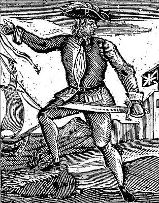
 Howell Davies - Pirate.
One of the earliest notable figures from the Milford Haven area is Howell Davis, a pirate born in 1680. He was shot dead in 1719 on the Portuguese island of Príncipe.[97] Other famous residents connected as seafarers include Isaac Davis, a former seaman who was engaged in the fur trade between the Pacific Northwest and China. He became an advisor to Kamehameha I, and helped form the Kingdom of Hawaii.[98] Milford Haven has produced, or attracted, several notable artists including Arthur Symons, poet, critic, and an art editor of The Savoy magazine, who was born in the town in 1865,[99] and Charles Norris, topographical artist, and author of A Historical Account of Tenby, who lived in Milford Haven from 1800 to 1810.[100]
Performing artists from Milford Haven include Helen Watts, a contralto who studied at the Royal Academy of Music and awarded the CBE in 1978.[101] From the acting world, George Winter, who appeared in the films Scum, All Quiet on the Western Front, and TV dramas Knights of God and Merlin Of the Crystal Cave was also born in the town.[102] More recent artists include Sarah Waters, author of Tipping the Velvet, Affinity and Fingersmith who although born in Neyland, attended MIlford Haven Grammar School.[103] Tailor and fashion designer Timothy Everest began his professional career working as a sales assistant at a branch of Hepworths in the town.[104] Sporting figures include Robert Hughes, who in 2005 won the Wales National Darts Championship.[105]
Milford Haven is also connected to notable military figures, such as Charles George Gordon, a British Army officer and administrator, remembered for his campaigns in China and northern Africa. During a two-year stay in Pembroke, he prepared plans for fortifications of Milford Haven.[106] Of those born in the town, Hubert William Lewis was awarded the Victoria Cross for acts of bravery during the First World War.[107] W.G. "Gugs" Gwilliam was awarded the Conspicuous Gallantry Medal for acts of bravery whilst serving on board the HMS Exeter during the Battle of the River Plate.[108] Other residents include Robert Fulke Greville and his uncle Charles Francis Greville, who improved and expanded Milford Haven as a more commercial and modern settlement; and John Zephaniah Holwell, a surgeon employed by the English East India Company, and survivor of the Black Hole of Calcutta, who owned "Castle Hall" in the 1770s.[109]
Milford Haven is also the birthplace of serial killer John Cooper, who in 2011 was convicted of murdering siblings Richard and Helen Thomas at their Scoveston home near Steynton in 1985, and Peter and Gwenda Dixon on the Pembrokeshire Coast Path near Little Haven in 1989.[110][111] He was additionally convicted of the rape of a teenager and assault of four others in woodland near the town's Mount Estate in 1996.[112]
Notes
- ^ One Wales: Connecting the Nation - The Wales Transport Strategy Welsh Assembly Government, April 2008, page 29 Retrieved 17 January 2010
- ^ KS01 Usual Resident Population: Census 2001 'Key Statistics for Urban Areas', Office For National Statistics D8271.xls (PDF) line 2540 Retrieved 17 January 2010
- ^ a b Davies (2008) p 556. 2001 population statistic confirmed at www.neighbourhood.statistics.gov.uk. Milford: Hakin (Ward) (2309), Milford Hubberston (2390), Milford: North (Ward) (2291), Milford: Central (Ward) (1874), Milford: East (Ward) (2032), Milford: West (Ward) (2190). Due to different methods of reporting, a population total of 13,096 is cited by Pembrokeshire County Council
- ^ Milford Haven urban areas nomisweb.co.uk
- ^ Owen, George. The Description of Pembrokeshire, Gomer Press, 1994. ISBN 9781859021200
- ^ Shakespeare, William; Cymbeline Act 3, Scene 4 The Tech at Massachusetts Institute of Technology
- ^ Brennan, Joseph J, A Catechism of the History of Ireland: Ancient, Medieval, and Modern (1878), Kessinger Publishing, 2008. ISBN 1-4367-1986-0
- ^ 4 August 1649 Timeline: British Civil wars Retrieved 19 January 2010
- ^ George, Barbara J; Pembrokeshire Sea Trading Before 1900 Field Studies Journal; Pg, 5-6; Retrieved 19 January 2010
- ^ a b c d e f g h i j k l Wing Commander Ken McKay A Vision Of Greatness: The History of Milford 1790-1990, Brace Harvatt Associates, 1989. ISBN 9780951521205
- ^ a b BBC South West Wales website 'A Brief History of Milford', Jon Gower Retrieved 19 January 2010
- ^ David Barnes. The Companion Guide to Wales, Companion Guides, 2005. ISBN 9781900639439
- ^ Encyclopedia Britannica: Milford Haven Retrieved 30 January 2010
- ^ Edwards, Sybil, The Story of the Milford Haven Waterway, Logaston Press, 2009. ISBN 9781906663100
- ^ "Archaeology in Wales - Ymddiriedolaeth Archaeolegol Dyfed - Dyfed Archaeological Trust". www.cambria.org.uk. http://www.cambria.org.uk/HLC/milford/area/307.htm. Retrieved 2010-02-10.
- ^ Francis Barrallier A_Life in Context icahistcarto.org
- ^ Rees, Thomas, The Beauties of England and Wales, or, Delineations, topographical, historical, and descriptive, of each county, Vernor & Hood, 1803 ASIN: B0018X3YSI
- ^ National Library of Wales Journal. 1977, Summer Volume XX/1 (from GENUKI.org) Retrieved 30 January 2010
- ^ Extract from Bartholomew, John (1887) 'Gazetteer of the British Isles' from Vision of Britain.org] Retrieved 30 January 2010
- ^ Pembrokeshire Record Office, from 'Archives Network Wales' Retrieved 30 January 2010
- ^ [1] Lewis, Samuel (1849) A Topographical Dictionary of Wales pp. 430-440. From British History Online.] Retrieved 30 january 2010
- ^ a b "Population Changes Round The Shores Of Milford Haven From 1800 To The Present Day". Gilpin, Margaret C; Field Studies Journal. http://www.field-studies-council.org/fieldstudies/documents/vol1.2_10.pdf. Retrieved 30 January 2010
- ^ Vision of Britain Descriptive Gazetteer entry for MILFORD", Wilson, John Marius (1870-1872). Retrieved 20 January 2010
- ^ 'The Great Eastern' New York Times, 23 May 1886 Retrieved 20 January 2010
- ^ Palmerston Forts Society Retrieved 20 january 2010
- ^ Palmerston Forts Society Retrieved 20 January 2010
- ^ a b Milford Haven UD: Total Population A Vision of Britain Through Time: Population Statistics
- ^ "Experience Pembrokeshire Website" Retrieved 30 January 2010
- ^ Richards, Bill, Pembrokeshire Under Fire: The Story Of The Air Raids OF 1940-1, Paterchurch Publications, 1995. ISBN 1-8707-4505-1
- ^ Oil Refinery For Milford Haven Article from The Glasgow Herald, 05.11.1957, Retrieved 02 January 2011
- ^ BBC News: The Sea Empress Disaster Retrieved 30 January 2010
- ^ Hughes, Wendy. The Story of Pembrokeshire, Gwasg Carreg Gwalch, 1993. ISBN 0-86381-253-8
- ^ Ultraliingua: German-English dictionary (ed. 2009)
- ^ a b BBC Wales "What's In A Name?": Milford Haven Retrieved 20 January 2010
- ^ Dictionary of the Place-names of Wales. Llandysul: Gomer Press. p. 321. ISBN 9781843239017.
- ^ a b "Milford Haven Waterway". Countryside Council for Wales. http://www.ccw.gov.uk/landscape--wildlife/protecting-our-landscape/historic-landscapes/milford-haven-waterway.aspx. Retrieved 15 January 2010.
- ^ Conduit, Brian (1998). Pembrokeshire and Gower Walks. Pathfinder Guide. Norwich: Jarrold Publishing and Ordnance Survey. p. 11. ISBN 0711706115.
- ^ "Mudflats". Pembrokeshire Biodiversity Partnership. http://www.biodiversitypembrokeshire.org.uk/publications/Mudflats%20HAP.pdf. Retrieved 17 January 2010.
- ^ "Historic Landscape Characterisation - Milford Haven". Dyfed Archaeological Trust. http://www.dyfedarchaeology.org.uk/HLC/milford/area/307.htm. Retrieved 15 January 2010.
- ^ Welsh Tourist Board Weather
- ^ "Miford Haven CB 1971-00 averages". YR.NO. http://www.yr.no/place/United_Kingdom/Wales/Tenby~2636104/statistics.html. Retrieved 27 oct 2011.
- ^ "Dale Fort 1961-90 averages". MetOffice. http://web.archive.org/web/20010210223501/http://www.metoffice.gov.uk/climate/uk/averages/sites/44.html. Retrieved 27 oct 2011.
- ^ Settlement Populations, Pembrokeshire County Council 2001 Census Retrieved 17 January 2010
- ^ "Pembrokeshire Review of Communities - Milford Haven Town". Pembrokeshire County Council. http://www.pembrokeshire.gov.uk/content.asp?Language=&id=12387&nav=101,154,988&parent_directory_id=646. Retrieved 14 January 2010.
- ^ "Milford Haven Town Council". Pembrokeshire County Council. http://www.pembrokeshire.gov.uk/content.asp?Language=&id=5086&nav=101,128&parent_directory_id=646. Retrieved 12 January 2010.
- ^ "Milford Haven - Government". Milford Haven Town Council. http://www.milfordhaven.info/. Retrieved 12 January 2010.
- ^ "Pembrokeshire County Council - Find your councillor". Pembrokeshire County Council. http://mgenglish.pembrokeshire.gov.uk/mgFindCouncillor.asp?XXR=0&AC=WARD&WID=187&. Retrieved 14 January 2010.
- ^ a b Davies (2008) p.659
- ^ Paul Davies profile, National Assembly for Wales assemblywales.org
- ^ Stephen Crabb MP party profile conservatives.com
- ^ Warburton, Jack Milford Haven in Old Picture Postcards, Zaltbommel, Netherlands, 1984. ISBN 90-288-2769-2
- ^ A Vision of Britain Through Time: Occupation Statistics Retrieved 20 January 2010
- ^ Hansard Extract - HC Deb 30 July 1959 vol 610 cc731-48 - INDUSTRIAL DEVELOPMENT, MILFORD HAVEN Retrieved 02 January 2011
- ^ The Guardian, 27 April 2007 - How green was my valley Retrieved 30 January 2010
- ^ Timeline: LNG plants in Wales BBC News article: 19 March 2009
- ^ Ship Cruises In For Record Visit BBC News article: Ship Cruises In For Record Visit, 24 July 2008
- ^ Milford Haven Port Authority Retrieved 20 January 2010
- ^ "New era for Milford shopping park". archive.thisismilfordhaven.co.uk. http://archive.thisismilfordhaven.co.uk/2005/1/27/744.html. Retrieved 2010-02-10.[dead link]
- ^ "Tall Ships bid for Wales". BBC News. 4 February 2001. http://news.bbc.co.uk/1/hi/wales/1152835.stm. Retrieved 14 January 2010.
- ^ "Milford Marina - Understanding the value of your recreation time". Milford Haven Port Authority. http://www.mhpa.co.uk/content.asp?article_id=1116&directory_id=1&d=16. Retrieved 23 January 2010.
- ^ "Milford Haven Information Centre". Pembrokeshire County Council. 17 August 2010. http://www.pembrokeshire.gov.uk/content.asp?id=10487&nav=103,949,954,958&parent_directory_id=646. Retrieved 17 August 2010.
- ^ "Milford Haven Heritage and Maritime Museum". Culture 24. http://www.culture24.org.uk/wa000049. Retrieved 23 January 2010.
- ^ Davies, John. A History of Wales, Penguin Books, 1994. ISBN 978-0-14-014581-6
- ^ Neighbourhood Statistics Milford: Central (Ward) Government 2001 Census Statistics - Ethnic Group
- ^ Davies, p.659
- ^ ONS 2001 Census Statistics Retrieved 20 january 2010
- ^ Haselden, Lucy (2003) Differences in estimates of Welsh Language Skills Ethnicity and Identity Branch, ONS p.11 Retrieved 20 January 2010
- ^ BBC News: Town wants Welsh language opt-out Retrieved 20 January 2010
- ^ a b c Milford Haven historic background dyfedarchaeology.org.uk Retrieved 20 January 2010
- ^ Sandy Haven to Milford Haven coastal walk bbc.co.uk
- ^ 'Nuisances' evicted from estate BBC News Article: 20 July 2003
- ^ Teenagers 'Taunted' Dead Man BBC News Article: 18 October 2000
- ^ Milford & West Wales Mercury, 18 August 2005 Retrieved 30 January 2010
- ^ 6 Threatened Sites British Archaeology Magazine Article, www.britarch.ac.uk, accessed 30th June 2011
- ^ Hubberstone Fort is one of Britain’s most endangered archaeological sites Article, www.WalesOnline.co.uk, 26th April 2011
- ^ Pembrokeshire Virtual Museum - Milford Haven Museum, Retrieved 7 February 2010
- ^ Torch Theatre history Retrieved 19 January 2010
- ^ Pembrokeshire County Council: Pembrokeshire Fish Weekend Retrieved 19 January 2010
- ^ Milford Haven Round Table: Carnival Retrieved 03 July 2011
- ^ Pembrokeshire County Council Libraries Retrieved 19 January 2010
- ^ Milford Haven Museum Retrieved January 2010
- ^ "Milford & West Wales Mercury". www.britishpapers.co.uk. http://www.britishpapers.co.uk/wales/milford-west-wales-mercury/. Retrieved 30 January 2010.
- ^ Teignmouth Twinning Association: Twin Towns in the UK Retrieved 30 January 2010
- ^ Pembrokeshire County Council: Milford Haven Leisure Centre. Retrieved 19 January 2010
- ^ Brief History of Pembrokeshire Yacht Club Retrieved 19 January 2010
- ^ Golf Club History Retrieved 19 January 2010
- ^ Milford Haven Port Authority Retrieved 30 January 2010
- ^ List of Schools in Pembrokeshire Pembrokeshire County Council, Retrieved 23 January 2010
- ^ School website Retrieved 19 January 2010
- ^ "MITEC - Home Page". www.pembs.ac.uk. http://www.pembs.ac.uk/mitec/index.html. Retrieved 10 February 2010.
- ^ ONS: Neighbourhood Statistics - Religion Retrieved January 2010
- ^ a b c d e Milford Haven Town Council: Worship Retrieved 19 January 2010
- ^ "A4076 - Roader's Digest: The SABRE Wiki". www.sabre-roads.org.uk. http://www.sabre-roads.org.uk/wiki/index.php?title=A4076. Retrieved 2010-02-10.
- ^ "Statutory Instrument 1998 No. 112". 195.99.1.70. http://195.99.1.70/si/si1998/19980112.htm. Retrieved 2010-02-10.
- ^ a b Pembrokeshire County Council: Bus routes Retrieved 20 January 2010
- ^ laluciole.net: A history of Britain's broad gauge railways Retrieved 30 january 2010
- ^ Famous Welsh: Howel (Howell or Hywel) Davis Retrieved 30 January 2010
- ^ Personal Ancestral File, kekoolani.org Retrieved 30 January 2010
- ^ britannica.com Retrieved 30 January 2010
- ^ Welsh Biography Online Retrieved 30 january 2010
- ^ O'Connor, Patrick (15 October 2009). "Helen Watts Obituary". The Guardian. http://www.guardian.co.uk/music/2009/oct/15/helen-watts-obituary. Retrieved 14 January 2010.
- ^ greatbritishlife.co.uk: George Winter Retrieved 30 January 2010
- ^ BBC Southwest Wales Retrieved 30 January 2010
- ^ Bespoke Tailor Fan Of PM's Style BBC News Article, Retrieved 03 July 2011
- ^ Profile - Robert Hughes Lakeside World Professional Darts Championship, Retrieved 30 June 2011
- ^ Major General Charles George GORDON Royal Engineers Museum. Retrieved 30 January 2010
- ^ Hubert William Lewis findagrave.com Retrieved 30 January 2010
- ^ Pembroke County War Memorial Retrieved 17 January 2011
- ^ Castle Hall Royal Commission on the Ancient and Historical Monuments of Wales; Retrieved 2 January 2010
- ^ John Cooper Guilty Of Two Pembrokeshire Double Murders, BBC News Article, 26 May 2011
- ^ 'Jealousy After Cooper's £94,000 Spot The Ball Win', Milford Mercury Article, 11 May 2011
- ^ John Cooper Trial: Murder Jury Hears Of Knife Rape, BBC News Article, 12 April 2011
References
- Davies, John; Jenkins, Nigel (2008). The Welsh Academy Encyclopaedia of Wales. Cardiff: University of Wales Press. ISBN 9780708319536.
- McKay, Ken (1989). A Vision Of Greatness: The History of Milford 1790-1990. Milford Haven: Brace Harvatt Associates. ISBN 9780951521205.
- Richards, Bill (1995). Pembrokeshire Under Fire: The Story Of The Air Raids Of 1940-1. Pembroke Dock: Paterchurch Publications. ISBN ISBN 1870745051.
- Warburton, Jack (1994). Milford Haven in Old Picture Postcards. Netherlands: Zaltbommel,. ISBN ISBN 90-288-2769-2.
External links
- Milford Haven Town Council
- Milford Haven Town Council Pembrokeshire County Council site
- Milford Haven Port Authority
- Fort Hubberstone
- Milford Haven Mini Site BBC
- Pill Priory - A History
- DigitalDan - Milford Haven
Communities of Pembrokeshire 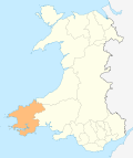
Ambleston · Amroth · Angle · Boncath · Brawdy · Burton · Camrose · Carew · Castlemartin · Cilgerran · Clydau · Clynderwen · Cosheston · Crymych · Cwm Gwaun · Dale · Dinas Cross · East Williamston · Eglwyswrw · Fishguard & Goodwick · Freystrop · Haverfordwest · Hayscastle · Herbrandston · Hook · Hubberston Hundleton · Jeffreyston · Johnston · Kilgetty/Begelly · Lampeter Velfrey · Lamphey · Letterston · Llanddewi Velfrey · Llandissilio West · Llangwm · Llanrhian · Llanstadwell · Llawhaden · Maenclochog · Manorbier · Manordeifi · Marloes and St Brides · Martletwy · Mathry · Merlin's Bridge · Milford Haven · Mynachlog-ddu · Narberth · Nevern · New Moat · Newport/Trefdraeth · Neyland · Nolton and Roch · Pembroke · Pembroke Dock · Penally · Pencaer · Puncheston · Rosemarket · Rudbaxton · Saundersfoot · Scleddau · Slebech · Solva · Spittal · St Davids · St Dogmaels · St Florence · St. Ishmael's · St Mary Out Liberty · Stackpole · Templeton · Tenby · The Havens · Tiers Cross · Trecwn · Uzmaston and Boulston · Walwyn's Castle · Wiston · Wolfscastle
Categories:- Milford Haven
- Towns in Pembrokeshire
- Ports and harbours of Wales
- Populated coastal places in Wales
- Seaside resorts in Wales
- Port cities and towns in Wales
- Marinas in the United Kingdom


Wikimedia Foundation. 2010.