- Milford Haven Waterway
-
- This article is about the waterway, see Milford Haven for the town.
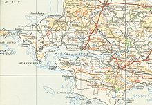 A map of Milford Haven Waterway from 1946
Milford Haven Waterway (Welsh: Aberdaugleddyf) is a natural harbour in Pembrokeshire, West Wales. The Haven is a ria or drowned valley flooded at the end of the last Ice Age.[1][2] formed by the Pembroke River and the Daugleddau estuary, and winds west to the sea. As one of the deepest natural harbours in the world, it is a busy shipping channel, trafficked by ferries from Pembroke Dock to Ireland, oil tankers and pleasure craft. Admiral Horatio Nelson, visiting the harbour with the Hamiltons, described it as the next best natural harbour to Trincomalee in Sri Lanka (then Ceylon) and "the finest port in Christendom".[3]
Contents
History
Main article: History of Milford HavenEarly history
From the 790s until the Norman Invasion in 1066, the waterway was used occasionally by Vikings looking for shelter. During one visit in 854, the Viking Chieftain Hubba wintered in the Haven with 23 ships, eventually lending his name to the district of Hubberston.[4] Evidence of metal working in the area was recently excavated, suggesting a level of industrialization in the period 750 - 1100.[5]
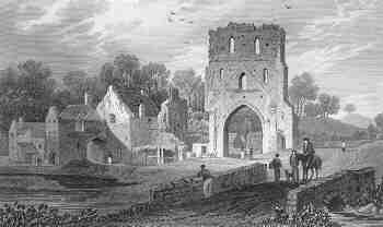
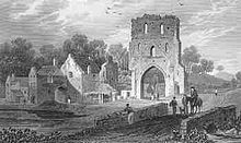 View of Pill Priory near Milford Haven 1829, Henry Gastineau
A Benedictine priory was established at the head of Hubberston Pill in 1170, as a daughter house of St Dogmaels Abbey. Built on virgin land, it stood alongside the priory on Caldey Island as part of the Tironian Order in West Wales, and was dedicated to St Budoc.[6] Founded by Adam de Rupe, it stood until the Dissolution under Henry VIII.[7] In 1171 Henry II designated the area the rendezvous for his Irish expedition. An army of 400 warships, 500 kinghts and 4,000 men-at-arms gathered in the haven before sailing to Waterford, and on to Dublin,[8] which marked the first time an English king had stood on Irish soil, and the beginning of Henry's invasion of Ireland. St Thomas a Becket chapel was dedicated in 1180, a structure which looked out over the Haven from the north shore of the town. In later years it was used as a beacon for sailors in foul weather,[9] and ultimately as a pig sty, until it was reconsecrated in the 20th century.
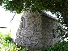 St Thomas a Becket Chapel, dedicated 1180 and used as a beacon church
In his play Cymbeline Act 3, Scene 2, (1611), Shakespeare remarks that Milford is a haven:
“ ...how far it is to this same blessed Milford: and by the way tell me how Wales was made so happy as to inherit such a haven...[10] ” By 1590, two forts had been constructed to defend the entrance to the harbour[11] George Owen of Henllys, in his Description of Penbrokshire, claimed in 1603 that Milford Haven was the most famous port of Christendom.[12] The area however was a source of anxiety for the Tudor monarchy. Due to its location, it was exposed to attacks from Ireland, a convenient base from which England could be invaded via Wales.[13] In 1405, the French landed in force having left Brest in July with more than twenty-eight hundred knights and men-at-arms led by Jean II de Rieux, the Marshal of France, in order to support Owain Glyndŵr's rebellion. It was here that Henry Tudor landed with his uncle, Jasper Tudor, in 1485 before his march towards Lincolnshire, ending in the Battle of Bosworth. In April 1603, Martin Pring used the Haven as his departure point for his exploratory voyage to Virginia.[14] The land comprising the site of Milford, the Manor of Hubberston and Pill, was acquired by the Barlow family following the dissolution of the monasteries in the mid-16th century. It acquired an additional strategic importance in the 17th century as a Royalist military base. Charles I ordered a fort to be built at Pill which could prevent re-enforcement of the Parliamentarian garrison of Pembroke Castle, and this was completed in 1643. On the 23 February 1644, a Parliamentarian force led by Rowland Laugharne crossed the Haven and landed at Castle Pill. The fort was gunned from both land and water, and a garrison was placed in Steynton church to prevent a Royalist attack from the garrison at Haverfordwest. The fort was eventually surrendered, and quickly taken,[15] along with St Thomas a Becket chapel. Just five years later in 1649 Milford Haven was again the site of Parliamentarian interest when it was chosen as the disembarkation site for Oliver Cromwell's Invasion of Ireland. Cromwell arrived in the Haven on 4 August, meeting George Monck,[16] before Cromwell and over a hundred crafts left for Dublin on 15 August.[17]
By the late 18th century, the two creeks which would delimit the future town of Milford's boundaries to the east and west, namely Hakin and Castle Pill, were being used as harbours for ships to load and unload coal, corn and limestone.,[18] A ferry service to Ireland operated from Hakin at the turn of the century, although this ceased in the early 19th century.[3] Although surrounding settlements at Steynton, Thornton, Priory, Liddeston and Hubberston/Hakin were established, they were little more than hamlets. The only man-made structures on the future site of Milford were the medieval chapel, and Summer Hill Farm, and its accompanying cottages.[3]
Coastal landscape and history
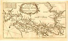 A Plan of Milford Haven, 1758.
Parts of the Haven are within the Pembrokeshire Coast National Park. The northern side is within the Preseli Environmentally Sensitive Area. The area includes: Angle Bay, Carew and Cresswell Rivers, Cosheston Pill, Daugleddau, Gann Estuary, Pembroke River, Pwllcrochan Flats and West Williamston Quarries Sites of Special Scientific Interest; Carew, Haverfordwest, Llangwm, Milford Haven, Neyland, Pembroke and Pembroke Dock (Royal Dockyard) Conservation Areas.[1]
The littoral landscape of Milford Haven shows evidence of maritime conquest, settlement, commerce, fishing and defence from the 11th century to the 20th century. Iron Age promontory forts are sited on several of the headlands at the entrance and along the course of the Haven and the Daugleddau. Early medieval, Christian and Viking sites are evidenced by place-names, documentary and epigraphic evidence, such as Early Christian Inscribed Stone monuments. The Norman conquest, achieved by coastally-sited castle boroughs, is still obvious at Pembroke, at Haverfordwest, and at Carew. Carew did not develop into a borough, but excavations have shown that a Dark Age stronghold and possible Romano-British site preceded the Norman castle.[1]
At the turn of the 18th and 19th centuries, two new towns were constructed: Milford in 1790 by Sir William Hamilton, and Pembroke Dock in 1802 as the site for a new Royal Naval Dockyard. Both towns have regular planned layouts, both have experienced a history of boom and slump in shipbuilding, fishing and as railheads and ocean terminals.[1] These two towns, which could handle the larger vessels then entering service, concentrated trade that had previously been dispersed at quays, jetties and landing places and small settlements such as Pennar, Lawrenny, Landshipping and Cosheston further up river.[1] These small ports served the coal mines of the Pembrokeshire Coalfield located on both shores of the Daugleddau, and also the large limestone quarries at West Williamston. The Daugleddau ports flourished in the 16th, 17th and 18th centuries, but continued to work through the 19th century by changing to using barges to tranship cargoes down river to bigger vessels at the mid-Haven ports.[1]
In the late 19th century, concerns about the potential threat posed by the French Navy prompted the construction of a number of Palmerston Forts at various strategically important coastal sites, including Milford Haven. Most of the forts are now disused.[1] The late 20th century brought the jetties, oil terminals and shore processing facilities of the oil and power industries. This industry reached its zenith in the 1970s when Middle Eastern supply difficulties forced oil transport to use ocean routes and Very Large Crude Carriers for which the Haven, with its deep waters and westerly position, was particularly suited.[1]
Shipping port
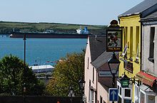
 View of harbour from town
Milford Haven has the largest port in Wales, and the third largest port in the United Kingdom.[19] Shipping operations in Milford Haven are managed by the independent Milford Haven Port Authority as a trust port. The port authority has responsibility for managing Milford Docks, Milford Marina and Pembroke Port and Ferry Terminal.
Petro Chemical
Milford Haven's association with the petro-chemical industry started with the opening of the first oil terminal and oil refinery in 1960; unfortunately this coincided with a serious oil-spill from Esso Portsmouth, the first oil tanker to unload there. Since then, there have been numerous spills of varying magnitude, providing the port authority with a great deal of experience. Uniquely at the time, the harbourmaster instituted the principle of cleaning up first and allocating the blame (and the responsibility of paying for it) later. There are two large oil refineries nearby which represent one fifth of the United Kingdom's oil refining capacity.
In 1996, it was the location of the Sea Empress oil spill, initially thought to be one of the most devastating oil tanker disasters the UK has ever seen. In the event, recovery has been surprisingly good, perhaps partly because of the very strong tides. The comparable Torrey Canyon spill in 1968, a ship which had been heading to Milford Haven, affected shores further south around southern Cornwall and northern France, was actually far more damaging.
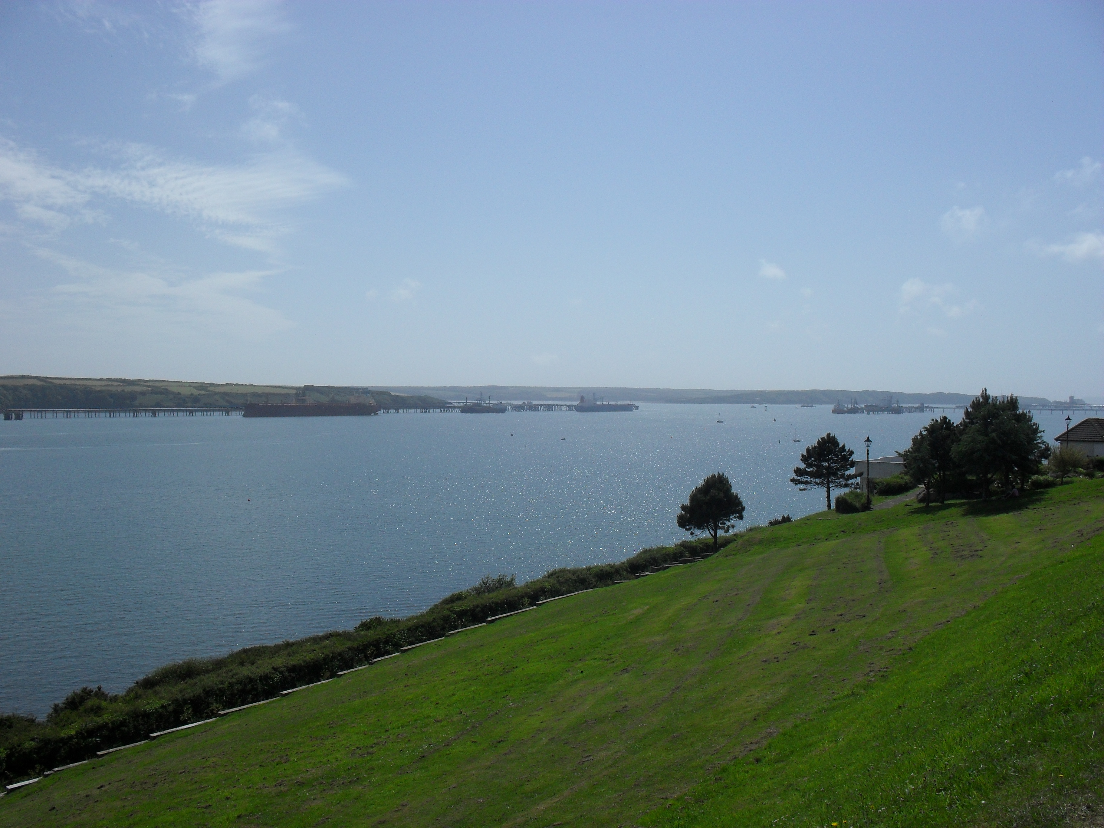
 View of Milford Haven Harbour from town
LNG
In light of the dwindling supplies of North Sea gas, Milford Haven has become home to two new LNG terminals which eventually could provide 25% of the UK's gas requirement. Under construction from 2006, South Hook is based on the former Esso refinery facility, while Dragon is based on a brownfield site. The regasified natural gas is to be fed through National Grid plc's South Wales Gas Pipeline to the distribution point at Tirley, Gloucestershire. The first vessel, the Q-Flex-class Tembek from Qatar, docked at South Hook on 20 March, 2009.[20]
Cruise terminal
The port authority started promoting Pembrokeshire as a cruise destination in 2003 and passenger numbers have steadily increased since then. In July 2008, the first transatlantic liner, the Maasdam arrived in Milford Haven.[21]
Milford Haven town
Main article: Milford HavenThe town of Milford Haven was founded as a whaling centre in the 18th century, and today the town's port is the fourth largest in the United Kingdom in terms of tonnage[22] and plays an important role in the United Kingdom's energy sector with several oil refineries and one of the biggest LNG terminals in the world. Milford Haven is the second largest settlement in Pembrokeshire, with a population of 13,100;[23] though its community boundaries make it the most populous in the county, with 13,096 people.[24] As a community, Milford Haven takes in the town of Milford Haven itself and the villages of Hakin, Hubberston, Liddeston, Steynton and Thornton.
Power generation
As a first stage of a wave power plant, there will be some testing at West Dale Bay.[25]
References
- ^ a b c d e f g h "Milford Haven Waterway". Countryside Council for Wales. http://www.ccw.gov.uk/landscape--wildlife/protecting-our-landscape/historic-landscapes-1/historic-landscapes-map/milford-haven-waterway.aspx. Retrieved 15 January 2010.[dead link]
- ^ "Milford Haven Waterway". Countryside Council for Wales. http://www.ccw.gov.uk/landscape--wildlife/protecting-our-landscape/historic-landscapes/milford-haven-waterway.aspx. Retrieved 07 August 2011.
- ^ a b c Wing Commander Ken McKay A Vision Of Greatness: The History of Milford 1790-1990, Brace Harvatt Associates, 1989. ISBN 9780951521205
- ^ Milford Haven Town Council website History, Chronology of Events Retrieved 17 January 2010
- ^ Medieval Works Found At LNG Site BBC News Article, 5 April 2005 Retrieved 17 January 2010
- ^ A History - The 12th Century: Pill Priory - Tironian House, Retrieved 17 January 2010
- ^ A Topographical Dictionary of Wales, Lewis, Samuel (1849) pp. 374-384 Retrieved 17 January 2010
- ^ Brennan, Joseph J, A Catechism of the History of Ireland: Ancient, Medieval, and Modern (1878), Kessinger Publishing, 2008. ISBN 1-4367-1986-0
- ^ McKay & Springer. Milford Haven Waterway & Town, Tempus Publishing Ltd, 1999. ISBN 978-0-75-241589-5
- ^ BBC: Milford Haven Slideshow Tour Retrieved 19 January 2010
- ^ Genealogy World - FORT HUBBERSTONE Mason, Graham, Retrieved 20 May 2011
- ^ Owen, George. The Description of Pembrokeshire, Gomer Press, 1994. ISBN 9781859021200
- ^ Jones, J Gwynfor. Wales & The Tudor State, Cardiff University of Wales Press, 1989. ISBN 0-7083-1039-7
- ^ Hoyt, Epaphras Antiquarian Researches: Comprising A History Of The Indian Wars In The Country Bordering The Connecticut River, Kessinger Publishing, 2007. ISBN 0-5482-5343-9
- ^ 1643-4: Civil War in Pembrokeshire Retrieved 18 January 2010
- ^ 4 August 1649 Timeline: British Civil wars Retrieved 19 January 2010
- ^ BBC, A Short History of Ireland ‘The righteous judgement of God’: Cromwell Retrieved 19 January 2010
- ^ George, Barbara J; Pembrokeshire Sea Trading Before 1900 Field Studies Journal; Pg, 5-6; Retrieved 19 January 2010
- ^ "Sandy Haven to Milford Haven coastal walk". Walk through time. BBC. http://www.bbc.co.uk/wales/southwest/sites/nhob_walk/includes/walk_printout.sssi?1. Retrieved 2009-01-15.
- ^ "First liquid gas delivery in port". BBC Wales. 2009-03-20. http://news.bbc.co.uk/1/hi/wales/south_west/7952415.stm. Retrieved 2009-03-20.
- ^ "Ship cruises in for record visit". BBC News. 24 July 2008. http://news.bbc.co.uk/1/hi/wales/south_west/7519016.stm. Retrieved 2009-01-15.
- ^ One Wales: Connecting the Nation - The Wales Transport Strategy Welsh Assembly Government, April 2008, page 29 Retrieved 17 January 2010
- ^ KS01 Usual Resident Population: Census 2001 'Key Statistics for Urban Areas', Office For National Statistics D8271.xls (PDF) line 2540 Retrieved 17 January 2010
- ^ Settlement Populations, Pembrokeshire County Council 2001 Census Retrieved 17 January 2010
- ^ "Wave power plan for Welsh coast". BBC News. 15 December 2005. http://news.bbc.co.uk/1/hi/wales/south_west/4528946.stm. Retrieved 2009-01-15.
Further reading
- Oil pollution in a major oil port, Capt. G. Dudley, in Ecological Effects of Oil Pollution (ed. E.B.Cowell), Inst. Petroleum, London, 1971.
External links
- Milford Haven Port Authority
- BBC Wales: South West: Milford Haven
- www.geograph.co.uk : photos of Milford Haven
- Countryside Council for Wales Historic Landscape Map
- Pill Priory - A history
Transport in Pembrokeshire Road 
National Cycle Network Railway lines Railway stations Clarbeston Road · Clunderwen · Fishguard Harbour · Haverfordwest · Johnston · Kilgetty · Lamphey · Manorbier · Milford Haven · Narberth · Pembroke Dock · Pembroke · Penally · Saundersfoot · Tenby
Air Sea Fishguard Harbour · Pembroke Dock · Milford HavenHarbours of the UK England Wales Barry Docks · Cardiff Docks · Fishguard Harbour · Milford Haven · Newport Docks · Pembroke Dock · Port of Port Talbot · Swansea DocksScotland Northern Irelend Categories:- Competent Harbour Authority
- Geography of Pembrokeshire
- Ports and harbours of Wales
- Transport in Pembrokeshire
- Celtic Wave ports
- Milford Haven


Wikimedia Foundation. 2010.