Cosheston

Cosheston

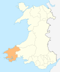
Cosheston is a village and parish in Pembrokeshire, Wales. It is situated on an inlet of the Daugleddau estuary, 3 km north-east of Pembroke. The northern part of the parish is in the Pembrokeshire Coast National Park. Together with the parishes of Upton and Nash, it constitutes the community of Cosheston, which had a population of 713 in 2001. With the community of Lamphey, it makes up the Pembrokeshire ward of Lamphey.

The placename means "Constantine's farm"[1]. Constantine might have been English or Welsh. Part of Little England beyond Wales, the area has been essentially English-speaking for 900 years.

The parish had an area of 813 Ha. Its census populations were: 401 (1801): 551 (1851): 556 (1901): 381 (1951): 593 (1981).

The percentage of Welsh speakers was 4.9 (1891): 4.3 (1931): 2.6 (1971).

References

  1. ^ Charles, B. G., The Placenames of Pembrokeshire, National Library of Wales, Aberystwyth, 1992, ISBN 0-907158-58-7, pp 686

External links

Coordinates: 51°41′47″N 4°53′20″W / 51.69639°N 4.88889°W / 51.69639; -4.88889


Wikimedia Foundation. 2010.

Игры ⚽ Нужна курсовая?

Look at other dictionaries:

  • Pembrokeshire — Pembrokeshire …   Wikipedia

  • Pembroke Dock — Coordinates: 51°41′36″N 4°56′45″W / 51.69333°N 4.94584°W / 51.69333; 4.94584 …   Wikipedia

  • Milford Haven Waterway — This article is about the waterway, see Milford Haven for the town. A map of Milford Haven Waterway from 1946 Milford Haven Waterway (Welsh: Aberdaugleddyf) is a natural harbour in Pembrokeshire, West Wales. The Haven is a ria or drowned valley… …   Wikipedia

  • Middleholm — Middleholm, also known as Midland Island, is a small island lying off southwest Pembrokeshire in Wales, southeast of Skomer. The island is known for its seabirds, including Manx Shearwaters and Atlantic Puffins, and for its plants, including Red… …   Wikipedia

  • Milford Haven — This article is about the town. For the waterway, see Milford Haven Waterway. Coordinates: 51°42′51″N 5°02′34″W / 51.71418°N 5.04274°W / …   Wikipedia

  • Newport, Pembrokeshire — Newport and the Nyfer estuary from Carn Ingli Coordinates …   Wikipedia

  • Tenby — Coordinates: 51°40′28″N 4°42′16″W / 51.6745°N 4.7044°W / 51.6745; 4.7044 …   Wikipedia

  • Cilgerran — Coordinates: 52°03′12″N 4°38′02″W / 52.05322°N 4.63396°W / 52.05322; 4.63396 …   Wikipedia

  • Neyland — Not to be confused with Nayland. Coordinates: 51°42′41″N 4°56′43″W / 51.711272°N 4.945231°W / 51.711272; 4.945231 …   Wikipedia

  • Manorbier — Coordinates: 51°38′40″N 4°47′53″W / 51.644444°N 4.798056°W / 51.644444; 4.798056 …   Wikipedia

Share the article and excerpts

Direct link
Do a right-click on the link above
and select “Copy Link”