- Nolton and Roch
-
Nolton and Roch is a community in the Hundred of Roose, Pembrokeshire, Wales. The community consists essentially of the parishes of Nolton and Roch. The western part of the community is in the Pembrokeshire Coast National Park. Its population (2001) was 746.
Nolton 51°49′17″N 5°5′47″W / 51.82139°N 5.09639°W is a village and parish on the coast of St Brides Bay, 9 km west of Haverfordwest. The name was originally old-tun and the dedication of the church to St Madoc suggests that the place was a pre-existing Welsh settlement appropriated by English immigrants around the time of the Norman conquest[1].
Census population of Nolton parish 186 (1801): 245 (1851): 160 (1901): 108 (1951): 176 (1981)
% Welsh speakers 14 (1891): 5 (1931): 8 (1971)
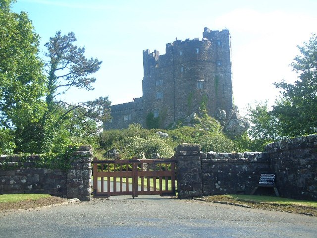
 Roch Castle
Roch (Welsh: Y Garn) 51°50′56″N 5°4′40″W / 51.84889°N 5.07778°W is a village and parish 3.5 km northeast of Nolton and 9 km northwest of Haverfordwest. The name is a rare example of a purely Norman French name: it was la Roche in 1271, and means "the rock"[2]. The Welsh name has the same meaning. The village stands on a prominent ridge of Precambrian rhyolite. Roch Castle stands on top of the most prominent outcrop of this, and is visible for miles around. The church of St Mary is 100 m southeast of the castle.
Census population of Roch parish 538 (1801): 763 (1851): 471 (1901): 377 (1951): 684 (1981)
% Welsh speakers 21 (1891): 22 (1931): 16 (1971)
The 8 km coastline of the community consists of picturesque cliffs and dunes, and is followed by the Pembrokeshire Coast Path. At the north end is the 3 km long Newgale beach, which is popular for bathing and surfing. The whole coast is underlain with coal measures and was a centre of industry from medieval times until 1905. Nolton Haven, on the border between the two parishes, was a port from which the local anthracite was shipped. The area is now a magnet for holidaymakers and second-homers.
The community is part of "Little England beyond Wales". The Pembrokeshire linguistic boundary runs along the northern edge of the community, and is particularly prominent here: the community has been predominantly English-speaking for 900 years, but the adjoining parishes of Brawdy and Hayscastle to the north were more Welsh-speaking.
External links
References
- ^ Charles, B. G., The Placenames of Pembrokeshire, National Library of Wales, Aberystwyth, 1992, ISBN 0-907158-58-7, p 619
- ^ Charles, op cit, p 622
Communities of Pembrokeshire 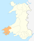
Ambleston · Amroth · Angle · Boncath · Brawdy · Burton · Camrose · Carew · Castlemartin · Cilgerran · Clydau · Clynderwen · Cosheston · Crymych · Cwm Gwaun · Dale · Dinas Cross · East Williamston · Eglwyswrw · Fishguard & Goodwick · Freystrop · Haverfordwest · Hayscastle · Herbrandston · Hook · Hubberston Hundleton · Jeffreyston · Johnston · Kilgetty/Begelly · Lampeter Velfrey · Lamphey · Letterston · Llanddewi Velfrey · Llandissilio West · Llangwm · Llanrhian · Llanstadwell · Llawhaden · Maenclochog · Manorbier · Manordeifi · Marloes and St Brides · Martletwy · Mathry · Merlin's Bridge · Milford Haven · Mynachlog-ddu · Narberth · Nevern · New Moat · Newport/Trefdraeth · Neyland · Nolton and Roch · Pembroke · Pembroke Dock · Penally · Pencaer · Puncheston · Rosemarket · Rudbaxton · Saundersfoot · Scleddau · Slebech · Solva · Spittal · St Davids · St Dogmaels · St Florence · St. Ishmael's · St Mary Out Liberty · Stackpole · Templeton · Tenby · The Havens · Tiers Cross · Trecwn · Uzmaston and Boulston · Walwyn's Castle · Wiston · Wolfscastle
Categories:- Villages in Pembrokeshire
- Communities in Pembrokeshire

Wikimedia Foundation. 2010.