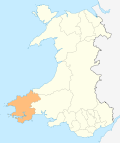
Clynderwen

Clynderwen

Clynderwen (Welsh: Clunderwen) (SN133198) is a rural village in Pembrokeshire, Wales. The village is known as a camping destination and is popular for self-catering holidays. It is also a community in Pembrokeshire, with its own community council of 10 members.

History

The village is on a road to the West Wales coast adjacent to the Preseli Hills (where the stones for Stonehenge were quarried) and owes its more recent origins to the advent of the railways in the 19th century. The Great Western Railway line from London to the West coast ports of Milford Haven, Neyland and Fishguard all pass through the village and a rail junction for the line to Fishguard existed until the 1950s. As the railways expanded, they became instrumental in the development of local economies and Clynderwen became a point where agricultural produce, livestock, etc. were transhipped. A small hotel was built next to the railway station and, for the next one hundred or so years, the village gently expanded. Nowadays it is within easy commuting distance of the nearby towns, but its function as a centre of the local agricultural community has long since ceased. On 1 April 2003[1], the village was transferred from Carmarthenshire to Pembrokeshire, following a boundary change between the counties. At the same time, a name change to Clunderwen was proposed to reflect the actual usage by the community council and on road and other signs. [2]

It is served by trains on the West Wales Line at Clunderwen railway station

References

Coordinates: 51°50′44″N 4°42′43″W / 51.84550°N 4.71181°W / 51.84550; -4.71181


Wikimedia Foundation. 2010.

Игры ⚽ Поможем написать реферат

Look at other dictionaries:

  • Clunderwen railway station — Clunderwen The station as seen from platform 1 Location …   Wikipedia

  • Telephone numbers in the United Kingdom — +44 redirects here. For the band, see +44 (band). United Kingdom telephone numbers Location of United Kingdom (dark green) Location Country United Kingdom Continent …   Wikipedia

  • A478 road — UK road routebox road= A478 length mi= 30 length km= direction= North South start= Cardigan destinations= Cardigan Tenby end= Tenby construction date= completion date= junctions= ukroadsmall|487 ukroadsmall|40 ukroadsmall|4115 ukroadsmall|477… …   Wikipedia

  • List of dialling codes in the United Kingdom — This is a list of telephone dialling codes in the United Kingdom. It is based on Ofcom s area code list, but includes defunct codes and historical changes, including the derivation of the two letter identities where known.[1][2] Note that… …   Wikipedia

  • Pembrokeshire — Pembrokeshire …   Wikipedia

  • North Pembrokeshire and Fishguard Railway — The North Pembrokeshire and Fishguard Railway was a British railway company operating in Wales in the late 19th century[1]. History The company started off as the Narberth Road and Maenclochog Railway which was opened between Narberth Road… …   Wikipedia

  • Middleholm — Middleholm, also known as Midland Island, is a small island lying off southwest Pembrokeshire in Wales, southeast of Skomer. The island is known for its seabirds, including Manx Shearwaters and Atlantic Puffins, and for its plants, including Red… …   Wikipedia

  • Milford Haven — This article is about the town. For the waterway, see Milford Haven Waterway. Coordinates: 51°42′51″N 5°02′34″W / 51.71418°N 5.04274°W / …   Wikipedia

  • Newport, Pembrokeshire — Newport and the Nyfer estuary from Carn Ingli Coordinates …   Wikipedia

  • Tenby — Coordinates: 51°40′28″N 4°42′16″W / 51.6745°N 4.7044°W / 51.6745; 4.7044 …   Wikipedia

Share the article and excerpts

Direct link
Do a right-click on the link above
and select “Copy Link”