- Clydau
-
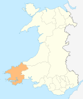
Clydau (sometimes written as Clydaï or Clydey) is a village, parish and community in the Hundred of Cilgerran, Pembrokeshire, Wales. The village is a small group of houses around the parish church, 8 km southwest of Newcastle Emlyn and 13 km southeast of Cardigan. Although the village is tiny, the parish is large, encompassing several larger hamlets, the village of Tegryn and a large number of scattered farms. The community consists essentially of the parishes of Clydey and West Cilrhedyn (3 km to the east: church at 51°59′9″N 4°30′32″W / 51.98583°N 4.50889°W).
The meaning of the Welsh placename is uncertain: the church is dedicated to St. Clydaï, who was allegedly a daughter of Brychan, and the parish may originally have been Llanglydaï[1]. The River Cneifa, a tributary of Afon Cych, divides the parish into two ancient divisions: Uwchlawrllan to the southeast and Islawrllan to the northwest. A remote upland area with no classified roads, the community is a bastion of the Welsh language.
Census population of community 1100 (1801): 1457 (1851): 1057 (1901): 829 (1951): 681 (2001). The percentage of Welsh speakers was: 99 (1891); 97 (1931); 91 (1971).
Clydau electoral ward also includes the community of Boncath and had a population (2001) of 1425, with 58% Welsh speakers.
References
- ^ Charles, B. G., The Placenames of Pembrokeshire, National Library of Wales, Aberystwyth, 1992, ISBN 0-907158-58-7, p 678
External links
Categories:- Villages in Pembrokeshire
- Communities in Pembrokeshire
Wikimedia Foundation. 2010.


