- Marloes and St Brides
-
Coordinates: 51°44′35″N 5°11′02″W / 51.743°N 5.184°W Marloes and St. Brides is a community council in the West Wales county of Pembrokeshire.
The main settlements are the villages of Marloes and St Brides.
External links
Communities of Pembrokeshire 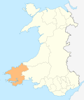
Ambleston · Amroth · Angle · Boncath · Brawdy · Burton · Camrose · Carew · Castlemartin · Cilgerran · Clydau · Clynderwen · Cosheston · Crymych · Cwm Gwaun · Dale · Dinas Cross · East Williamston · Eglwyswrw · Fishguard & Goodwick · Freystrop · Haverfordwest · Hayscastle · Herbrandston · Hook · Hubberston Hundleton · Jeffreyston · Johnston · Kilgetty/Begelly · Lampeter Velfrey · Lamphey · Letterston · Llanddewi Velfrey · Llandissilio West · Llangwm · Llanrhian · Llanstadwell · Llawhaden · Maenclochog · Manorbier · Manordeifi · Marloes and St Brides · Martletwy · Mathry · Merlin's Bridge · Milford Haven · Mynachlog-ddu · Narberth · Nevern · New Moat · Newport/Trefdraeth · Neyland · Nolton and Roch · Pembroke · Pembroke Dock · Penally · Pencaer · Puncheston · Rosemarket · Rudbaxton · Saundersfoot · Scleddau · Slebech · Solva · Spittal · St Davids · St Dogmaels · St Florence · St. Ishmael's · St Mary Out Liberty · Stackpole · Templeton · Tenby · The Havens · Tiers Cross · Trecwn · Uzmaston and Boulston · Walwyn's Castle · Wiston · Wolfscastle
Categories:- Communities in Pembrokeshire
- Pembrokeshire geography stubs

Wikimedia Foundation. 2010.