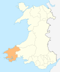
Jeffreyston

Jeffreyston
Jeffreyston
Principal area Pembrokeshire
Ceremonial county Dyfed
Country Wales
Sovereign state United Kingdom
Post town KILGETTY
Postcode district SA68
Dialling code 01834
Police Dyfed-Powys
Fire Mid and West Wales
Ambulance Welsh
EU Parliament Wales
List of places: UK • Wales • Pembrokeshire

Jeffreyston is a community in Pembrokeshire.

Jeffreyston lies on the B4586 road about one mile west from the main A477 road; the nearest town is Tenby about six miles to the south and east.

The parish church is dedicated to St Jeffrey and St Oswald.[1]

As well as Jeffreyston itself, the community includes the settlements of Broadmoor, Cresselly, Loveston and Yerbeston.

References

  1. ^ [1]

Coordinates: 51°43′30″N 04°46′00″W / 51.725°N 4.7666667°W / 51.725; -4.7666667


Wikimedia Foundation. 2010.

Игры ⚽ Нужно сделать НИР?

Look at other dictionaries:

  • Jeffreyston — Original name in latin Jeffreyston Name in other language Jefferston, Jeffreston, Jeffreyston State code GB Continent/City Europe/London longitude 51.725 latitude 4.7675 altitude 71 Population 0 Date 2011 07 31 …   Cities with a population over 1000 database

  • Pembrokeshire — Pembrokeshire …   Wikipedia

  • Middleholm — Middleholm, also known as Midland Island, is a small island lying off southwest Pembrokeshire in Wales, southeast of Skomer. The island is known for its seabirds, including Manx Shearwaters and Atlantic Puffins, and for its plants, including Red… …   Wikipedia

  • Milford Haven — This article is about the town. For the waterway, see Milford Haven Waterway. Coordinates: 51°42′51″N 5°02′34″W / 51.71418°N 5.04274°W / …   Wikipedia

  • Newport, Pembrokeshire — Newport and the Nyfer estuary from Carn Ingli Coordinates …   Wikipedia

  • Tenby — Coordinates: 51°40′28″N 4°42′16″W / 51.6745°N 4.7044°W / 51.6745; 4.7044 …   Wikipedia

  • Pembroke Dock — Coordinates: 51°41′36″N 4°56′45″W / 51.69333°N 4.94584°W / 51.69333; 4.94584 …   Wikipedia

  • Cilgerran — Coordinates: 52°03′12″N 4°38′02″W / 52.05322°N 4.63396°W / 52.05322; 4.63396 …   Wikipedia

  • Neyland — Not to be confused with Nayland. Coordinates: 51°42′41″N 4°56′43″W / 51.711272°N 4.945231°W / 51.711272; 4.945231 …   Wikipedia

  • Manorbier — Coordinates: 51°38′40″N 4°47′53″W / 51.644444°N 4.798056°W / 51.644444; 4.798056 …   Wikipedia

Share the article and excerpts

Direct link
Do a right-click on the link above
and select “Copy Link”