- Kilgetty
-
Kilgetty Welsh: Cilgeti Population 2,000 Principal area Pembrokeshire Ceremonial county Dyfed Country Wales Sovereign state United Kingdom Post town KILGETTY Postcode district SA68 Dialling code 01834 Police Dyfed-Powys Fire Mid and West Wales Ambulance Welsh EU Parliament Wales UK Parliament Carmarthen West and South Pembrokeshire List of places: UK • Wales • Pembrokeshire Kilgetty (Welsh: Cilgeti) is a village near Tenby in Pembrokeshire, Wales. It lies at the crossing of the A477 road between St. Clears and Pembroke Dock and the A478 road between Tenby and Cardigan.
The village has local shopping facilities with a medium-sized supermarket, newsagents, chemists, butchers, fish and chip shop and Chinese takeaway.
The pub, which was previously called the Railway Inn, is now known as the White Horse. There is also a RAOB social club and a local sports club that has a cricket ground.
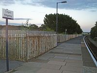 Kilgetty railway station
Kilgetty railway station is on the West Wales Line.
External links
Coordinates: 51°44′N 4°43′W / 51.733°N 4.717°W
Communities of Pembrokeshire 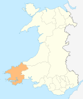
Ambleston · Amroth · Angle · Boncath · Brawdy · Burton · Camrose · Carew · Castlemartin · Cilgerran · Clydau · Clynderwen · Cosheston · Crymych · Cwm Gwaun · Dale · Dinas Cross · East Williamston · Eglwyswrw · Fishguard & Goodwick · Freystrop · Haverfordwest · Hayscastle · Herbrandston · Hook · Hubberston Hundleton · Jeffreyston · Johnston · Kilgetty/Begelly · Lampeter Velfrey · Lamphey · Letterston · Llanddewi Velfrey · Llandissilio West · Llangwm · Llanrhian · Llanstadwell · Llawhaden · Maenclochog · Manorbier · Manordeifi · Marloes and St Brides · Martletwy · Mathry · Merlin's Bridge · Milford Haven · Mynachlog-ddu · Narberth · Nevern · New Moat · Newport/Trefdraeth · Neyland · Nolton and Roch · Pembroke · Pembroke Dock · Penally · Pencaer · Puncheston · Rosemarket · Rudbaxton · Saundersfoot · Scleddau · Slebech · Solva · Spittal · St Davids · St Dogmaels · St Florence · St. Ishmael's · St Mary Out Liberty · Stackpole · Templeton · Tenby · The Havens · Tiers Cross · Trecwn · Uzmaston and Boulston · Walwyn's Castle · Wiston · Wolfscastle
Categories:- Villages in Pembrokeshire
- Communities in Pembrokeshire
- Pembrokeshire geography stubs


Wikimedia Foundation. 2010.